Day 0: Hjørring - Hirtshals (Denmark)/ Stavanger (Norway) 40 km
Travelling in public transport with a bicycle can be a hassle. Not in Germany and Denmark. I have to change
trains all the time and sometimes there are delays but at the end of the day I have
covered all the way from Holland to Northern Denmark. I have decided not to cycle
all the way from my home in Holland to the the Nordkapp but to begin the journey
in Southern Norway. So I am able to be in my beloved mountain landscapes as
much as possible before heading northward to the Nordkapp.
It is one o'clock in the middle of the night as I reach Hjørring. Trains are
not going further northward to Hirtshals where the ferry to Norway is leaving.
I get out of the train to look for a place to sleep.
Hjørring by night is quite a miserable place. There are only men on the streets,
all drunk. I decide not to search for a hotel but to cycle in the direction of Hirtshals.
Maybe I find a good place to camp in the wild. I find a place to sleep on top of a hill.
After a short sleep I wake up and in the early morning light I cycle the last kilometres
to Hirtshals. I am much too early so I have to wait a few hours in the cold, windy
harbour before I can leave. I am freezing there for hours so I decide to take the first
ferry which goes to Stavanger rather than to wait an additional four hours for the
ferry to Kristiansand.
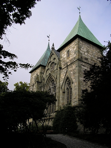
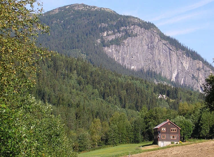
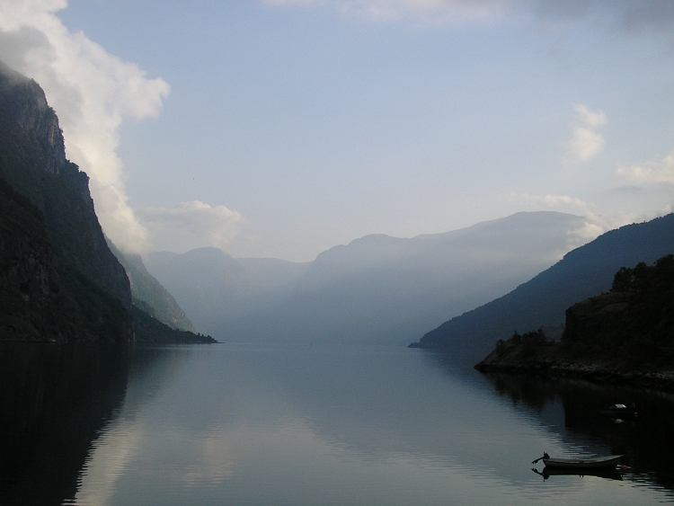
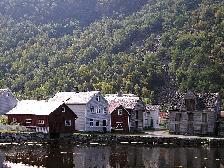
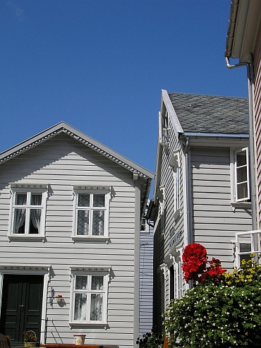
So eight hours later I am in the center of Stavanger, the city of timbered houses.
I have read that Stavanger has the most wooden houses of any European town. This is
a good place to start the journey.
Day 1: Stavanger - Tau - Jørpeland - Preikestolen - Preikestolhytta 26 km
After the cycling journey in the Indian Himalayas with my friends Willem Hoffmans and
Jeroen van Meijgaarden last year, this time I will cycle mostly alone. In Trondheim
I will meet my friends Menno Faber and Klaartje Arntzen to cycle a few days together
but the rest of the trip will be a solo experience. This will be my first solo trip since
my adventures in South America in 2003.
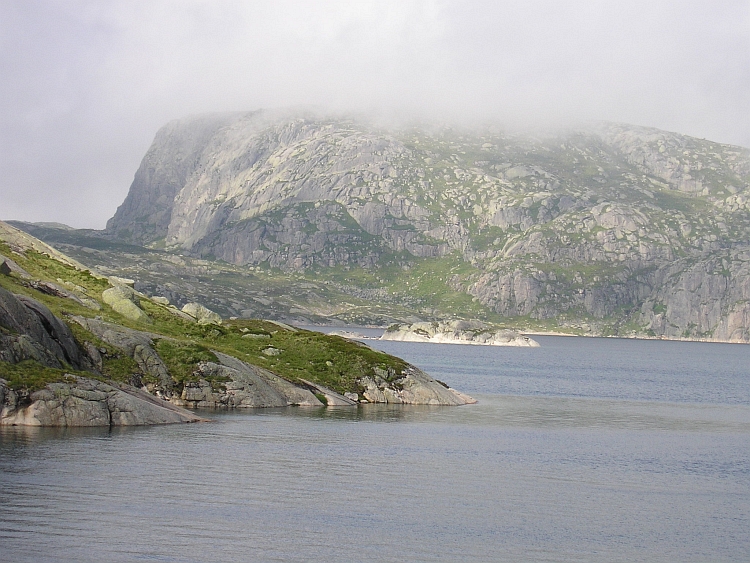
The journey begins with... another ferry! Great blue skies cover the blue sea. An
old man tells me that two farmers make their living on the tiny island to the
right. A ferry goes to the little island twice a day. An interesting landscape with
islands, fjords and vast hill ranges unfolds. Along lots of tiny islands the ferry
finds its way to the village of Tau. To the east the hills will become higher and higher.
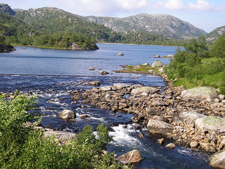
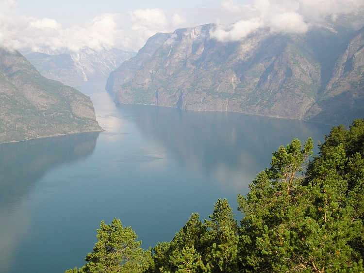
Deep fjords cut through the mountains and hills and high plains. Today I want to cycle
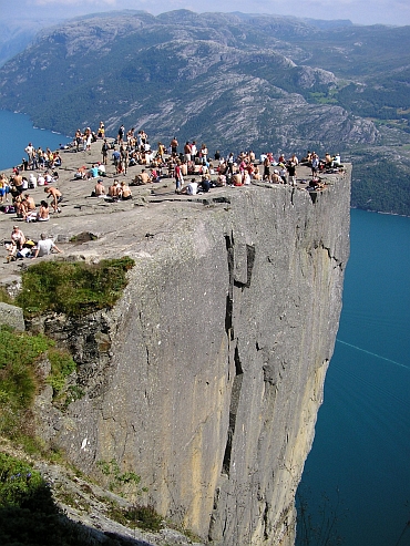
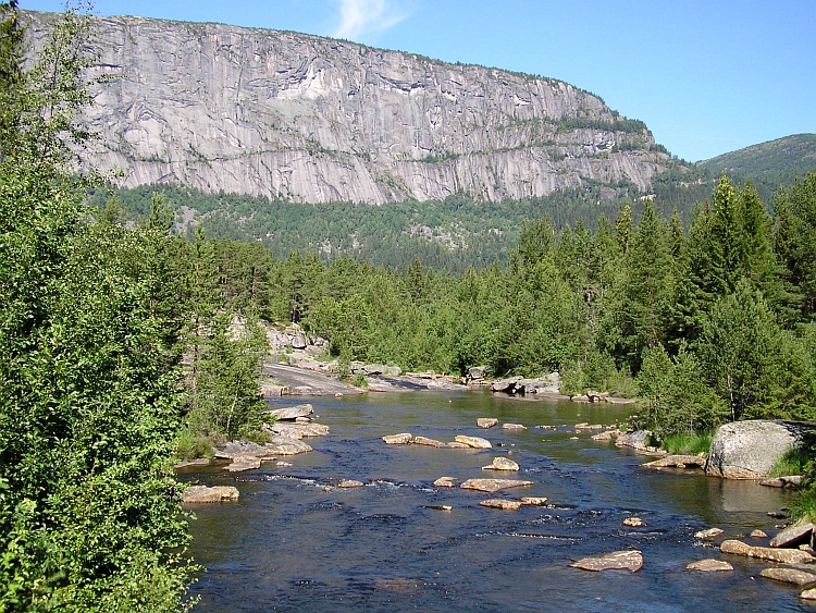
from Tau to the Preikestolhytta, from where it is possible to walk to the famous Preikestolen,
a gigantic rock cliff above the Lysefjord.
After leaving the ferry in Tau, I cycle along the coast to Jørpeland and further to
Jossang through green hill landscapes. From Jossang a steep road leads in five kilometres to
the Preikestolhytta, the base for the walk to the Preikestolen. I leave my bicycle
at the hut, have my first time ever Rømmegrøt dish and start the walk up the
706 meter high Preikestolen.
The weather is exceptionally good. It is nearly thirty degrees and there is no cloud
to be seen. It is sunday and lots of Norwegians are also on the way to the Preikestolen.
It is a nice hike upward through forested hills. After a few kilometre there is a pass.
A first look in the depths below to the Lysefjord is obtained. After crossing the pass
the path goes up and down, sometimes there are great views seven hundred meter down in
the Lysefjord. Reaching the Preikestolen is a great moment. Hundred men and women are
closely packed on a small rock plateau, a dazzling seven hundred meters sheer
vertical above the turquoise waters of the lovely Lysefjord. From the Preikestolen
there is a view all over the fjord untill the end, fifty kilometre eastward. The
sight is a first Norwegian highlight, coming back to the Preikestolhytta, having my second
Rømmegrøt dish and camping along the lake are a second and third highlight.
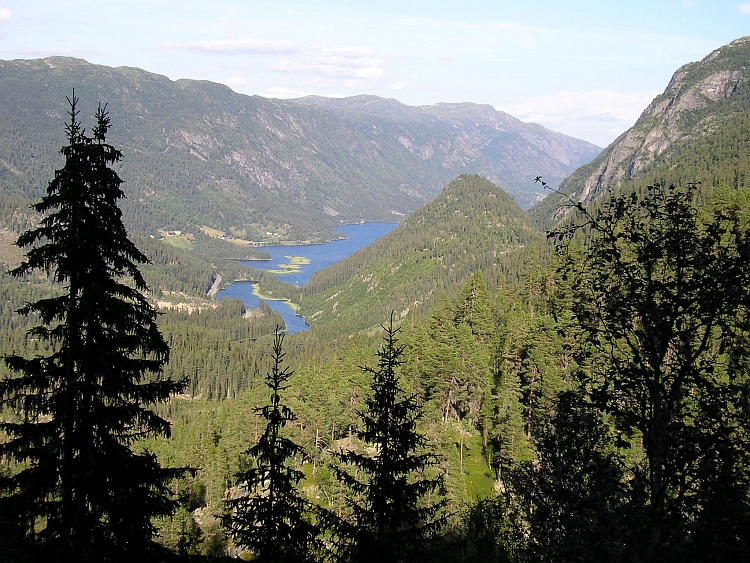
Day 2: Preikesolhytta - Kvalåg - Forsand - Lysebotn - Sirdal 68 km
The view from the Preikestolen was a great taster. Today I will see much more of the
Lysefjord. I want to travel to the east in the direction of Setesdal. Another ferry
trip will bring me from Forsand to Lysebotn, the end of the Lysefjord. But first I
have to cycle down to the Forsand.
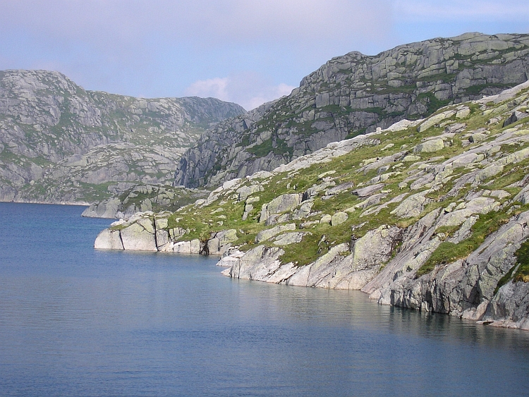
A grey layer of clouds is hanging above the mountains and the sea. The road to the Lysefjord
passes tiny fishing villages. The main road is quite unpleasant but the backroad along
Kvalåg is very scenic. Although I cycle along the sea, the road is winding up and down
all the time across small, steep hill ranges. I pass dark forests, open grasslands,
small bays along the sea and sometimes I have a glimpse of the higher inland mountains
in the east. I meet very nice Swiss cyclists who are heading southward. Together we cycle
to the huge bridge over the Lysejord. Here we split again. They are going southward,
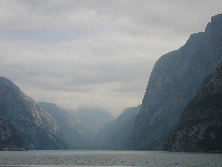
I am heading eastward. In Forsand I wait for the ferry to Lysebotn.
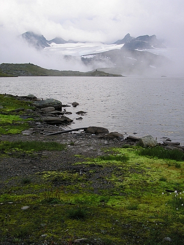
The ferry to Lysebotn goes through a dazzling vertical world. I see the Preikestolen
again, this time from below. Near Lysebotn basejumpers jump nearly thousand vertical meters
from a steep cliff down to a small meadow. Lyse is the Norwegian word for light.
Today there is a shimmering ethereal light which turns the water into an eerie grey,
very unlike the brigh blue turquoise waters of yesterday.
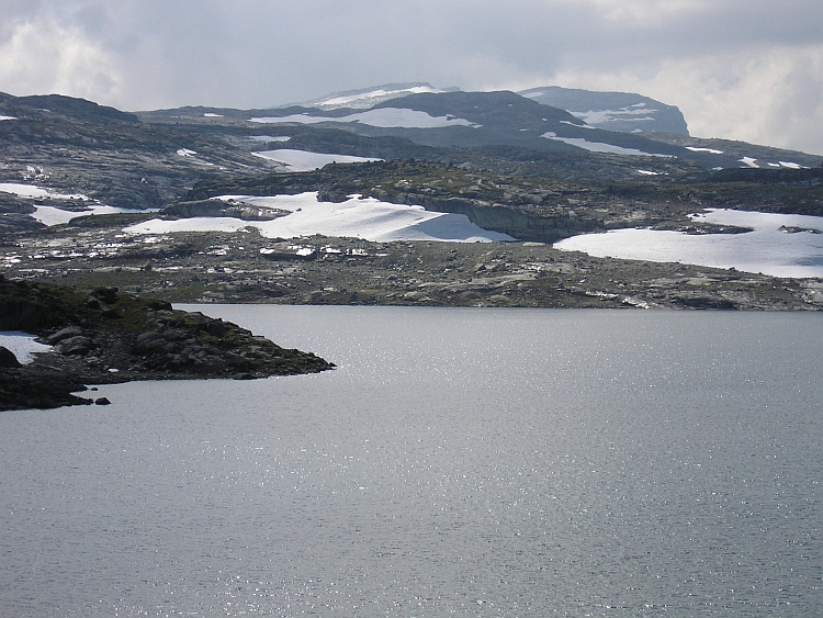
After a few hours the ferry reaches Lysebotn, the end of the fjord. Now the real
work begins. In 26 hairpins the road winds up to a view point at 800 meter
altitude. There is also a tunnel of a kilometre on the way. All the time the road
is ten percent steep. In eight kilometre I climb to the viewpoint. After the viewpoint
the road is even steeper. After ten kilometre I am at 1.000 meter high and far
above the treeline. The road goes up even further but now less steep. Then I reach
the huge Highlands of the Lyseheiene, a great granitic plateau. The landscape
is a wild patchwork of bare rocks and grasses and lakes, steep hills and
depressions. The High plains are certainly not flat.
Now and then the cloud cover is opening. The clouds are hanging only a few meters
above the plains. Because of the wind the hazy clouds are chasing over rapidly.
As I am cycling eastward the clouds disappear but not the wind. I have to work
hard and it is getting late. It is late in the evening as I decend into the Sirdal
valley, where I find a nice camping.
Day 3: Sirdal-Valle-Bykle-Hovden-Haukeli 144 km
A breakfast in Norway is a delight. As soon as the shop opens, I buy fresh bread
which is full of taste. The salads are good value in Norway too and so are the marmalades.
Norwegian cheese tend to be rather dull.
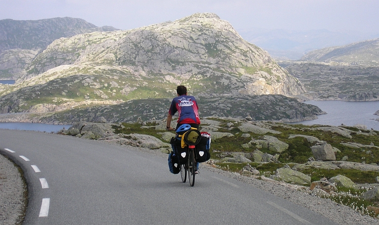
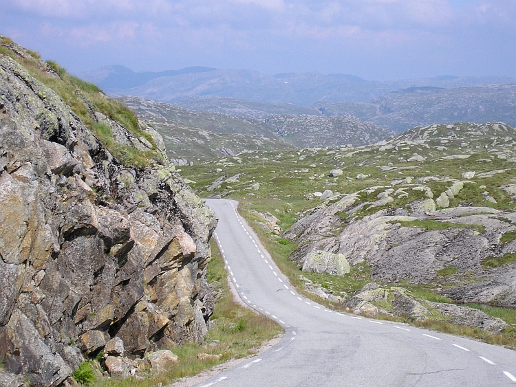
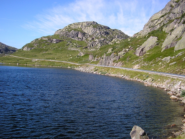
I start the day with an ascent back to the highlands. I have to cross the highlands
of the Sirdalsheiene to reach the Setesdal Valley. After 45 minutes I reach the
Sirdalsheiene. These are true highlands: flat, wide, endless. Again there is lots of
water. Small lakes, big lakes. There is not a place where there is no water to be seen.
I am still happy to enjoy the great weather. Again the sky is cloudless. After cycling
across the plains, the road goes down to the Setesdal Valley. After a long descent I
reach the valley at one o'clock in the afternoon.
The Setesdal Valley runs from the Highlands in a straight line southward to Kristiansand.
I follow the valley northward which means that over a long time I will be climbing a bit.
The Setesdal valley is a kilometre wide and is flanked by steep cliffs. The valley is
the terrain of pine forests. Once in a while there is a village with surroundings of
grasslands and once in a while I pass a lake.
Because the valley is low, the temperatures are much higher than on the high plains.
It is thirty degrees now, exceptional great weather for Norwegian standards. There
are quite strong headwinds which means that my energies are seeping faster than usual.
The villages are lovely and there are lots of rest places along the way so I am taking
quite some time to rest now and a while. The church of Bykle is a great place to rest.
Another time I rest along the river. I enjoy the long day so I do not stop cycling.
It is already eveningtime as I reach the highlands between Hovden and Haukeli. The
narrow valley makes place for a wide open landscape. There are great views over
lonely mountain ranges in the north and the east. That will be my playground for
the coming days. First I have to go down steeply to Haukeli. Late in the evening
I reach the place where I stay in the camping.
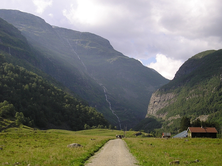
Day 4: Haukeli - Rauland - Rjukan - Austbygdi 123 km
The road starts climbing as soon as I leave Haukeli. I stop at the pass where I
am having breakfast. Far below is the Lake of Tatok between steep forested mountains.
It is still fresh in the early morning but the sun is warming the air rapidly. As I am
finished with my breakfast, it is already warm.
After a few minutes I have descended to the romantic Tatok Lake. There are some small farmer
communities along the lake. With the green mountains on the left side and the lake
on the right side I proceed in a complete silence. Even the wind is absent. The water
of the lake is still. In Rauland I make a stop at a cafe. The waiter hears about my
intention to cycle to the Nordkapp and a few minutes later the man who runs the cafe sits
at my table. He is very interested in the journey. He is thinking about how to gain clients
on this beautiful spot. Strange enough there are surprisingly few tourists passing by
on the road and so there is low potential for clients.
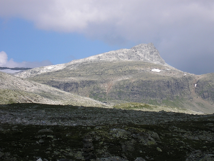
After Rauland I climb to a plateau with great views to the higher elevated
Hardangervidda highlands. Along the huge Møsvatnet Lake I remain high but then
the road goes down steeply into a deep green valley. The road goes down spectacularly
to Rjukan on foot of the 1.883 meter towering Gaustatoppen. After Rjukan
the road goes down even further to the Tinnsjå Lake. which lies at an elevation
of only 200 meter. It is at least thirty degrees as I reach the camping in Austbygdi.
The weather is simply too good for Norwegian standards. An hour later a cracking thunderstorm
breaks loose on the other side of the lake. We are lucky to have the great views and to
miss the shower.
Day 5: Austbygdi - Tessungdalen - Uvdal - Geilo 94 km
The day opens with grey skies but as I have packed my bicycle, the sun has already removed
the fog. It is again sunny weather. I am climbing steeply up through the narrow
Tessungdalen valley. A nice backroad without traffic is leading through the woods.
After an hour I reach a lonely valley with grasslands and a few farms. The valley is
at once very wide. I am not too far under the treeline now. There are splendid
views to the higher elevated Hardangervidda in the distance. After ten kilometre the
road leaves the valley and goes steeply up. Soon I am above the treeline. I reach
a flat plateau of bare grasslands. I can see more than hundred kilometres forward now.
For the first time I see really high snowcapped mountains, although still far away.
This will be the playground for the coming days. First I have to descend a few hundred meters,
climb again a few hundred meters and have some minors climbs before I reach Geilo.
These last fifty kilometres are not too interesting but are very useful in bringing
me closer to the famous Rallarvegen, an unpaved road which crosses the northern
Hardangervidda highlands, passes an icecap and goes down towards the Aurlandsfjord.
Day 6: Geilo - Haugastøl - Finse - Flåm 111 km
At the bakery of Geilo I meet two Swiss cyclists. They have finished the Rallarvegen
yesterday. We discuss different routes in Norway and South America. After an hour
we leave the bakery, they proceed further eastward, I go the opposite direction.
In ten kilometre I climb to the highlands and an additional twelve flat kilometres
along the Ustevatnet Lake bring me to the start of the Rallarvegen at Haugastêl.
The lake is just above the treeline and all the time there are great views over the
1.933 meter high Hallingskarvet Mountain Range.
The Rallarvegen is probably the most famous cycling path of Norway. A ninety kilometre
unpaved road crosses the northern Hardangervidda plateau, right along the Hardangerjøkulen
Icecap before the road goes down to the Aurlandsfjord. The Rallarvegen was originally
used as a construction road for the transport of materials and personal to build the
Flømsbanen Railway. Today the road is used by maybe a hundred cyclists on a summer day
like this.
The weather will not remain this good however. The forecast says that late in the afternoon
or evening bad weather will arrive in Southern Norway. But now is now and now the
weather is fine. You cannot depend your trip on forecasts so I leave the asphalt for
a fair and smooth sand trail. The unpaved road is of surprisingly high quality; riding on the
road more or less feels like riding asphalt. Lots of people are on the way, even families with
kids. Slowly the road climbs higher and higher. The landscape is changing all the time.
No dramatic changes but on details so that ever new valleys, grasslands, lakes
and mountains pass the eye. Then I reach a wider valley where I can see the
Hardangerjøkulen Icecap for the first time. In fact I do not see the icecap but I
see masses of ice hanging between the individual mountain tops. The vast body of ice that
lays behind the gacier tongues, cannot be seen. In the meantime the road still climbs
over the bare and deserted valley untill I reach the Finsevatnet Lake. Along the lake
lies a village of hotels, mountain huts and country houses. Finse has a train station.
Cyclists can decide to avoid the steep descent to the fjord and go back by train.
I take a break at the Finsehut. I originally planned to stop here to relax in the
afternoon but I decide that I rather like to go on. The weather is still fine, tomorrow
will probably be far worse.
The road still goes up for a few kilometre. The road is much emptier now. Most of
the cyclists stop at Finsehytta to return with the train or go further tomorrow.
The grasslands are gone now. It is too high for grasses. There are only stones, rocks
and snowfields. It is late in the afternoon as I reach the highest point of the Rallarvegen.
It is a long way down. I descend slowly because the narrow road is composed of big stones.
The further I descend, the worse the road seems to be. kilometre after kilometre the road goes
down and still I have not reached the treeline. The road is very narrow as I cycle
on a steep flank above a lake. At the end of the lake the flank is even steeper.
After the lake the river forms a waterfall which plunges into the depth below. The road
is winding down above the ravine and is very narrow and very steep. A small mistake can
be fatal here and correcting a mistake is impossible with a fully loaded bicycle so
I decide to walk the passage.
The landscape is only composed of vertical elements here. Big cliffs are here,
there ans everywhere. Rivers are running through narrow gorges and all plunge
down with huge waterfalls in the depths. Hundreds of meters below a wide valley
is gathering all the water coming from the hanging valleys above. That is
where I have to go. I see parts of the road steeply winding and twisting down beneath
the waterfalls with lots of bends and hairpins. After this first passage I am
able to cycle again. Soon I reach the treeline. There will be an additional thousand
meter to descend still. Some passages are composed of huge stones and cannot be cycled, sometimes
the road goes up for a long time, then there is a very long section where the road is some
20 % steep on an exposed hillslope, sometimes right above a gigantic waterfall. I
am able to cycle still. For the first time in hours I see people again. Two cyclists
are walking down with the bicycles in their hands. A kilometre further I overtake
more cyclists. I am not the only one here any more. Then I reach the valley bottom.
I have not reached a village yet but there are no difficulties any more now. Wow. After
the descent of the Pico Veleta in the Sierra Nevada into the Alpujerras this must
be the most scenically spectacular road that I have cycled in Europe. And I must
admit that the road is more challenging than I expected.
I hurry down over nice asphalt. It is nine o'clock as I reach the picturesque village
of Flåm. Fifteen minutes later I arrive at the pleasant camping close to the fjord.
Day 7: Flåm - Laerdal - Borgund - Tyin - Ârdal 178 km
Again the weather forecasts prophesize disaster, but so far the meteorologists were wrong
the whole week. As I wake up, the weather still looks good. The still waters of the fjord
suggest pure tranquility. In fact, that is how I myself feel as well After the long, tiring
day trip yesterday I want to take things slowly today. I am thinking about taking the ferry
across the Aurlandsfjord ans Sognefjord and going up a little towards the Jotunheimen
mountains. The female camping owner tells me that the ferry trip is great but that cycling
the high road between Aurland and Laerdal is exceptional.
So after the splendid but tiring trip yesterday I am cycling up the 10 % steep
road. After Aurland the road goes with hairpins right up over a flank of the fjord.
After a few kilometres I am eight hundred vertical meters above the fjord. There
are some misty clouds clinging to the higher parts of the fjord walls, but that
does not spoil the party. The views are all the better in the diffuse light
circumstances. Again I am lucky to enjoy the magnificent picture-perfect Norwegian
views in such un-Norwegian bright blue weather.
After enjoying the scenery I climb further. The road follows the course of a
valley now. The Aurlandfjord is out of sight here. I am climbing above the
treeline again. Through a lonely valley filled with grasslands I pass big mountains
before the road makes its final curves towards the pass. I see that I am at more than 1.300
meter elevation again.
On the other side of the pass the road goes down a few kilometre
and climbs back again to a second high pass. An impressive rocky mountain looms up to the left,
complete with white glaciers and dark rock cliffs. After the second pass a steep descent
brings me within half an hour back to the sea. A few minutes later I reach Laerdal where I have
a lunch.
So now I am on the busy road to Oslo. The road will climb again up to high plains before I
can leave the road to Ârdal. Because it is still very early in the afternoon,
I want to climb the first few hundred meters today. Maybe I am able to fulfill the
second part of the ascent tomorrow as well as the ascent from Ârdal to The Sognefjellet
in Jotunheimen.
Slowly the weather is deteriorating. There is quite a strong headwind and the sun is
hiding more and more frequently behind the clouds. After the magnificent sceneries of
the Rallarvegen yesterday and the Aurland-Laerdal traverse this morning, the broad
Laerdalen valley does not set the senses ablaze. Despite this, there are three major
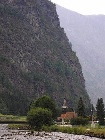
tourist traps in the valley. After the museumlike wooden village of Laerdal there is
an old viking trail along the river. The last and most important is the very famous
stave church of Borgund. I am enjoying the sight for a few minutes as three huge buses
arrive and unload a lot of tourists. I decide to leave. There is a big, very touristic
restaurant that looks unpleasant so I decide not to eat. I will look for a camping and
a supermarket now. Lots of campings are shown on my map.
There is only one tent at the camping of Borgund and there is not a supermarket. I have to go
some further. Ten kilometre further there is another camping vut again the camping is empty
and I have not seen a shop where I can buy some food. Hopefully I am more lucky in
the next village. My stomach is demanding food.
The next camping is again empty and there is no food available. How is this possible?
Again I have to go on and quite far, as the next camping is twenty kilometres further.
The last kilometres are climbing substantially. I feel that my powers diminish rapidly.
I really need to eat now. I have cycled more than 120 kilometre and after breakfast
I have not eaten that much any more. In a regional products shop I am able to buy
some impressively expansive goat cheese. I am eating some bare cheese and go further.
When I reach the camping of Maristova, I see that the camping has a restaurant. As
I call the reception an old woman comes. She tells that the restaurant is closed. I have
not enough cheese to stay here, which means that I have to go on all the way across the pass and
down to Ârdal, unless I find a supermarket and a hotel room on the highlands
around Tyin.
Things are looking sombre now. I eat a little goat cheese. I have only very
little left. I am above the treeline now and the wind is blowing ever harder across
the plains. My powers diminish and I start to feel shaky. I eat a bit of goat cheese
and I can go again. With my last powers I reach a place where cabins can be rent, there is also
a restaurant. The cabin is not cheap, more than a hundred euros. People in the restaurant
offer some help.
'I see that you are having doubts whether to take the cabin because it is so expansive.'
'You are right. But I have no choice. I do not have something to eat There are no supermarkets
on the way.'
'From what direction do you come from?'
'From Laerdal - Borgund.'
'There are no supermarkets indeed. But you are lucky. You are just in time to reach one.
Only one kilometre further in the direction of Oslo is a supermarket which is opened
untill 7 o'clock. Then you have thirty minutes right now.'
I decide to go there and to camp on the plains. As I arrive at the supermarket, I see that the supermarket
has closed at six o'clock. That is forty minutes ago. This means that I have to go on
to Tyin. Again I have to climb five kilometres. As I reach the pass, I am shaking again.
I eat the last goat cheese. I have to cycle ten kilometre along the lake against the wind
and then I only have to go down. The landscape is magnificent now. Despite the air is grey
and there are some rain showers here and there, I can still see the peaks of the
Jotunheimen mountains in the distance, the highest mountains of Norway. I do not
have much time to enjoy. I am very hungry and it is late. A long descent brings me to
Ârdal where I arrive at nine o'clock. I am able to buy some food at a petrol
station. My powers return and I decide to climb three kilometre to the nice and
friendly Utla Valley.
Day 8: Ârdal - Turtagrø - Jotunheimen (Sognefjellet) 56 km
After two tough days, I am planning on a more relaxed day now. Ârdal is not a nice
place to stay however and the only reasonable option from Ârdal is the long ascent
to another 1.300 meter high pass, to descend a little to Turtagrø and up again
to the 1.400 meter high Sognefjellet, the highest paved road of Norway. Despite
a lot of climbing, the distance is not too far. The road goes up steeply. Because
of the grey weather, there is not too much to be seen. Even when I reach the pass,
there is not much to be seen. The Jotunheimen mountains are covered under a blanket of clouds.
I descend to the Turtagrø mountain hut where I take a long break. A few kilometres
after Turtagrø a thunderstorm comes up from the Sognefjord and is heading towards
the Jotunheimen mountains, that means: they are heading towards me. I cycle with all my powers,
the road is not too steep any more. Thick, ice cold raindrops start to fall. As
I look behind, I see that a tremendous rain shower is overtaking me. Both the icy
rains and the thunder makes me hurry and just as hell breaks loose, I arrive at the
mountain hut of the sognefjellet. Here I will spend the rest of the afternoon and the night.
Day 9: Sognefjellet-Lom-Bismo-Grottli 114 km
It has rained the whole night but since I have finished breakfast, it is dry. So I
am on my way again, down from the glacier world of Jotunheimen to the lower mountains
and hills around Lom. The weather is still grey but I am happy enough that it does not rain.
In two hours I have descended to Lom, which has a fine stave church.
From Lom I am going northwestward. Through a wide valley the road goes up slowly. After sixty
kilometre I reach a high plateau above the treeline. At that moment bad weather is rolling in
again. I am lucky that I am just passing a big hotel in the middle of nothing but unlucky that
the hotel is quite expansive. I decide to take a room in the prestigious Grottli hotel.
Maybe tomorrow is a better day to cross the highlands.
Day 10: Grottli - Dalsnibba (1.500 m) - Geiranger - Hellesylt - Sunnmøre Alps - Ålesund 122 km
The whole night there is heavy rainfall. While I am having breakfast, it is still raining. I
prepare for a wet day but as soon as I am ready to go, the rain has suddenly stopped.
As I proceed, small gaps appear in the cloud cover. Many mountain tops are visible
again and I see that the landscape is gorgeous.
I am in a wide valley with bare grasslands and a big lake that is surrounded by
lonely mountain ranges. At the end of the valley a sheer vertical rock face is
looming above the horizon. The road goes in a straight line to the mountain range.
The road winds just before these mountains to the right into a much narrower
valley. I am surrounded by steep mountains, some have big white glaciers on their
slopes.
I am on the road to Geiranger now with its famous Geirangerfjord, the most famous of
all fjords. Before I descend to Geiranger, I will make the five kilometre ascent to
the Dalsnibba mountain at an elevation of nearly 1.500 meter altitude. An unpaved road
goes to the top with an average of 10 % steepness. The road is of good quality so after
40 minutes I am at the top. While I was climbing, Dutch tourists in a camper have
made a nice cup of coffee for me and together we enjoy the views. Deep down below
the Geirangerfjord is visible.
A long descent with breathtaking views bring me to the most tourististic place of Norway:
Geiranger. The whole day huge boats come and go, taking thousands of tourists per day.
I must admit that the landscape is really gorgeous with the bluegreen waters and
the steep mountains enclosing the fjord.
I have just missed the ferry. No problem. The sun has warmed the air to a comfortable 25 degrees.
I have an hour to relax and I am just lazing in the sun.
After an hour the ferry leaves. The ferry trip is really nice as it passes high
cliffs and tremendous waterfalls. Because of the warm summer most of the snow on the
higher parts of the mountains has melted, otherwise the view could have been even better.
The ferry trip takes an hour. Then I reach the village of Hellesylt from where
I will cycle further in the direction of Ålesund.
In Hellesylt I leave the tourist area and I am back in the obscurity of the Norwegian landscape.
Going from Geiranger to Ålesund, I expected that the mountains would gradually
turn into hills but still snowcapped mountains are towering above my head.
I am climbing twenty minutes as the road flattens and for the first time I have
an overview of the landscape. And that is every bit as spectacular as the Geirangerfjord
or Jotunheimen. I am in a narrow valley with small grasslands, little lakes, surrounded
by perfect rock needles, towering 1.400 to 1.700 meter high. Every hundred meter I
have to stop to make yet another picture. I reach a small pass and descend to the
Norangsfjord where more perfect rock needles rise up right on all sides of
the fjord. I cycle to Lekneset where I have to wait another hour for a ferry.
The ferry brings me to Sæbø, where I have to wait another hour for a ferry to
Store Standal. I decide to cycle on in this great landscape under those perfect
weather conditions. Maybe tomorrow the weather will be bad. It is very late already
but tomorrow I can take a rest day in Ålesund. It is uncertain however if I will
reach Ålesund today. It is eight o'clock now and I need yet another ferry to
reach the Ålesund peninsula.
The sun is going down across the Storfjord but the sights do not diminish. The rocks
on the other side of the fjord are turning orange while I am riding on the shadow
side of the fjord. I reach Festøya from where the last ferry goes. It is a quarter
past nine as the ferry has crossed the fjord. Now I have to ride an additional twenty
kilometre to reach the camping of Ålesund. That means that I have to hurry because
the sun has just gone down. Just as I have completely lost the way, I meet two
cyclists who just come back from a day trip. The three of us ride over small backroads
into the city. It is ten o'clock in the evening as I reach the camping. I have to buy food still
but again I am lucky as two American travellers invite me for dinner. They have eaten
a delicious fish dish but they have made too much for themselves. There is also beer and wine
so the rest of the evening and night we are wining and dining.
Day 11: Ålesund (rest day) 0 km
Day 12: Ålesund - Valldal - Trollstigen - Åndalsnes 57 km
After zigzagging for nearly two weeks through Southern Norway I will now turn eastward
in the direction of Trondheim. I am crossing the Storfjord again by ferry. In Stranda
I will switch ferries, in this way I am able to reach Valldal on foot of the
Trollstigen pass. It is early in the morning and the Sunnmøre Alps are partly
hiding behind veils of mist which make the views all the more spectacular.
In Stranda I switch ferries. I have a private ferry now. The ferryman tells me that
there is a Dutch family living in Valldal who run a cafe in front of the church.
I decide to take a look. I am welcomed heartily and I order a juice and a coffee.
The family has moved a year ago. The woman tells that they feel welcome in the community.
The cafe has developed to a meeting place for the villagers.
The weather is brilliant again. Even the fog has disappeared now. The climb to the
Trollstigen Pass is beautiful. First through strawberries fields, then through dense
forests, then through alpine meadows the road goes up through the Valldalen valley.
Lots of tourists are on the way in campers and there are also a few cyclists (all
on a racing bike) on the way. So I am cycling with a Norwegian cyclist for half an hour
and chatting with a Norwegian couple for another half hour.
I reach the Trollstigen Pass sooner than expected. However beautiful the ascent,
the descent is the most spectacular part of the trip. The road finds its way down
over the steep slope between the cascading waterfalls by means of a series of hairpin
bends. The valley is backed by a sheer vertical line of rockwalls. All the ingredients
together make the Trollstigen descent the most famous road of Norway.
As I descend, I meet the Norwegian cyclist again and as I reach the camping of åndalsnes,
down in the valley, I also meet the Norwegian couple again. They give me a reflecting
shirt to be safer in tunnels. They thought it would be unsafe without and took action.
I feel a bit ashamed that I have not thought of that myself but at the same time I
feel good for the generosity of the Norwegians.
The waitress of the camping bar tells me, that she cycles a lot with her friend on the
islands to the north. She suggests me to explore the region. She is so enthusiastic,
that I decide that I will take a look in the area. One of the highlights is the famous
Atlantikhavsvegen, which crosses a series of small islands in a spectacular way. There
are nice fishing villages on the way. So I will leave the mountains for a while for
truly coastal sceneries the coming days.
Day 13: Åndalsnes - Isfjorden - Nesjestranda - Nes - Malme - Elnesvågen - Bud 133 km
I will meet my friends Menno Faber and Klaartje Arntzen about three days in Trondheim.
They are cycling in the Rondane and Dovrefjell area now. I will cycle the Atlantikhavsvegen
from Bud to Kristiansund and hope to arrive in Trondheim about three days.
I am having breakfast with the Norwegian couple I met yesterday. We say farewell
and I am on my way again. Another sunshine day welcomes me. The whole day I am cycling along
fjords. I have to cycle more than forty kilometres to cycle around the Fannfjord.
Gradually I leave the mountains further and further behind but once in a while
there are great views to the snowcapped mountains in the distance.
The last twenty kilometres I ride into the seamist and views are reduced the lowest hundred meters
of the hills. The top of the hills are dissolved in the fog. I have to wait all day
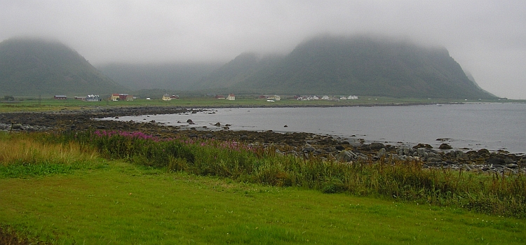
for the highlight of the day. The village of Bud lies at the northwestern corner
of Southern Norway on the edge of the Atlantic Ocean. Bud is a very scenic fishing
village with red wooden houses. Everywhere fishes are being dried and there are hundreds
of seagulls on the rocky slopes. There is also a nice panorama hill that is on three sides
enclosed by the sea.
Day 14: Bud - Atlantikhavsvegen - Kristiansund - Årvågen - Svanem - Kyrkseterøra 160 km
There is still seamist hanging over the land and over the ocean. I am having breakfast
on the panorama hill, a great beginning of the day.
Thirty minutes later I am on my way. The road follows the coast. There are lots
of small islands rising no more than a meter above the sea level. There is no traffic on
the road nor are there villages with more than a few houses. I do not see any people
for two hours. The silence is overwhelming. There are some steep rocky hill ranges
scattered in the landscape but the upper part of the hills are veiled in the mists.
There is no wind, nor are there any waves in the sea. Complete silence.
Slowly I am making progress. Can it be that the humid air is so thick that it effectively lowers my
velocity? It is nearly twelve o'clock as I reach Vevang where the Atlantikhavsvegen
crosses a series of small islands with huge bridges. A great sight, but probably much greater
under stormy conditions as the sea splashes right over the road. But those are not the
conditions of today. The sea is as calm as can be.
I reach the city of Kristiansund. The city is much bigger than expected and
suddenly I am amidst busy traffic. After crossing the island and taking the ferry
to the next island, I am back in obscurity. The trip becomes a bit dull in these misty
conditions. Maybe the sights are magnificent in sunny conditions, but now there is
nothing to be seen. I have to carry on though, because I have seriously underestimated
the distance to Trondheim. I have to cover distance to be able to reach Trondheim tomorrow.
I cross island after island. Sometimes there is a bridge in between, sometimes I have
to wait for a ferry. I meet a Dutch couple who cycled a lot in their younger days.
Together we eat some cookies.
I want to reach the camping of Kyrkseterøra today. That is still fifty
kilometre. It is six o'clock now. I doubt if I should push on. There are no campings
in between. I decide that I have the energy to do so. I am cycling much faster
now and eventually I reach the camping easily on time.
Day 15: Kyrkseterøra - Orkanger - Trondheim 109 km
I get up early in the morning. That means that I have the whole day to cycle the
last kilometres to Trondheim. I am cycling through the rolling hills of Trøndelag.
sometimes along a fjord, sometimes through small valleys. The Trøndelag area is
rather unlike the landcapes that I have crossed until now. The gentle hills and valleys
are filled with pastures. The mountains and glaciers seem far away. The sun is shining
again, the conditions are perfect. Although I am further north than I have ever been, the
climate seems mild. There is no wind and the temperature is around twenty degrees.
Sooner than I expected, I reach Trondheim. In an internet cafe I read that Menno & Klaartje
are waiting for me in the youth hostal. Fifteen minutes later we meet. We have the whole afternoon
to have a beer and to stroll around in the city. Trondheim is a patchwork of traditional
wooden houses and modern architecture. The Nidaros Cathedral is the biggest church
of Norway.
Day 16: Trondheim - Vanvikan - Skaudalen 40 km
As we wake up, we are confronted with a very unfamiliar sight. It is raining cats and
dogs. We decide to wait a bit before we take off. We wait in a cafe for the weather
to clear up a bit. That does not happen. We take the twelve o'clock ferry to Vanvikan,
maybe the weather is better as the ferry arrives.
It is dry as we reach Vanvikan. We take a lunch break. As we start cycling, it begins to
rain again. The weather will not clear up today anymore. Through the deserted hills
we carry on. No tourists visit this area so there are no campings. We are happy therefore
when we find a small, cosy apartment, where we can spend the night.
Day 17: Skaudalen - Verrabotn - Follafoss - Malm 58 km
It does not rain any more but the skies are completely covered with clouds. The most
spectacular stretch is a kilometre after Verrabotn. It is forbidden to pass this stretch
this week, because road improvements are carried out. With dynamite the roadworkers
are creating space for a widening of the road. The result is that loose screeslopes lie
over the road now and block the passage. The alternative to this road is a detour of
fifty kilometre. At this time however the roadworkers have a break so that we may
try to pass. And so we decide to do. That is easily said. I try to carry the bike
with the bags over the loose scree. That was a very unwise decision, because now I
cannot use my hands. After a struggle of fifteen minutes I am able to reach the
other side of the scree slope. Soon Klaartje and Menno reach the other side as well.
At the end of the day we reach Malm. We decide to take a hotel because there are no
campings here. We do not trust the weather whatsoever, but an hour later the clouds suddenly
disappear and the sun is shining again. Maybe that is the influence of the city of
Namsos, which we will reach tomorrow and sounds like the name of a Greek Island.
Day 18: Malm - Namdalseidet - Namsos 73 km
The weather is definitely good again. The sky is blue and we can cycle in shirts once
more. As we are climbing to Namdalseidet, we have a stong wind in the back. As we come closer to Namsos,
the hills are getting higher and higher. We descend to the coast. Steep hills
with pine trees rise up right behind the sea. A few painted houses are scattered
in small bays with perfect white beaches. The sun is shining and the temperature
is rising to 25 degrees. The description of the surroundings of Namsos is apt for a Greek
Island but we are in Central Norway now. We enjoy the perfect surroundings but when we
see Namsos in the distance, there is a big disappointment. Large industry complexes
with lots of pipes and dirty smoke lie in a wide bay. The town is downright ugly
with the most unaesthetic church that I have seen. The camping of Namsos is in a
friendly place in a sidevalley however, in front of the Namsos airport.
Day 19: Namsos - Ytterby - Salen - Lund - Kolvereid - Holm - Vennesund 145 km
In Namsos I say farewell to Menno and Klaartje. They will do some island hopping while
I will be going north towards Bodø and ultimately the Nordkapp. Maybe we will
see each other again in Brønnøysund. We will keep contact about where we are.
The landscape north of Namsos is one of big hills or small mountains. Between the mountains
is lots of water. Big lakes and fjords divide the mountain ranges. There seems to
be more water than land. Sometimes I do not know whether I am cycling along a lake
or along the sea.
There are no villages. The road is constantly climbing and descending. Every time I leave
the sea or a lake for a short or a long ascent, the descent brings me back to a new
gigantic lake or fjord. Sometimes the water can be circumvented, sometimes a ferry
brings me to the other side.
The whole day I cycle through this land/water wilderness. Near Kolvereid there are
some villages and small communities, then I am back in this strangely obscure yet
wonderful part of Norway. I pass the province border of Nordland. Only The Troms and
the Finnmark Province lie further north. When the evening falls, I reach the
Heilhornet mountain range. The mountain range consists of three coneshaped peaks
on a row. The peaks are considerably higher than the other mountains and its rocky
slopes do not fail to impress. The late evening sun throws orange light on the
mountains and the sea as I reach Holm with its lovely white little church. A ferry
brings me to the other side of the fjord, where I rest in the camping of Vennesund.
Day 20: Vennesund - Vik - Brønnøysund - Torghatten 68 km
After the long day trip yesterday, my legs feel tired now. Luckily today is a
completely flat stage. With the sea on the left hand and the Norwegian mountains
on the right hand I am strolling along tiny villages, gently rolling hills, rocky mountains,
green pastures and along the ocean with lots of islands before the coast. In other words, the
landscape is extraordinary rich in variation. This region is more inhabited,
which is very welcome now I am so tired. I take a long rest at a cafe in Vik.
In Brønnøysund I take all the time to find out a possibility to meet
Menno & Klaartje again today. I propose to meet in Torghatten, a mountain with a gap
on an island. There is also a camping.
After I reach the Torghatten camping, I visit the gap. The rest of the afternoon I
am lying in the sun. In the evening I see Menno & Klaartje reaching the camping. I have
bought food for three and with a few beers we celebrate our reunion.
Day 21: Torghatten - Brønnøysund - Forvika - Tjøtta - Offersøya 55 km
We will cycle together again one more day with the three of us. Then we will split definitely.
Menno & Klaartje will do some more islands while I will head to Bodø. Unfortunately
the weather is quite bad. There are some showers here and there in the mountains. The
sun does not have a chance today, it seems. When we have crossed the island and are back in
Brønnøysund, hell breaks loose. When it rains, it really pours, like Elvis sang.
We are waiting under the roof of a supermarket. We want to reach the two o'clock ferry,
fifteen kilometre further, and we do not have more time than an hour.
When the rain seems to diminish, we cycle as fast as we can, only to search for shelter twenty meter further
as it is raining far too hard. Ten minutes later the rains stop and quietly we cycle
to the ferry. In the meantime the weather has cleared up completely. Vast blue skies
from horizon to horizon, as if the rain showers have never happened.
We cycle on a small flat stretch between the ocean and a thousand meter high mountain ridge to the village
of Forvika. A ferry brings us to the fascinating mountain range of the Seven Sisters.
After the sea lies a long mountain range with seven summits on a row, all composed
of bare rock. The most strangely wonderful part of the landscape is a completely red
island, a kind of Ayers Rock in the sea.
We are very much impressed by the landscape so that we fail to see that new showers
are developing behind our backs, untill we hear the thunder rumble. The sky before
us is as blue as heavens can be while the sky behind us is as black as ink. The
mountains are still bathing in the sun while black clouds roll over these same
mountains, an extraordinary sight. We are cycling as fast as we can to reach a
camping, before the bad weather is able to reach us. As we reach the camping, we
see that the shower does not come in our direction. While we try to catch breath again,
we get a bucketful of fish from camping guests who joined a fishing excursion. So the
rest of the day we are cooking and eating fish. In the evening we are wandering to
look for elks. We have not seen one in our lives and according to the locals, there
are elks who are supposed to live here. We fail to see them. Disappointed we walk back
to the camping. Then we see one, across the fields, a kilometre in the distance... maybe.
But we do not check. Too far, too late, too tired. Maybe tomorrow we will really see him.
Or her.
Day 22: Offersøya - Alstahaug - Sandnessjøen - Nesna - Vågaholmen - Forøya - Amnøya 120 km
Menno, Klaartje and I are cycling together to Alstahaug. There is a museum and a nice
church in the village. This is the place where we say goodbye for the last time.
We make some coffee and enjoy the warm morning sun. Then it is time to carry on.
I am cycling on the stately lane back to the route 17 while Menno and Klaartje
wave goodbye.
Again the weather is grandiose, the sky is even deeper blue than usual. This is
a deep blue sky that is supposed to decorate places such as Marrakech, not the
Norwegian coast. But it makes the coast with its dozens of bare and rocky mountains
all the more beautiful. After a while I leave the coast and cycle in a long valley,
right along the Sevens Sisters, this time from the other side as yesterday. I descend
to Sandnessjøen and cross its interesting bridge. The steel bridge with its rigid
mathematical line play contrasts sharply with the dramatic bare mountain ranges that
are surrounding the fjord.
I reach Nesna from where I take a ferry to Vågaholmen. I want to circumvent
a long detour around a fjord with a lot of long tunnels. I am talking to a local
woman who lives on a small island before the coast. She tells me she has travelled
a lot in her life.
"Have you been at the Nordkapp?", I ask.
"No, I have never been further north than Bodø"
I do not understand how it is possible that this intelligent woman is not interested
in the North country. On the other hand, why do I want to go to the Nordkapp?
Is it really that interesting there? Probably it is just bare nothingness that awaits me
there.
A different kind of nothingness awaits me much earlier. There is a thick seamist
hanging over the sea and the islands. In Vågaholmen I leave the ferry and step
into the greyness. After a few kilometre the grey mist gets thinner. Then I see them,
in a small meadow. Elks. Two females stop grazing and look me in the eye. I try
to move slowly and take a picture. Yes. We got 'em. Then I try to come closer. Slowly I
take a step in their direction. And that was a mistake. The spell is broken and they start to run.
I take another picture of the elks running and then they are gone.
My spirits are on a high, now I have seen those thick brown animals. I reach the
top of a small hill. What I see is extraordinary. Before me lies a savannah and
behind it a perfect coneshaped volcano, the Kilimanjaro. At least, it looks like
savannah and it looks like the Kilimanjaro, including the veils of mist that is
surrounding the lower slopes of the mountain. Certainly not the scenery I tend
to think of when I imagine Norway. But this is real, right here, right now. Slowly
I travel further. Another valley and another hill further I am standing in front
of Mount Kenya. A gigantic rock cliff, surrounded by nothing but a bed of seamist.
Far in the distance I can see the Svartisen glacier vaguely. I cycle a few kilometres
further untill I reach a fjord. As the ferry arrives, I am surrounded by the mist
again. Therefore I miss the view to the Svartisen that I would have had otherwise.
The last two hours of the day are not the best. I am riding through a depressing greyness.
Sights are zero, zip, nada. No sound, no views, only cold, damp nothingness. The
camping is 32 kilometre further on the island of Amnøya. There are few settlements in
the obscure landscape, the villages exist of no more than a few houses. No people
are to be seen. I reach a first island, then I reach the island of Amnøya.
I have to ring at a house to meet the camping owner and then ride behind the car
of the camping owner to the place where I am supposed to pitch my tent. It is a
completely silent bay. I pitch my tent at the beach. Now I am feeling all alone.
I am alone in fact, on a nearly deserted island. A gloomy, melancholy mood overwhelms
me. I have been cycling on my own regularly the last years without ever having those
gloomy feelings and now I am suddenly feeling alone and forlorn. After a long and
wonderful day. Only two hours of dreadful mist are able to depress me. I try to
sleep and forget.
Day 23: Amnøya - Ønes - Saltstraumen - Bodø - Moskenes - Å 151 km
The haunting feeling does not disappear as I sleep. I wake up because of a large
relocation of water. Is that a whale? A tsunami? Or just a wave? I sleep again but
later in the night I hear a huge water movement again. As soon as the night is over, I
wake up. I have to wake up whatsoever to reach the seven o'clock ferry in Vassdalsvik,
which is twenty kilometre from here. The mist has not gone and strangely, it is raining.
So this is no mist any more, these are clouds. The light drizzle is as gloomy as the mist
or maybe it is the same. I pack my bicycle and after an hour cycling I reach Vassdalsvik.
I am glad as the ferry arrives, I am among people now.
It is still early as I leave the ferry in Ørnes. Despite the bad weather, the
landscape is quite interesting with immense bays, big beaches and steep mountains
falling in the sea. I can only see the lowest two hundred meter of the mountains
but that is enough.
After the seaside landscape, the rest of the day is not too interesting any more.
I just want to reach Bodø, where I can take the ferry to Lofoten. I pass Saltstraumen,
which is the biggest maelstrom of the world. But that does not impress me either.
I fee spiritually as grey as the weather. That does not get any better as I ride
into the city of Bodø on the busy E6 highway. All day I am unhappy to be alone
and now I am not alone any more, I am unhappy because of all the people.
As I reach Bodø I have just missed the six o'clock ferry so I have to wait untill
one o'clock in the evening or cycle all the way back through the city to the camping.
Then a woman comes to me and says I have not missed the ferry if I hurry now. I go
aboard just in time and there we go. At the same time the sun breaks through and I have
a gorgeous site over the rocky coast. The sun is going down behind the Lofoten islands
in a wild palette of colours. With the misty clouds, the gloomy feelings have disappered.
And I am very much looking forward to explore the cliff coast of Lofoten tomorrow.
The ferry reaches the Lofoten at ten o'clock in the evening. The sun is just going
down. The sky is turning from orange to pink while I am cycling the three kilometres
to the camping of Å, the southernmost village of the Lofoten. I meet a
fellow cyclist just before Å. It is the 45 year old German Thomas Fläschner.
We cycle together to the camping and have dinner. Tomorrow we will cycle together
one day. Then we will split as Thomas will meet a friend in Svolvaer about three days.
Day 24: Å - Moskenes - Reine - Hamnøya - Ramberg - Leknes - Borge - Knutstad 96 km
I wake up late in the morning to compensate for the short night yesterday. It is sunny
once again but there is a very strong northern wind. We shall have headwinds today.
Thomas is waking up a minute later. We take our time and explore the great campsite
between. The camping is situated right above the sea, between steep needleshaped
mountains. There is a small lake on the area and a small fjord marks the end of the
camping. The village of Å is also very nice with its red wooden rørbu houses, which
were used for fishing but now function as a youth hostal. It is nearly twelve o'clock
when we are finished sightseeing and begin to cycle against the wind.
The landscape of the Lofoten is wild and fascinating. Cliffs of nearly thousand
meter high rise out of the sea. However steep, the granite mountains still
possess a green glow because of the small vegetation. In this way the landscape
resembles the Machu Picchu landscape in Peru.
Narrow fjords and small lakes fill the depressions between the rock walls.
Thomas and I cannot stop snapping pictures. Unfortunately the
weather is a bit hazy, which does not work out well on photos. But we are lucky
enough, that the sun is shining again. We proceed slowly because of the
wind. It takes ages before we reach beautiful Reine after eight kilometre.
We reach a long fjord where we are sheltered for the stormy wind. Soon we arrive
in Ramberg at the western side of the Moskenøya island. We are surprised by the
tropical white beaches of Ramberg. In fact, the temperatures are tropical as well.
We miss the palm trees however for a true tropical vibe. Trees are missing in general
in the Lofoten landscape. Rocks, grasses and water. Those are the natural elements
where the islands are made of.
After having lunch and having an additional tea break we carry on. Thomas and I share
a similar taste of music so that we are talking all the time. Once in a while I look around
and see that this is actually one of the most beautiful day trips I have made. Thomas, who
has done this kind of cycling trips for twenty years now, is equally impressed. We cycle
along a new fjord with turquoise waters, surrounded by steep grassy slopes. The wind
is not so strong any more, so that we progress pretty well now.
A tunnel under the sea bring us at the Vestågøya island. The landscape is
not as spectacular as the southern islands any more but still beautiful. We cycle
to a camping in Knutstad. We are the only human guests but certainly not alone.
We are visited by a million blood thirsty mosquitoes, who make cooking a very nervous
adventure. At the end of the dinner everyone of us has eaten their bellies full.
Day 25: Knutstad - Kabelvåg - Svolvaer - Melbu - Stokmarknes - Sortland 127 km
So this is the end of the good weather. It is not raining yet, but the weather is all grey.
The forecasts say that there will be rainfall in the afternoon and I guess that this time
the meteorologists will not be mistaken again. Thomas and I say farewell. Thomas will cycle
back to Borge to visit the Viking museum. I will head further north to the Vesterålen
islands.
There are great views across the sea channel. It is fascinating to see the line of houses on foot of the mountains of the
Austvågøya island along the sea. Soon I reach the island, the biggest
of the Lofoten islands. I take a rest in the nice village of Kabelvåg. I
cycle further along Svolvaer to Melbu. I meet two young Norwegian women, who cycle from
the Nordkapp to Southern Norway. It is the first time they undertake such a journey
and they are very enthusiastic, which pleases me a lot.
I take the ferry to Stokmarknes on the Vesterålen and cycle further. I see
rain showers on the Lofoten islands, on the other side of the sea. I want to cycle
40 kilometre further to the camping of Sortland because it is still early in the
afternoon and take the risk of getting wet. I have quite strong headwinds but it
does not start raining untill five kilometre before Sortland. It is really pouring
and I reach the camping all wet, in fact the first time that I am soaked in Norway.
Day 26: Sortland - Bø - Bleik - Andenes - Gryllefjord - Torsken 124 km
It is raining hard all night and it is raining hard in the morning. As there is nothing to do
in Sortland, I decide to cycle to Andenes, a small city at the northern tip of the vesterålen.
First I find shelter in the bakery of Sortland, where I take breakfast and take coffee
and another coffee. Then I am ready to do it. I cycle over desolate moorlands between
hills that are covered by clouds. I have some problems with my chains which is a bit
of a hassle. I have to stop to repair At that time, I am overtaken by a fellow cyclist.
It is Erwin Peterman, a 36 year old dutch cyclist from Amsterdam. He is also
cycling to the Nordkapp. From now on we will carry on together.
As we reach Andøya, the rain stops. The cliffs are still covered in clouds,
which is still a fascinating sight. The wind is howling and is blowing straight in the
face as we reach the Atlantic coast of the island. We cross big moorland plateaus
but all the time there we have views of the mountains, partly hidden in the clouds.
We keep following the coastline, sometimes on the edge of the cliffs, sometimes
on the flat moorlands. The wind is blowing harder and harder. We reach Andenes
where we decide to take the ferry to the Senja island. If the weather is good
tomorrow, we will cycle a detour across the Senja Island and we will have more
time as we cross the sea now.
The ferry trip is a shaky one, literally. It is called the 'whale route' because of the
abundance of whales in these parts of the Atlantic Ocean, but the 'pale route' would be
a more apt description. Many passengers have powder white faces. The ship is being
thrown back and forth by the wind and the waves. One man is gurgling and growling
like a whale the whole two hours of the trip. We do not spot any whales outside the ship.
We reach Gryllefjord, where we cycle a few kilometres further and find a rørbu,
a scenic wooden fishing house that is now used as a hut for tourists.
Day 27: Torsken - Senja - Finnsnes / Tromsø 72 km
It is raining again. There is nothing to be seen as everything is dissolved in clouds
and rain showers. It has no use to take the interesting detour and so we take the
short way to Finnsnes. Indeed, there is nothing to see. It is not a great trip
therefore. Not good, not bad, and certainly not interesting. There are no highlights.
We reach Finnnsnes and take the ferry to Tromsø where we try to forget the Norwegian
prices as we go wining and dining in a high quality restaurant in downtown Tromsø.
Day 28: Tromsø - Lyngseidet - Storslett - Sandelva 150 km
The sky is still full of clouds that hang low above and around the mountains. It
is not raining, though. We leave Tromsø and cycle to the E8 highway. Along the wide
Ramfjord we are heading to Fagernes. We climb to a small watershed and reach an
enormous valley. The landscape looks really arctic now with its dark rocks and its
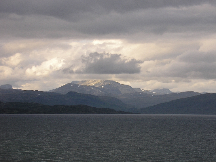
glaciers. At the end of the valley we reach a wide fjord and look across the sea to
the Lyngfjellan Alps. The landscape is full of ice and snow, big rock walls are towering
above the surrounding ice. Carefully the sun tries to throw a bit of light between the
clouds. Its icy white glow is reflected on the water.
"It feels like we are in Alaska now.", says Erwin.
A ferry takes us to the mountains on the other side of the fjord. The Lyngfjellan
mountain range is often called the Lyngfjellan Alps and quite rightly so. The
mountain range lies on a long peninsula. On both sides the mountains rise sheer
directly out of the sea. The highest mountain is 1.833 meter high. No other mountain
range this far north in Norway is that high. In the middle of the mountain range
is a low pass between these high mountains. We cross the mountain range by following
a narrow valley that is leading to the pass. On the other side of the mountains
lies the friendly village of Lyngseidet along a new fjord. We take a ferry to
the other side of the water, where we have even better views over the mountain range.
Most of the clouds have gone and the glaciers are bathing in the sun.
After crossing the fjord, we follow the coastline. Now the alpine mountains are gone,
the landscape becomes increasingly wider. Villages are sparse and we see only very few
local people. We are three hundred kilometre north of Narvik now but still five hundred
kilometre south of the Nordkapp. The biggest city to the north or east is Alta, the capital
of Finnmark with no more than 7.000 inhabitants. We hope to reach Alta tomorrow.
Tourists are not to be seen. The season is as good as over towards the end of August.
We find out that the campings are empty but it is easy to rent a hut, which is not too expansive
in the low season. We find a small hut along the beautiful lake of Sandelva.
Day 29: Sandelva - Burfjord - Alteidet - Talvik - Alta 167 km
The sky is deep blue as we wake up. It is still very fresh. We cycle ourselves warm
on the ascent. Rapidly we are far above the lake and above the treeline, which is
around three hundred meter high, this far north. We pass interesting landscapes.
Fjords, highlands, even an icecap. And we see lots of reindeers. At the pass there is a tourist
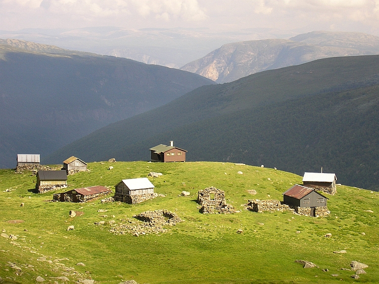
camp with a few Sami tents. The sami men and women try to look as authentic as
possible and wear their colourful clothes. I buy a dangerously sharp knife. We see
the first reindeers but we are more interested in a hot chocolate in the cafe to warm
ourselves. As we carry on half an hour later, it is much warmer already. We are
freezing one last time during the descent. Then the temperatures rise further and further
untill nearly twenty degrees. According to a local woman this is one of the very best
days of the year, so we may call ourselves lucky again.
It is great cycling untill we reach the Altafjord. We see Alta in the distance but we still
have 50 kilometre to cycle to the camping of Alta. It is late in the evening as
we reach the capital of Finnmark. From here we are able to reach the Nordkapp in two long days.
Day 30: Alta - Skáidi - Olderfjord 121 km
There are only 7.000 people living in Alta but it takes fifteen kilometre to
cross the village (or is this a city?). After Alta we climb to the highlands with the
obscure name Skáiddeduottar. The name is apt. Sheer nothingness awaits us at the
Skáiddeduottar plains. There are only grasses, stones and reindeers. And us.
The sky is grey but no rain is going to fall. The whole day we travel through the
tundra landscape. Once again we have strong headwind but we keep going with a good
pace. The only village on the plains is Skáidi, where we buy some food for the
dinner this evening. At the end of the day we go down and reach the sea again in
Olderfjord where we stay the night.
Day 31: Olderfjord - Honningsvåg - Nordkapp - Honningsvåg 170 km
This could be the last day. We get up early in the morning. We will just see. We have
to reach the Nordkapp today as we want to catch the airplane from Alta back home the
day after tomorrow. Tomorrow we have to catch the two o'clock bus in Honningsvåg,
the only village with bus service to Alta, which lies 35 kilometre from the Nordkapp.
We do not want to think about tomorrow now. We have to reach the Nordkapp today and
that should be easily possible.
The clouds are hanging
low. The water looks icy. The whole morning we cycle along the huge Porsangerfjord.
The fjord is 20 kilometre wide. All the time we have views over the two hundred
meter high ridge on the other side of the water. No villages, no mountain tops,
nothing is to be seen there.
Early in the afternoon we reach the tunnel to the Magerøya island. It
goes more than two hundred meter under the sea. The tunnel is seven kilometre long.
It is not busy in the tunnel, in fact it feels perfectly safe to cycle here. Yet
it takes ages before we reach daylight again. After ten minutes we have another long
tunnel. Then we reach Honningsvåg, a nice village, quite a big place in fact.
The coloured houses are closely packed together on the bare slopes. There are no
fully grown trees on the Magerøya island.
After we leave Honningsvåg, we are on the bleak, deserted highlands of Magerøya.
A stormy wind is smashed in our faces. The road is going up and down all the time.
The circumstances are really harsh now. It is no more than a few degrees and there
are some rain showers here and there on the island. Then we see the Nordkapp
in the distance. It does not look far anymore but it is supposed to be still
fifteen kilometres, which can take quite some time in this storm.
We are creeping forward. Then the road starts to go down. The road descends to sea level
and then starts to climb again steeply, right against the storm. Sometimes I follow Erwin,
sometimes Erwin follows me. There is no shelter against the storm. Not before the
Nordkapp.
We are at the highlands again. But where is the Nordkapp? The plains are endless.
Then we see the buildings of the Nordkapp. A few minutes later we arrive. The wind is
so desolately cold that after a few minutes we go inside the building to find shelter. We
are welcomed by the Royal Nordkapp Association and write our names in the cyclists
guest book.
This was it. We decide that we deserve a good glass of beer. That is all that I cab think
about now. But that means that we have to cycle all the way back to Honningsvåg
instead of staying in a camping or a hut a few kilometre away. And so again we are
driven by our desires. I see us walking out of the building into the emptiness of
the landscape to face the storm one last time. The Arctic Dream is over. We have
realized it...
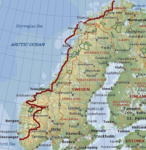
Map of the route
Statistics
Fast Facts
Fast Facts
# Days
# Cycling days
Distance on bicycle
Distance / Days
Distance / Cycling days
Longest distance on a day
Highest point on bicycle
# Elks spotted
# Reindeers spotted
# Mosquito bites
# Ferries taken
# Islands crossed on bicycle
# Fjords that were passed
Statistics
31
30
3.277 km
104 km
108 km
178 km
1.473 m (Dalsnibba)
2
hundreds
average of 10/day
27
24
116
Highlights of the Journey
Highlights
Norway is one big outdoors park. Just being there is the greatest highlight of this country
Okay it is a cliche but the fjord landscape is unrivalled. And every fjord has its own charm
Cycle the Rallarvegen from Geilo to Flåm and see all Norwegian landscapes pass by on a single unpaved cycling path
Exploring the virtually unknown beauty of the Sunnmøre Alps between Geiranger and Ålesund
Cycling and ferrying the E17 to Bodø through the dramatic landscapes of Helgoland
Being on the Lofoten or Vesterålen islands with its dazzling cliffs rising out of the sea

 Travelling in public transport with a bicycle can be a hassle. Not in Germany and Denmark. I have to change
trains all the time and sometimes there are delays but at the end of the day I have
covered all the way from Holland to Northern Denmark. I have decided not to cycle
all the way from my home in Holland to the the Nordkapp but to begin the journey
in Southern Norway. So I am able to be in my beloved mountain landscapes as
much as possible before heading northward to the Nordkapp.
Travelling in public transport with a bicycle can be a hassle. Not in Germany and Denmark. I have to change
trains all the time and sometimes there are delays but at the end of the day I have
covered all the way from Holland to Northern Denmark. I have decided not to cycle
all the way from my home in Holland to the the Nordkapp but to begin the journey
in Southern Norway. So I am able to be in my beloved mountain landscapes as
much as possible before heading northward to the Nordkapp.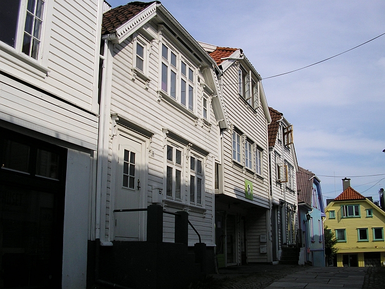
 After the cycling journey in the Indian Himalayas with my friends Willem Hoffmans and
Jeroen van Meijgaarden last year, this time I will cycle mostly alone. In Trondheim
I will meet my friends Menno Faber and Klaartje Arntzen to cycle a few days together
but the rest of the trip will be a solo experience. This will be my first solo trip since
my adventures in South America in 2003.
After the cycling journey in the Indian Himalayas with my friends Willem Hoffmans and
Jeroen van Meijgaarden last year, this time I will cycle mostly alone. In Trondheim
I will meet my friends Menno Faber and Klaartje Arntzen to cycle a few days together
but the rest of the trip will be a solo experience. This will be my first solo trip since
my adventures in South America in 2003.
 After a few minutes I have descended to the romantic Tatok Lake. There are some small farmer
communities along the lake. With the green mountains on the left side and the lake
on the right side I proceed in a complete silence. Even the wind is absent. The water
of the lake is still. In Rauland I make a stop at a cafe. The waiter hears about my
intention to cycle to the Nordkapp and a few minutes later the man who runs the cafe sits
at my table. He is very interested in the journey. He is thinking about how to gain clients
on this beautiful spot. Strange enough there are surprisingly few tourists passing by
on the road and so there is low potential for clients.
After a few minutes I have descended to the romantic Tatok Lake. There are some small farmer
communities along the lake. With the green mountains on the left side and the lake
on the right side I proceed in a complete silence. Even the wind is absent. The water
of the lake is still. In Rauland I make a stop at a cafe. The waiter hears about my
intention to cycle to the Nordkapp and a few minutes later the man who runs the cafe sits
at my table. He is very interested in the journey. He is thinking about how to gain clients
on this beautiful spot. Strange enough there are surprisingly few tourists passing by
on the road and so there is low potential for clients.
 The landscape is only composed of vertical elements here. Big cliffs are here,
there ans everywhere. Rivers are running through narrow gorges and all plunge
down with huge waterfalls in the depths. Hundreds of meters below a wide valley
is gathering all the water coming from the hanging valleys above. That is
where I have to go. I see parts of the road steeply winding and twisting down beneath
the waterfalls with lots of bends and hairpins. After this first passage I am
able to cycle again. Soon I reach the treeline. There will be an additional thousand
meter to descend still. Some passages are composed of huge stones and cannot be cycled, sometimes
the road goes up for a long time, then there is a very long section where the road is some
20 % steep on an exposed hillslope, sometimes right above a gigantic waterfall. I
am able to cycle still. For the first time in hours I see people again. Two cyclists
are walking down with the bicycles in their hands. A kilometre further I overtake
more cyclists. I am not the only one here any more. Then I reach the valley bottom.
I have not reached a village yet but there are no difficulties any more now. Wow. After
the descent of the Pico Veleta in the Sierra Nevada into the Alpujerras this must
be the most scenically spectacular road that I have cycled in Europe. And I must
admit that the road is more challenging than I expected.
The landscape is only composed of vertical elements here. Big cliffs are here,
there ans everywhere. Rivers are running through narrow gorges and all plunge
down with huge waterfalls in the depths. Hundreds of meters below a wide valley
is gathering all the water coming from the hanging valleys above. That is
where I have to go. I see parts of the road steeply winding and twisting down beneath
the waterfalls with lots of bends and hairpins. After this first passage I am
able to cycle again. Soon I reach the treeline. There will be an additional thousand
meter to descend still. Some passages are composed of huge stones and cannot be cycled, sometimes
the road goes up for a long time, then there is a very long section where the road is some
20 % steep on an exposed hillslope, sometimes right above a gigantic waterfall. I
am able to cycle still. For the first time in hours I see people again. Two cyclists
are walking down with the bicycles in their hands. A kilometre further I overtake
more cyclists. I am not the only one here any more. Then I reach the valley bottom.
I have not reached a village yet but there are no difficulties any more now. Wow. After
the descent of the Pico Veleta in the Sierra Nevada into the Alpujerras this must
be the most scenically spectacular road that I have cycled in Europe. And I must
admit that the road is more challenging than I expected.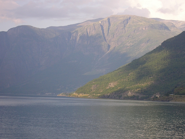
 So now I am on the busy road to Oslo. The road will climb again up to high plains before I
can leave the road to Ârdal. Because it is still very early in the afternoon,
I want to climb the first few hundred meters today. Maybe I am able to fulfill the
second part of the ascent tomorrow as well as the ascent from Ârdal to The Sognefjellet
in Jotunheimen.
So now I am on the busy road to Oslo. The road will climb again up to high plains before I
can leave the road to Ârdal. Because it is still very early in the afternoon,
I want to climb the first few hundred meters today. Maybe I am able to fulfill the
second part of the ascent tomorrow as well as the ascent from Ârdal to The Sognefjellet
in Jotunheimen.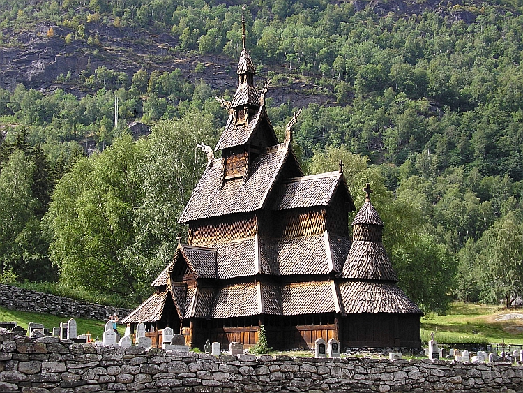
 After two tough days, I am planning on a more relaxed day now. Ârdal is not a nice
place to stay however and the only reasonable option from Ârdal is the long ascent
to another 1.300 meter high pass, to descend a little to Turtagrø and up again
to the 1.400 meter high Sognefjellet, the highest paved road of Norway. Despite
a lot of climbing, the distance is not too far. The road goes up steeply. Because
of the grey weather, there is not too much to be seen. Even when I reach the pass,
there is not much to be seen. The Jotunheimen mountains are covered under a blanket of clouds.
I descend to the Turtagrø mountain hut where I take a long break. A few kilometres
after Turtagrø a thunderstorm comes up from the Sognefjord and is heading towards
the Jotunheimen mountains, that means: they are heading towards me. I cycle with all my powers,
the road is not too steep any more. Thick, ice cold raindrops start to fall. As
I look behind, I see that a tremendous rain shower is overtaking me. Both the icy
rains and the thunder makes me hurry and just as hell breaks loose, I arrive at the
mountain hut of the sognefjellet. Here I will spend the rest of the afternoon and the night.
After two tough days, I am planning on a more relaxed day now. Ârdal is not a nice
place to stay however and the only reasonable option from Ârdal is the long ascent
to another 1.300 meter high pass, to descend a little to Turtagrø and up again
to the 1.400 meter high Sognefjellet, the highest paved road of Norway. Despite
a lot of climbing, the distance is not too far. The road goes up steeply. Because
of the grey weather, there is not too much to be seen. Even when I reach the pass,
there is not much to be seen. The Jotunheimen mountains are covered under a blanket of clouds.
I descend to the Turtagrø mountain hut where I take a long break. A few kilometres
after Turtagrø a thunderstorm comes up from the Sognefjord and is heading towards
the Jotunheimen mountains, that means: they are heading towards me. I cycle with all my powers,
the road is not too steep any more. Thick, ice cold raindrops start to fall. As
I look behind, I see that a tremendous rain shower is overtaking me. Both the icy
rains and the thunder makes me hurry and just as hell breaks loose, I arrive at the
mountain hut of the sognefjellet. Here I will spend the rest of the afternoon and the night.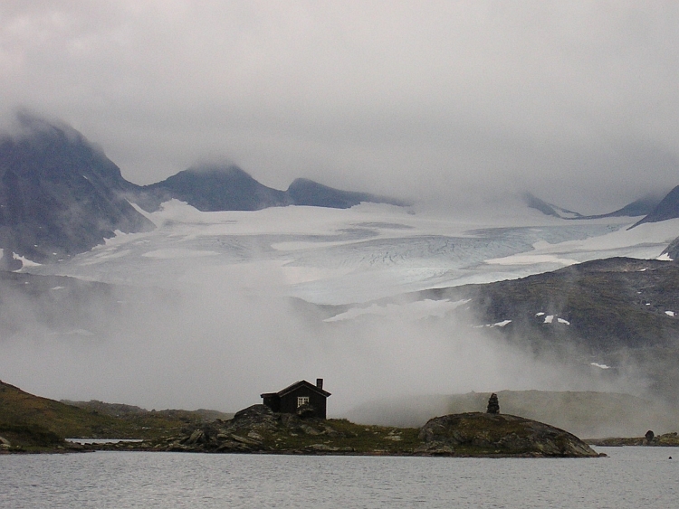
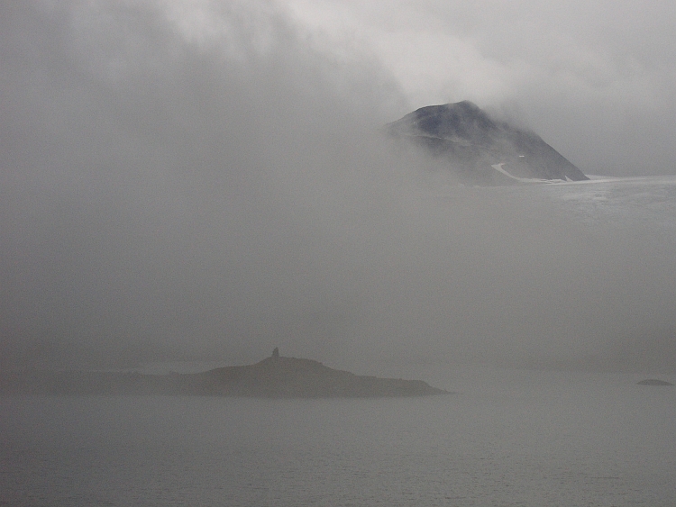
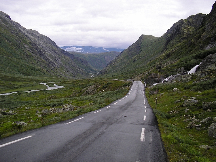
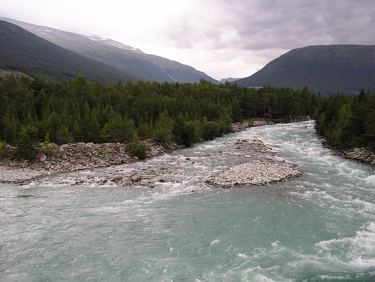
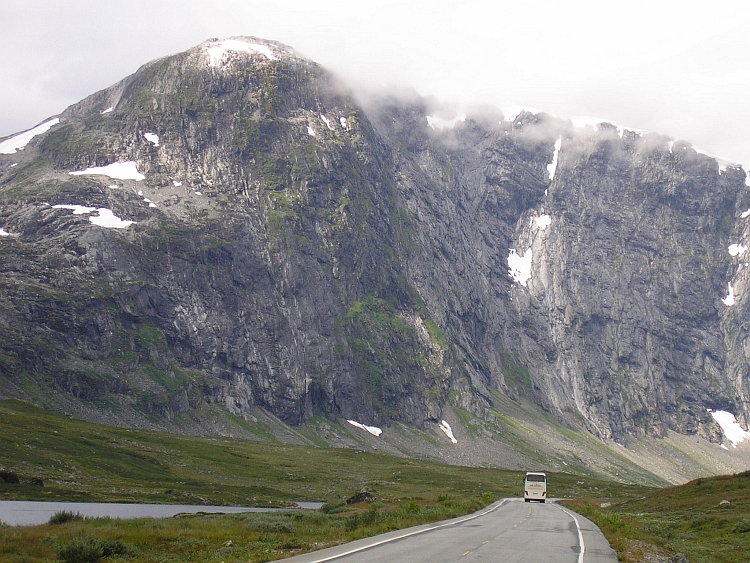
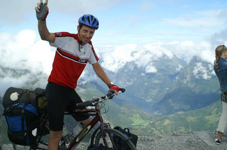
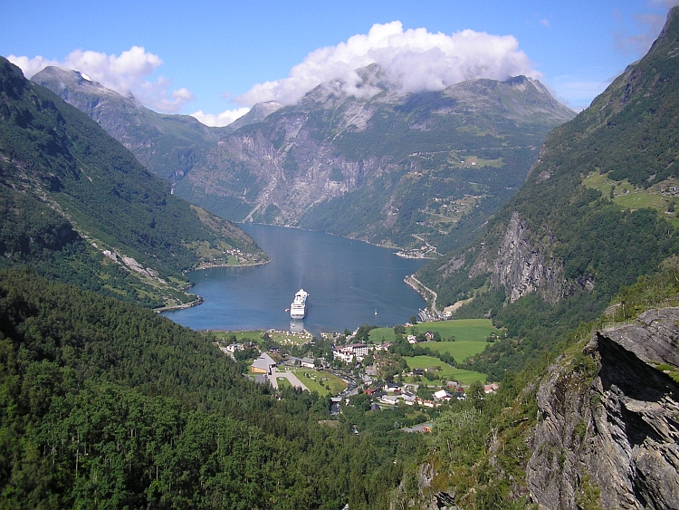
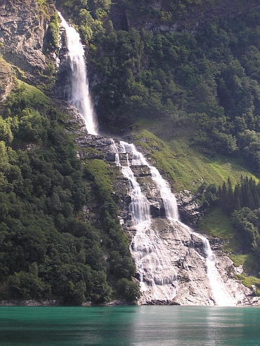
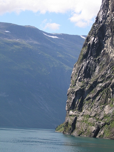

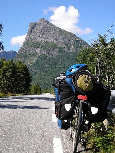
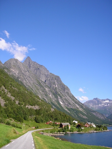
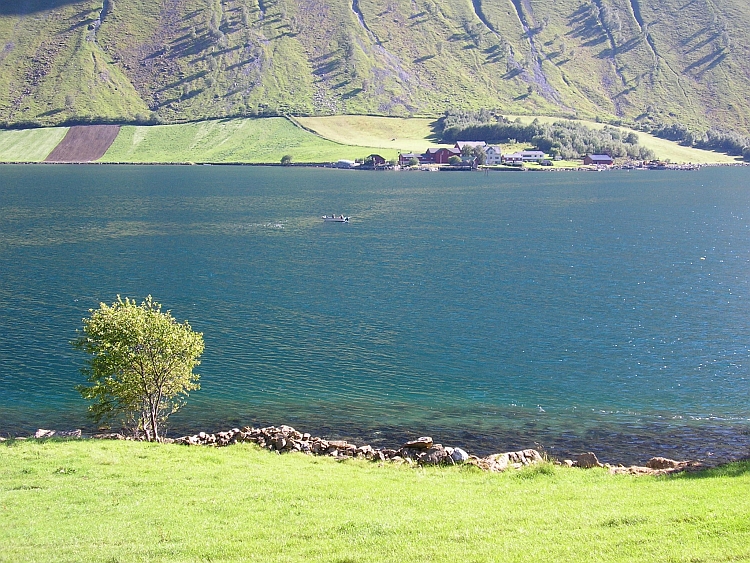

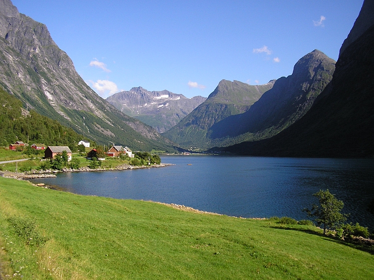
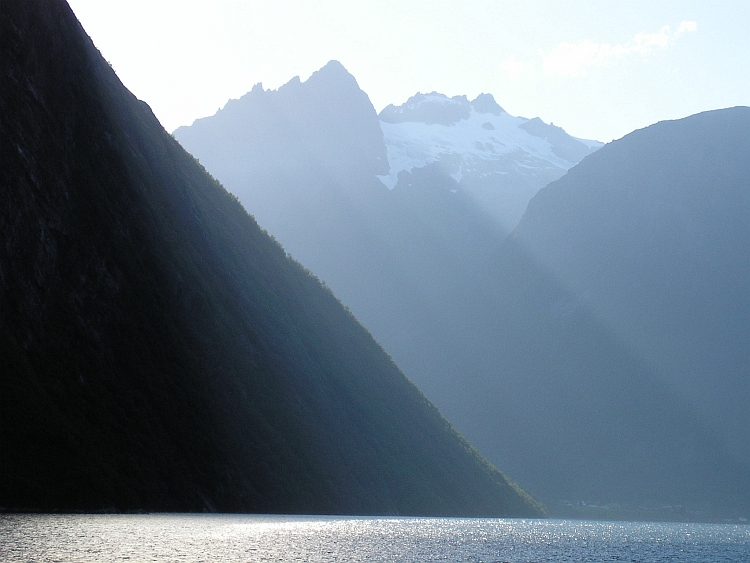
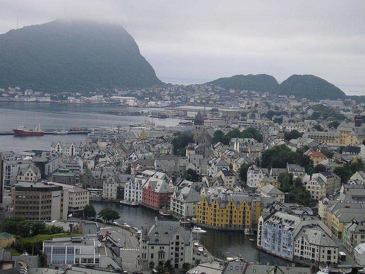
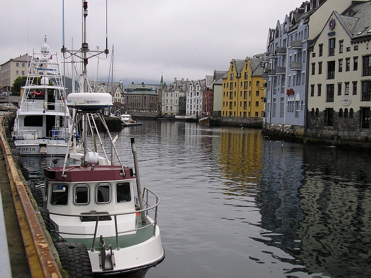
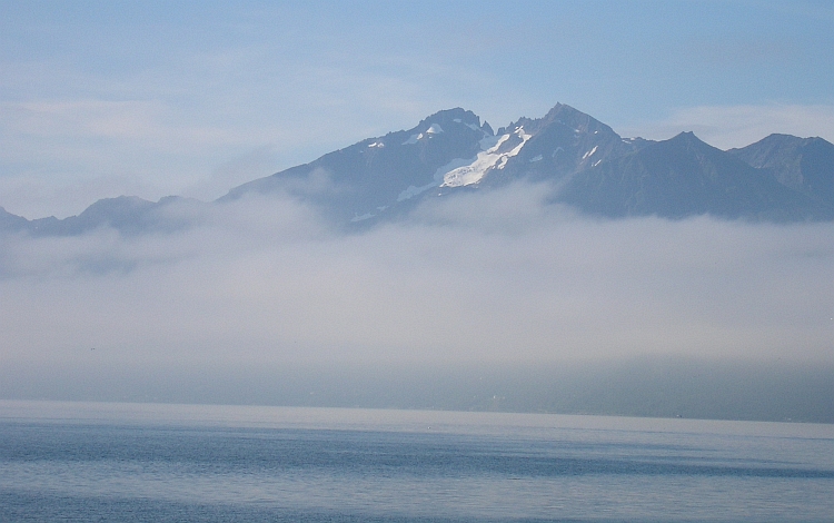
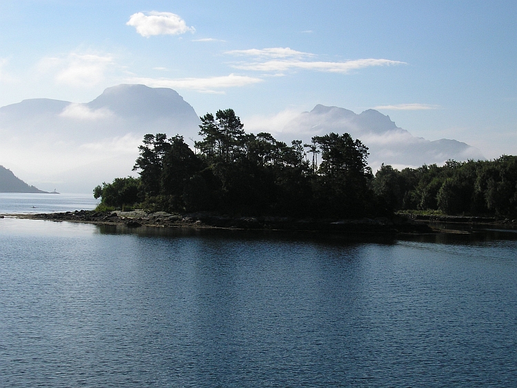
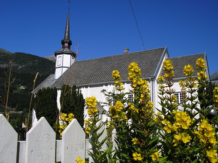
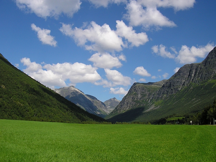
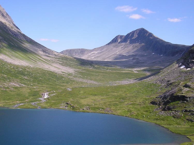
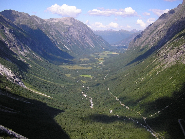
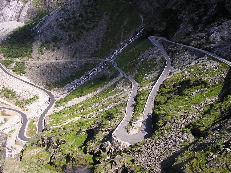
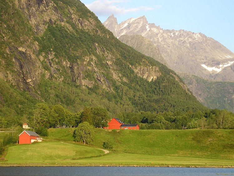
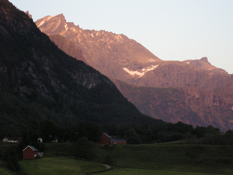
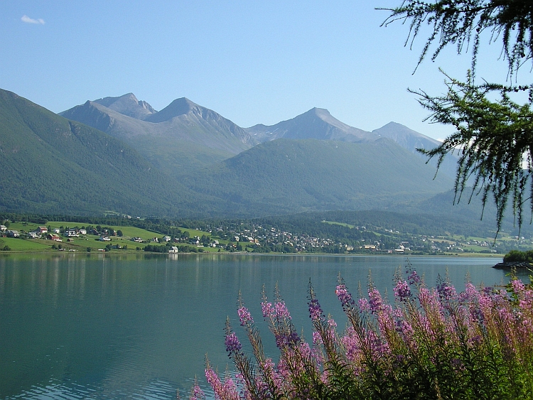

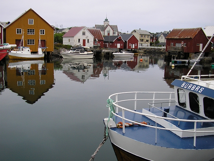
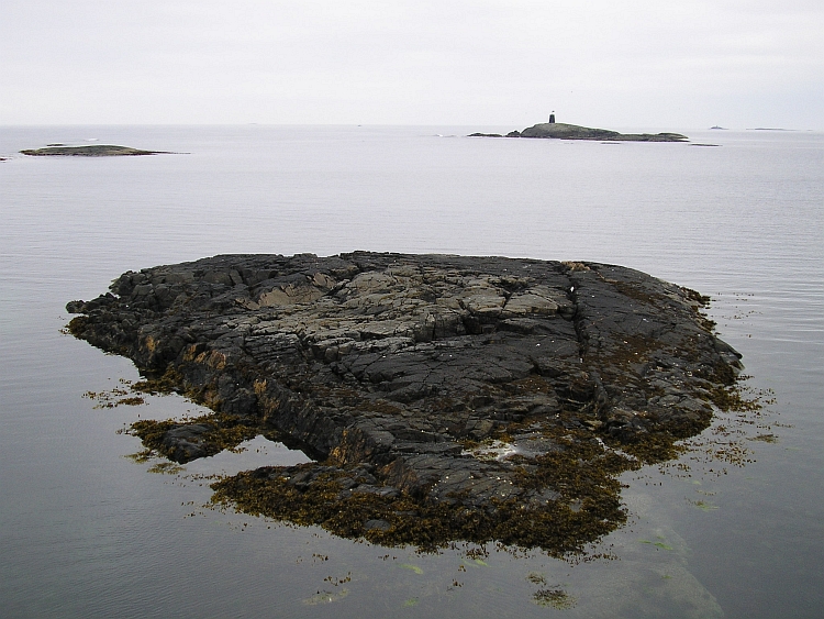
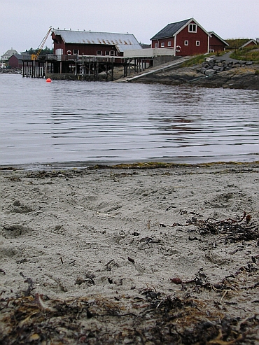
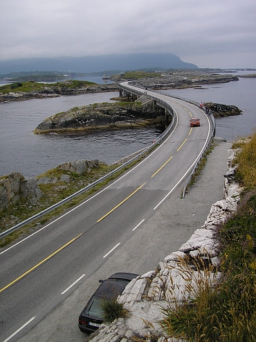
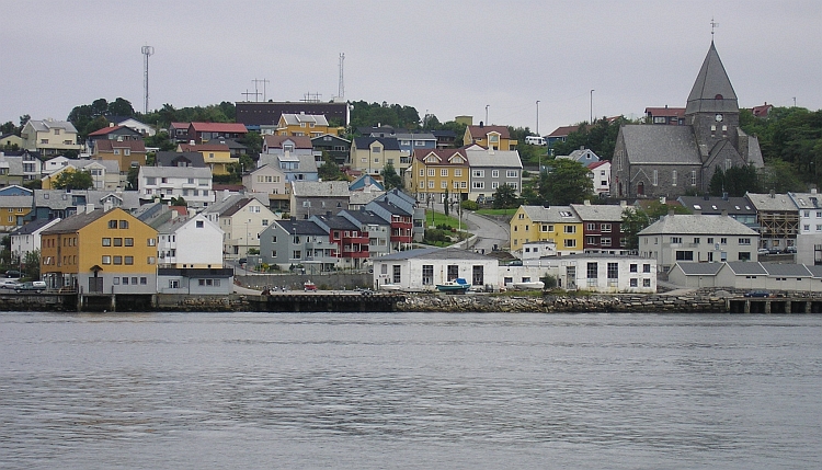
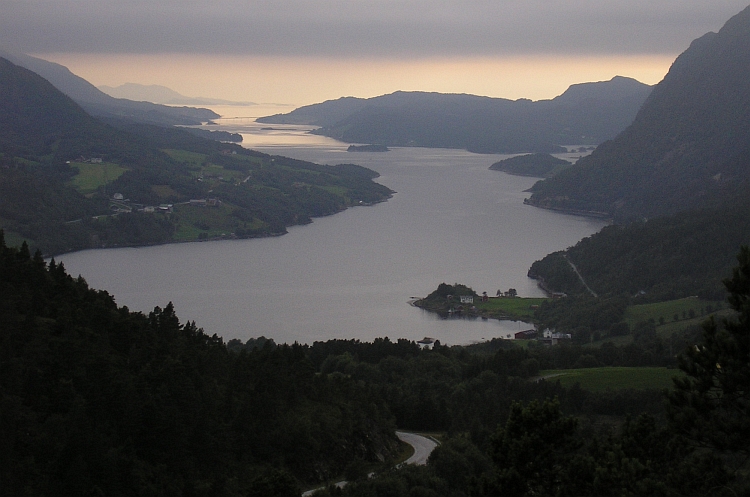
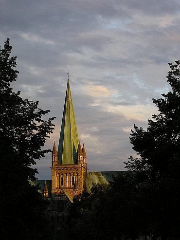
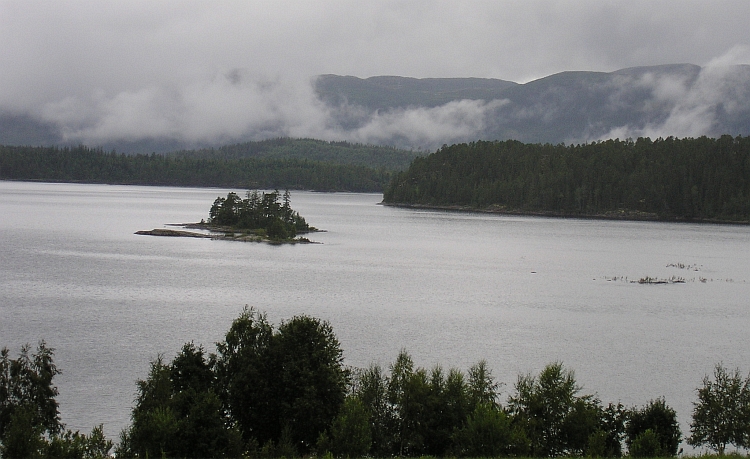
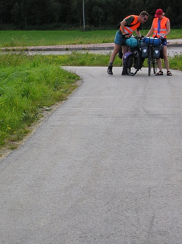
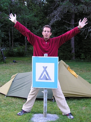
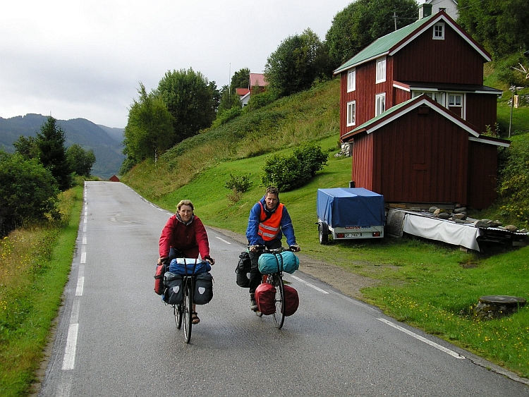
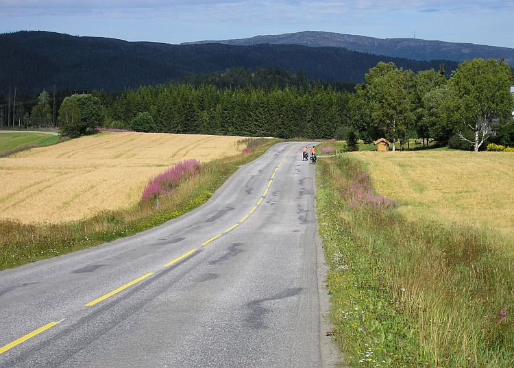
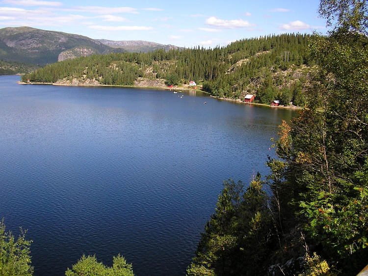
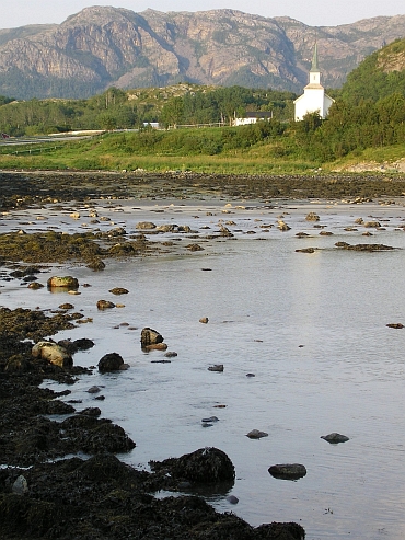
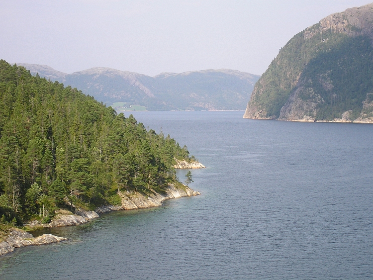
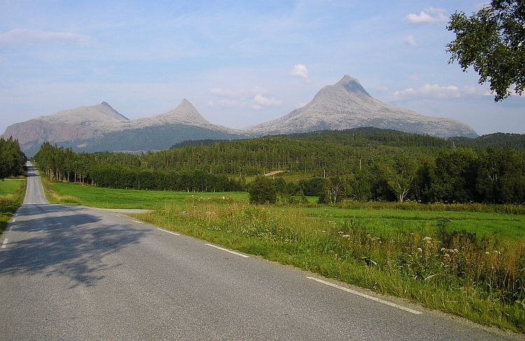
 After the long day trip yesterday, my legs feel tired now. Luckily today is a
completely flat stage. With the sea on the left hand and the Norwegian mountains
on the right hand I am strolling along tiny villages, gently rolling hills, rocky mountains,
green pastures and along the ocean with lots of islands before the coast. In other words, the
landscape is extraordinary rich in variation. This region is more inhabited,
which is very welcome now I am so tired. I take a long rest at a cafe in Vik.
In Brønnøysund I take all the time to find out a possibility to meet
Menno & Klaartje again today. I propose to meet in Torghatten, a mountain with a gap
on an island. There is also a camping.
After the long day trip yesterday, my legs feel tired now. Luckily today is a
completely flat stage. With the sea on the left hand and the Norwegian mountains
on the right hand I am strolling along tiny villages, gently rolling hills, rocky mountains,
green pastures and along the ocean with lots of islands before the coast. In other words, the
landscape is extraordinary rich in variation. This region is more inhabited,
which is very welcome now I am so tired. I take a long rest at a cafe in Vik.
In Brønnøysund I take all the time to find out a possibility to meet
Menno & Klaartje again today. I propose to meet in Torghatten, a mountain with a gap
on an island. There is also a camping.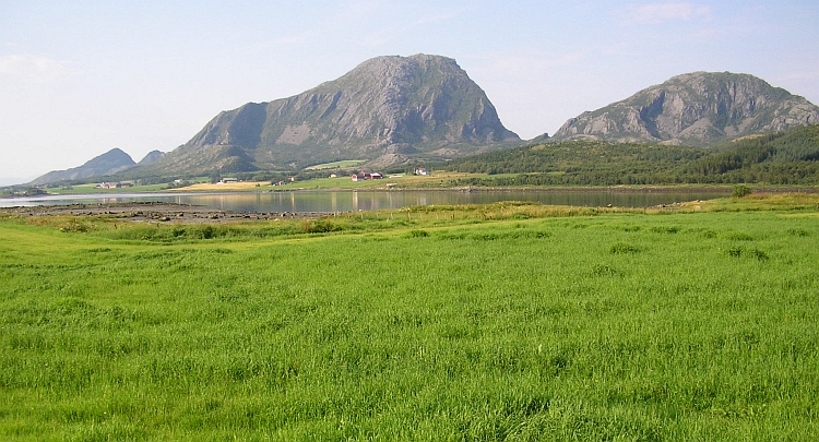
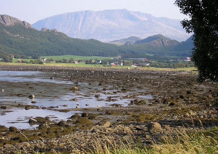
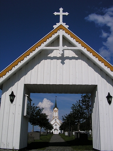
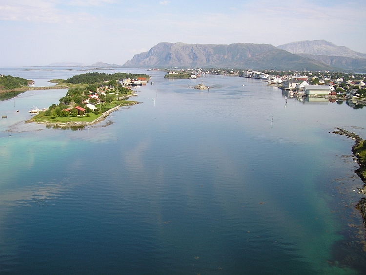
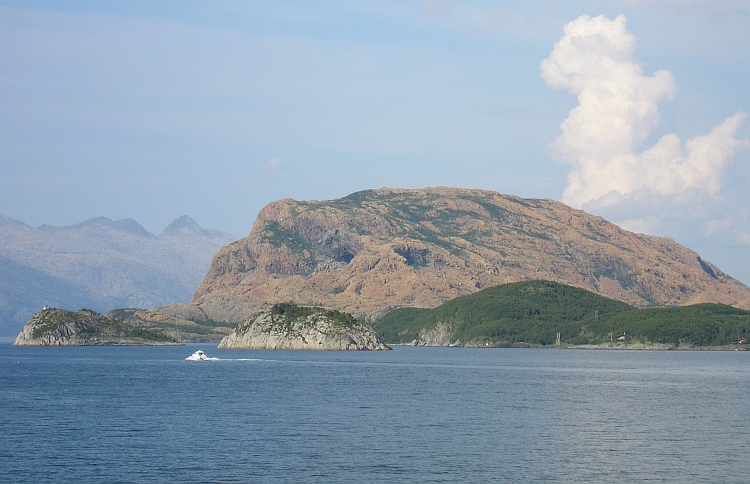
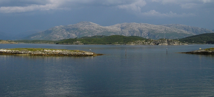
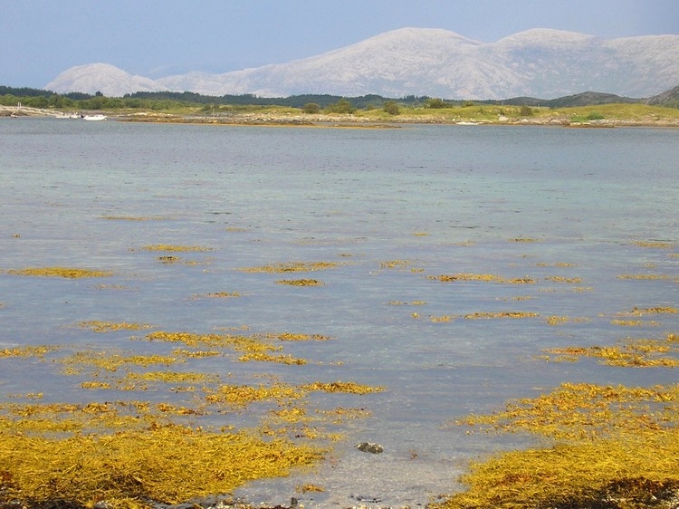
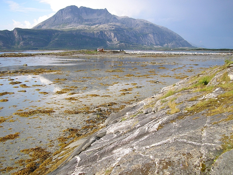
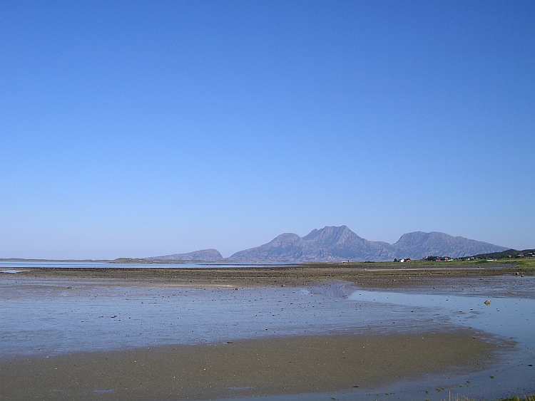
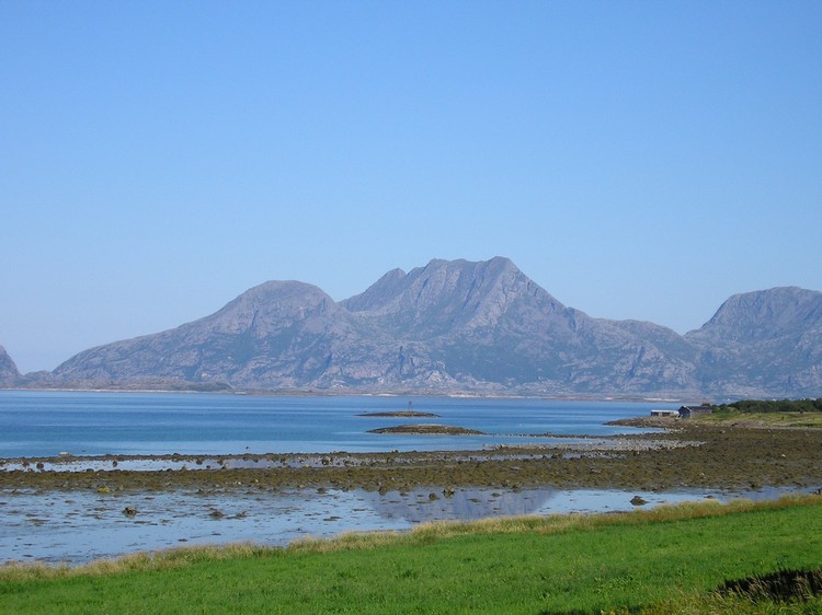
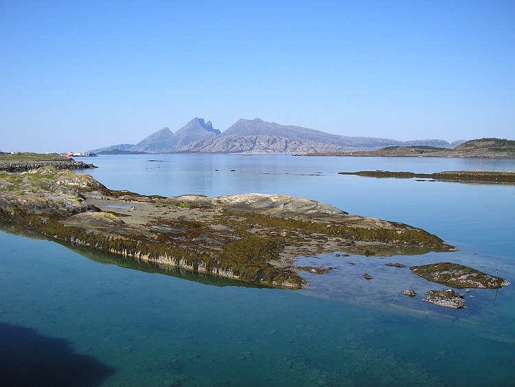
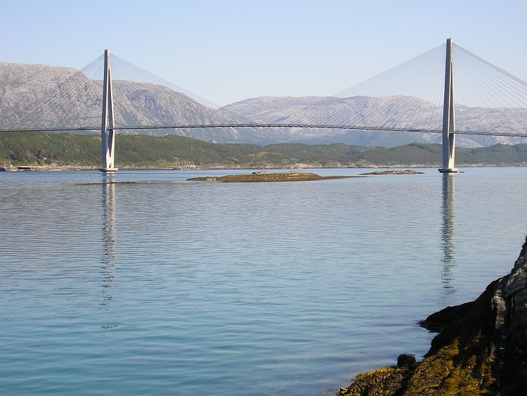
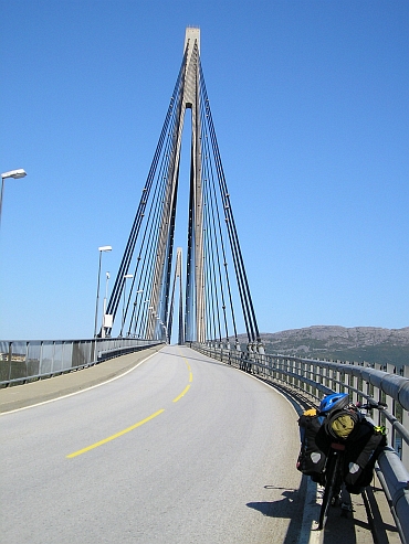 I reach Nesna from where I take a ferry to Vågaholmen. I want to circumvent
a long detour around a fjord with a lot of long tunnels. I am talking to a local
woman who lives on a small island before the coast. She tells me she has travelled
a lot in her life.
I reach Nesna from where I take a ferry to Vågaholmen. I want to circumvent
a long detour around a fjord with a lot of long tunnels. I am talking to a local
woman who lives on a small island before the coast. She tells me she has travelled
a lot in her life.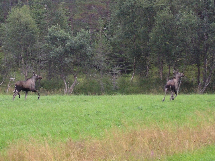
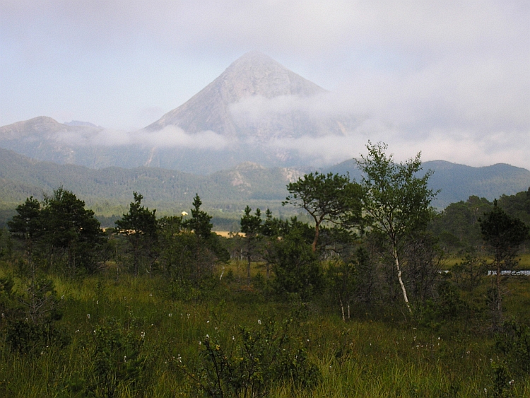
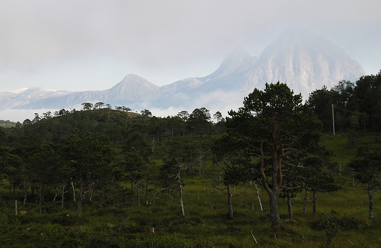
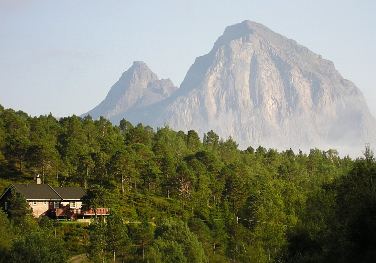
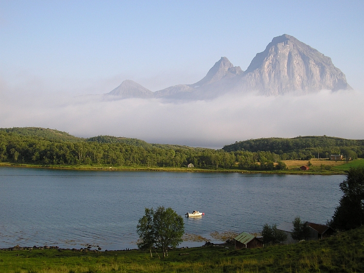
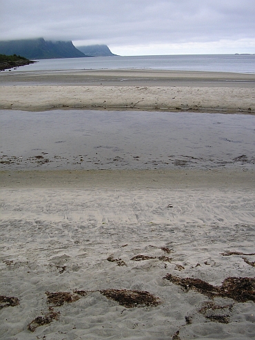
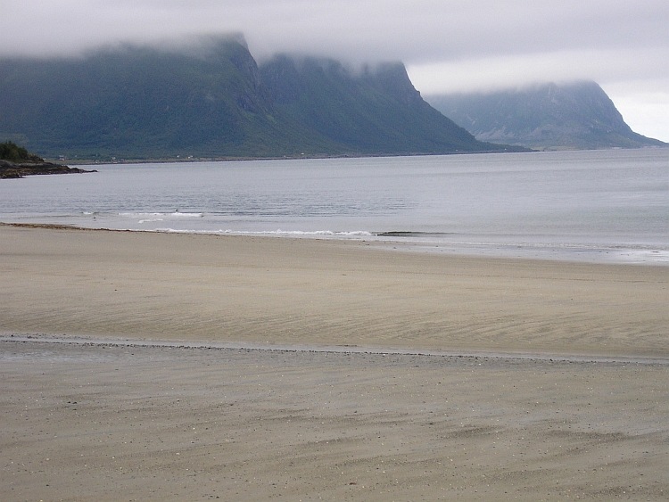
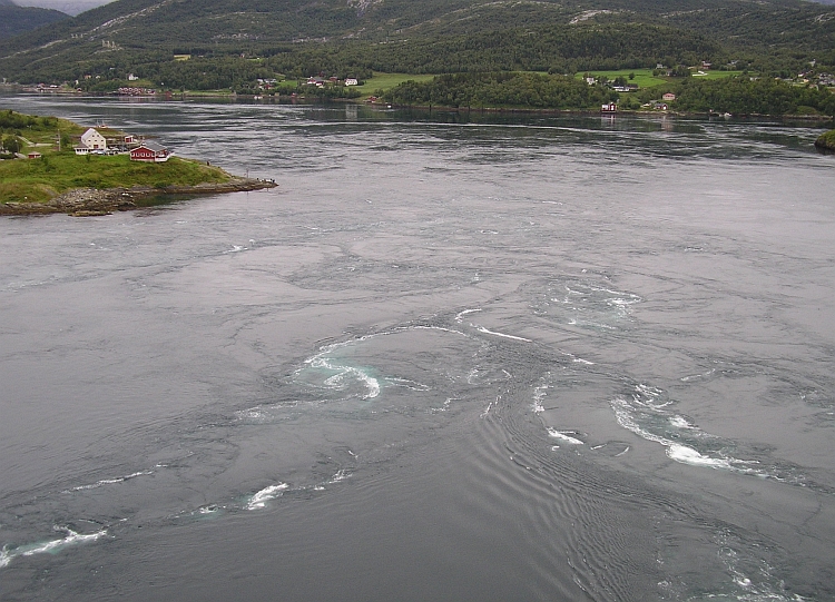
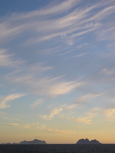
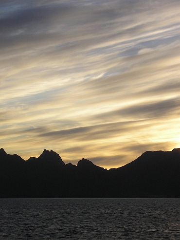
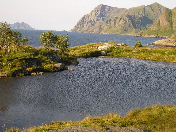
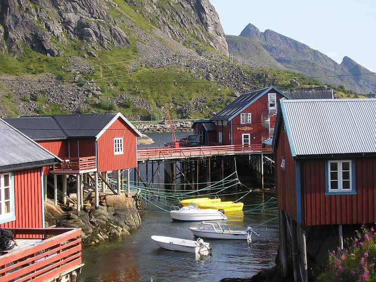
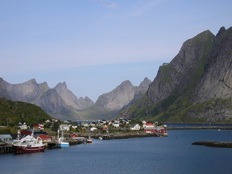
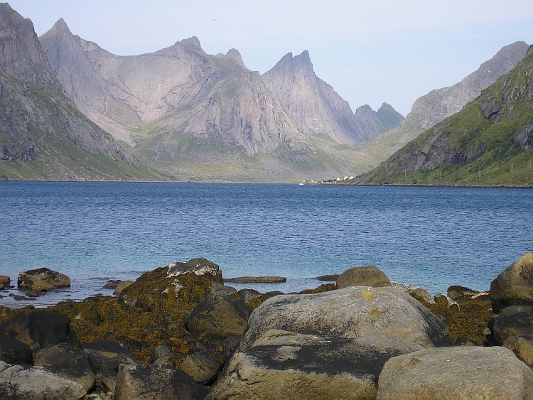
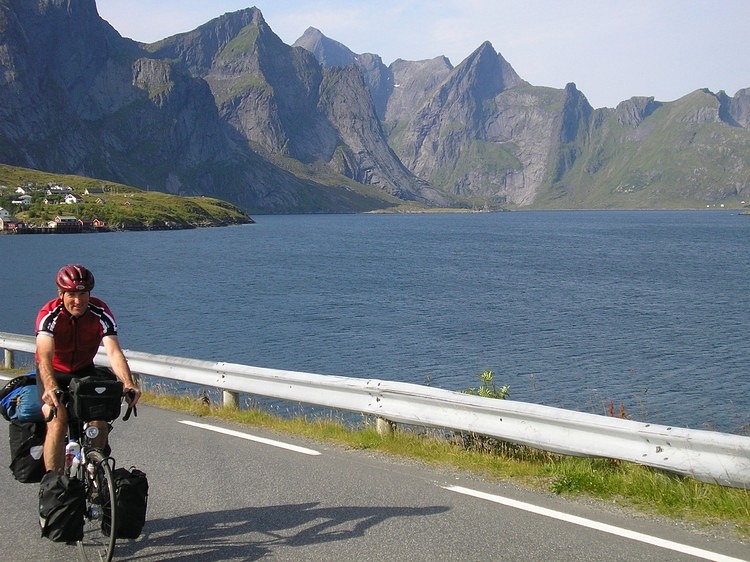
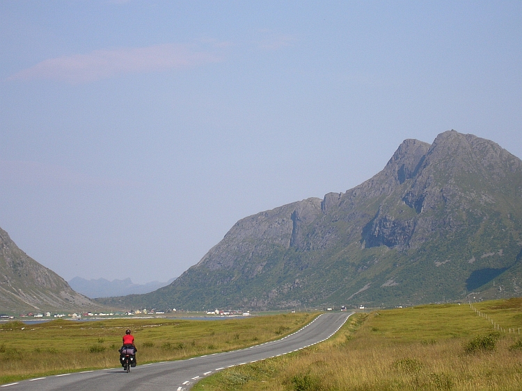
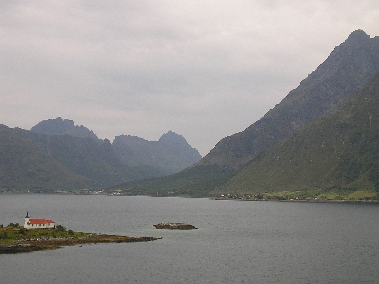
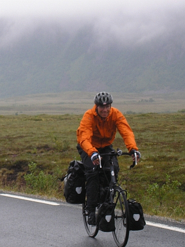
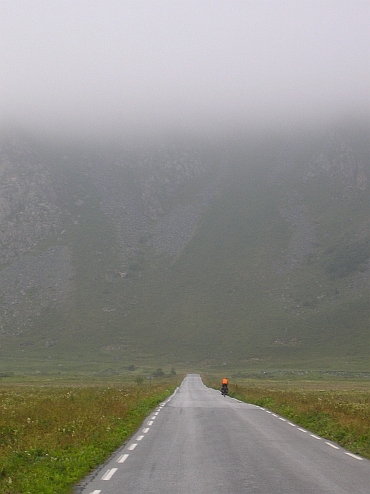
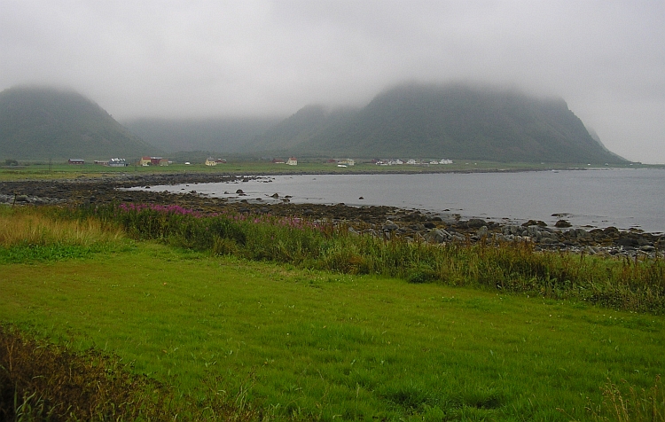
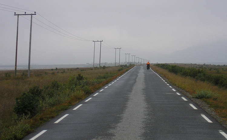
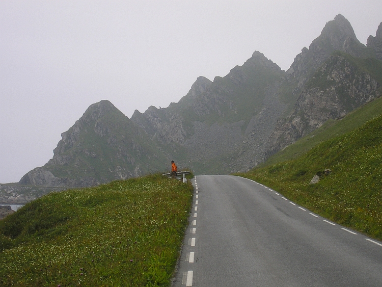
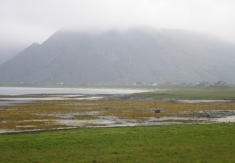
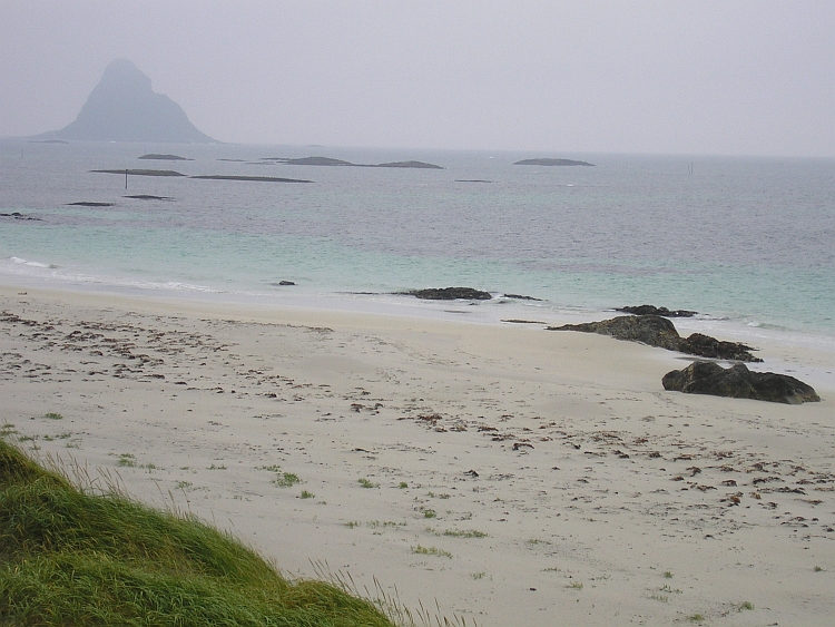
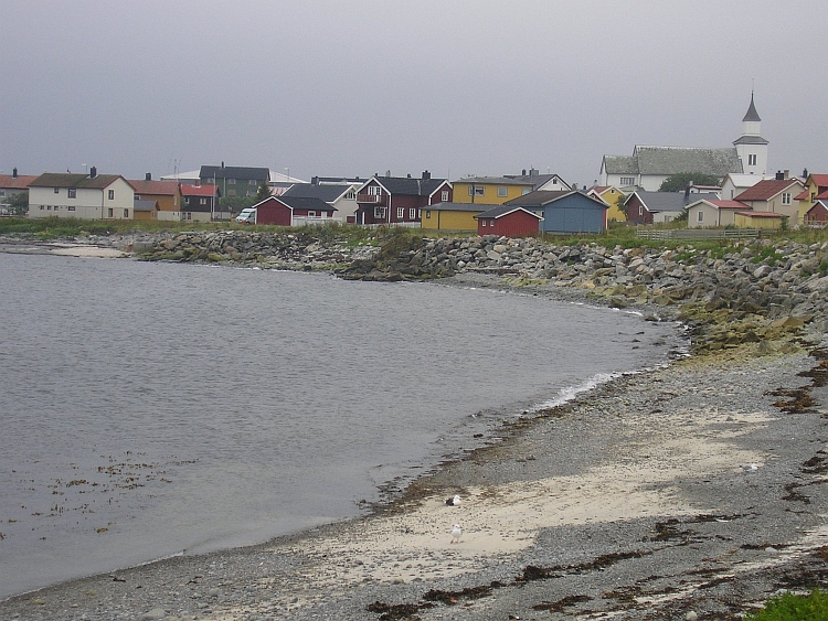
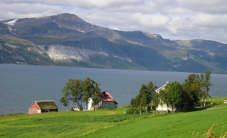
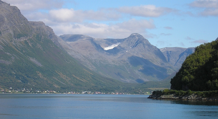
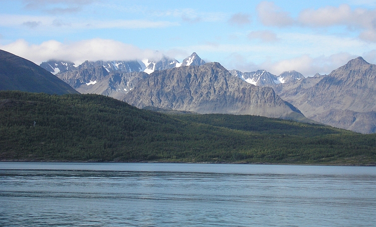
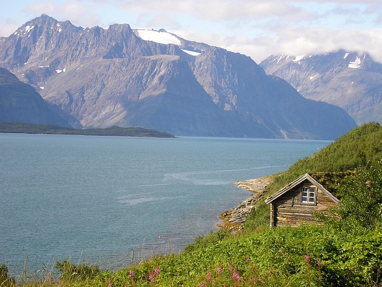
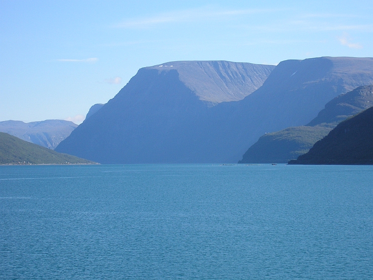
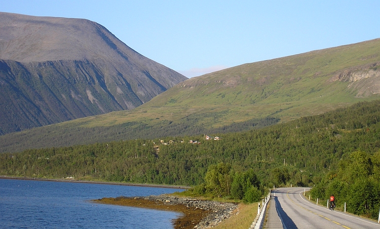
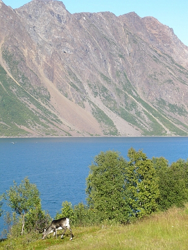 The sky is deep blue as we wake up. It is still very fresh. We cycle ourselves warm
on the ascent. Rapidly we are far above the lake and above the treeline, which is
around three hundred meter high, this far north. We pass interesting landscapes.
Fjords, highlands, even an icecap. And we see lots of reindeers. At the pass there is a tourist
camp with a few Sami tents. The sami men and women try to look as authentic as
possible and wear their colourful clothes. I buy a dangerously sharp knife. We see
the first reindeers but we are more interested in a hot chocolate in the cafe to warm
ourselves. As we carry on half an hour later, it is much warmer already. We are
freezing one last time during the descent. Then the temperatures rise further and further
untill nearly twenty degrees. According to a local woman this is one of the very best
days of the year, so we may call ourselves lucky again.
The sky is deep blue as we wake up. It is still very fresh. We cycle ourselves warm
on the ascent. Rapidly we are far above the lake and above the treeline, which is
around three hundred meter high, this far north. We pass interesting landscapes.
Fjords, highlands, even an icecap. And we see lots of reindeers. At the pass there is a tourist
camp with a few Sami tents. The sami men and women try to look as authentic as
possible and wear their colourful clothes. I buy a dangerously sharp knife. We see
the first reindeers but we are more interested in a hot chocolate in the cafe to warm
ourselves. As we carry on half an hour later, it is much warmer already. We are
freezing one last time during the descent. Then the temperatures rise further and further
untill nearly twenty degrees. According to a local woman this is one of the very best
days of the year, so we may call ourselves lucky again.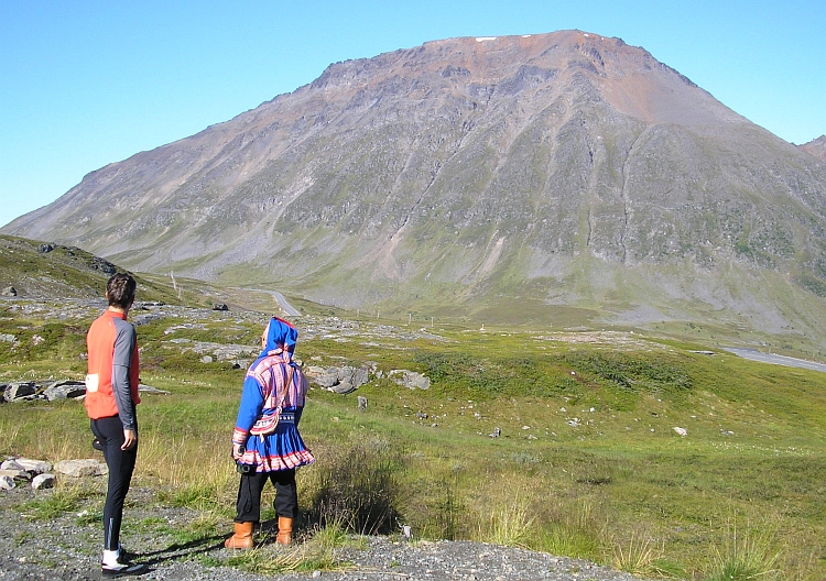
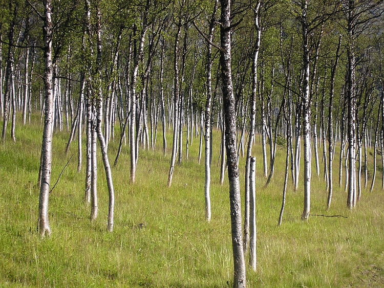
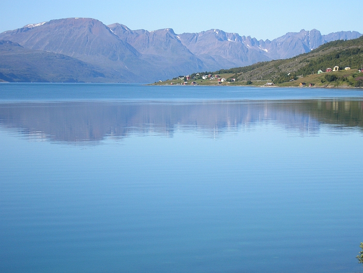
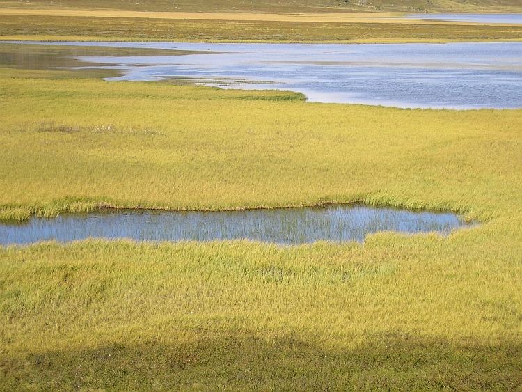
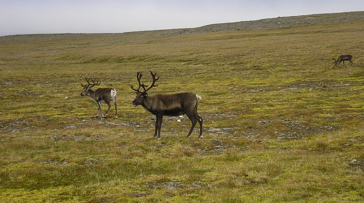 This could be the last day. We get up early in the morning. We will just see. We have
to reach the Nordkapp today as we want to catch the airplane from Alta back home the
day after tomorrow. Tomorrow we have to catch the two o'clock bus in Honningsvåg,
the only village with bus service to Alta, which lies 35 kilometre from the Nordkapp.
We do not want to think about tomorrow now. We have to reach the Nordkapp today and
that should be easily possible.
This could be the last day. We get up early in the morning. We will just see. We have
to reach the Nordkapp today as we want to catch the airplane from Alta back home the
day after tomorrow. Tomorrow we have to catch the two o'clock bus in Honningsvåg,
the only village with bus service to Alta, which lies 35 kilometre from the Nordkapp.
We do not want to think about tomorrow now. We have to reach the Nordkapp today and
that should be easily possible.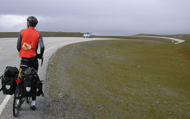
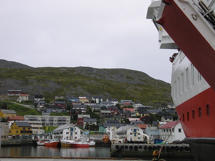
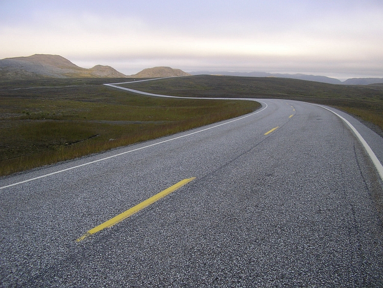
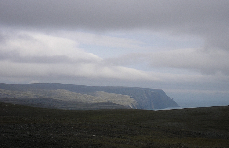
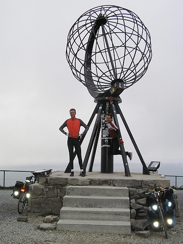 We are creeping forward. Then the road starts to go down. The road descends to sea level
and then starts to climb again steeply, right against the storm. Sometimes I follow Erwin,
sometimes Erwin follows me. There is no shelter against the storm. Not before the
Nordkapp.
We are creeping forward. Then the road starts to go down. The road descends to sea level
and then starts to climb again steeply, right against the storm. Sometimes I follow Erwin,
sometimes Erwin follows me. There is no shelter against the storm. Not before the
Nordkapp.