| Start Page | 1) Ecuador | 2) Peru | 3) Bolivia | 4) Chile & Argentina | 5) Colombia | 6) Central America | 7) Mexico | 8) U.S.A. | 9) Canada |  |
| Start Page | 1) Ecuador | 2) Peru | 3) Bolivia | 4) Chile & Argentina | 5) Colombia | 6) Central America | 7) Mexico | 8) U.S.A. | 9) Canada | |
|
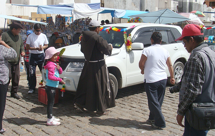
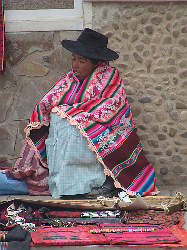
The long Road. Part 3 of 9: Bolivia
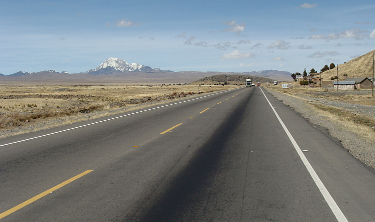
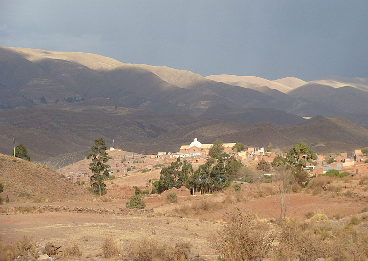
 One of the classic South American bike experience is the 'highway' that leads
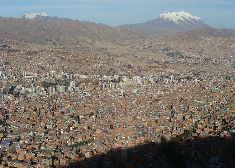
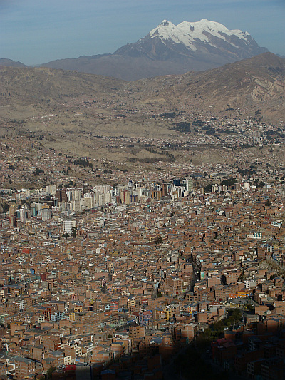
down from El Alto to La Paz. The capital of Bolivia is perhaps the most
beautiful city in the world as viewed from above. Hundreds of thousands of
houses seemed to be carved out of the immense mountain slopes. The houses
on the flamks of the mountain were painted in the same color as the syrrounding
mountains themselves: in ocher brown and terracotta. Only the office buildings
of the business center had abnormal, artificial colors. In the background loomed
the majestic snow domes of the Illimani mountain high above the cityscape.
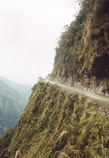
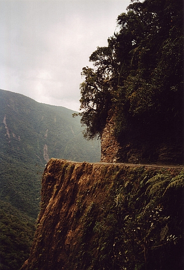
I rushed down over the highway gainst the breathtaking view of the vertical
city and the mountains of the Cordillera Real. I could feel the adrenaline
flow through my veins. I had to make sure that I kept watching the road. In
addition to the taxis, trucks and stray dogs were several rather unusual road
users such as entire families who walked in their best garb on the niddle of the
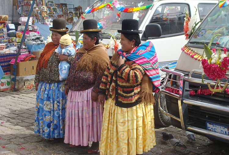
highway or people who found a quiet spot on the highway to defecate. La Paz was
not changed much since my visit eight years ago. She was still a feast for the
senses. A fun party that may turn in the wink of an eye into a very
annoying party, but one that excites anyway.
One of the classic South American bike experience is the 'highway' that leads
down from El Alto to La Paz. The capital of Bolivia is perhaps the most
beautiful city in the world as viewed from above. Hundreds of thousands of
houses seemed to be carved out of the immense mountain slopes. The houses
on the flamks of the mountain were painted in the same color as the syrrounding
mountains themselves: in ocher brown and terracotta. Only the office buildings
of the business center had abnormal, artificial colors. In the background loomed
the majestic snow domes of the Illimani mountain high above the cityscape.
I rushed down over the highway gainst the breathtaking view of the vertical
city and the mountains of the Cordillera Real. I could feel the adrenaline
flow through my veins. I had to make sure that I kept watching the road. In
addition to the taxis, trucks and stray dogs were several rather unusual road
users such as entire families who walked in their best garb on the niddle of the
highway or people who found a quiet spot on the highway to defecate. La Paz was
not changed much since my visit eight years ago. She was still a feast for the
senses. A fun party that may turn in the wink of an eye into a very
annoying party, but one that excites anyway. 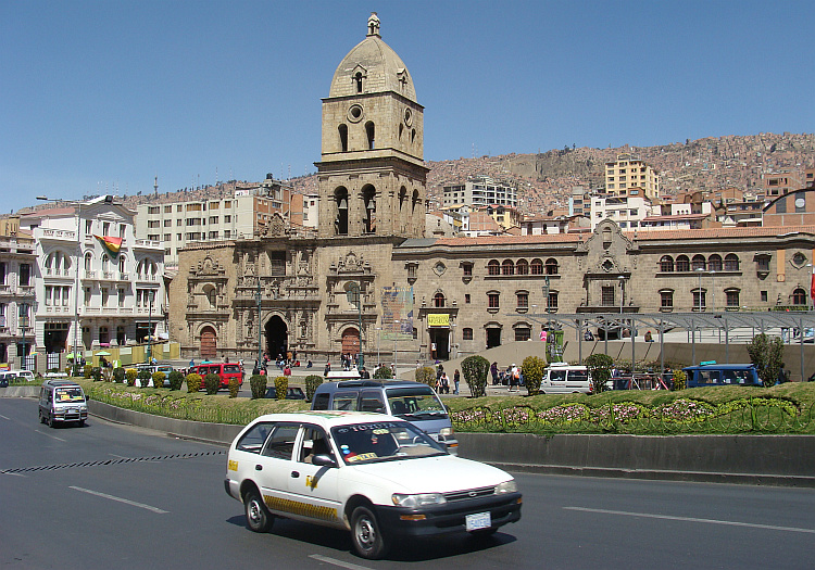

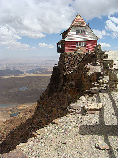 As a ski area the Chacaltaya might not stand the comparison with the European
ski areas, but the mountain views were fine. I locked my bike and climbed the
final rocks up to the summit at 5400 meters altitude. It was visible how big the
agglomeration La Paz-El Alto had become. El Alto seemed to be at least five times larger
than La Paz, which is wedged in a valley and cannot grow anymore.
As a ski area the Chacaltaya might not stand the comparison with the European
ski areas, but the mountain views were fine. I locked my bike and climbed the
final rocks up to the summit at 5400 meters altitude. It was visible how big the
agglomeration La Paz-El Alto had become. El Alto seemed to be at least five times larger
than La Paz, which is wedged in a valley and cannot grow anymore. 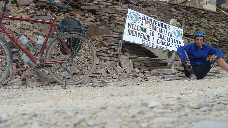
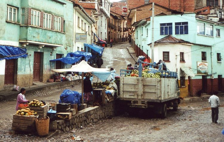
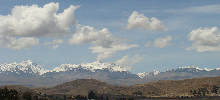
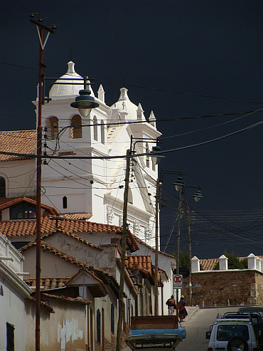
 I cycled towards the mountains through the streets of La Paz. I spent my days in
Bolivia in 2003 at the end of the dry season and after a few days I still did
not have any free views over the mountain massif of the Cordillera Real. But a
bright morning sun shone towards me on this day. It was the first time that the
mountains of the Cordillera Real were not shrouded in mist and that the main
mountain range in Bolivia revealed itself in its full glory. It was a nervous
affair to find my way up over the steep streets in the ultimate South American
traffic chaos of La Paz. As the slowest road user my position in the traffic
was vulnerable. All around me the taxis and buses were crawling in all directions.
Against the driving direction, at right angles to the direction of travel and in
all possible oblique angles and only occasionally a taxi or bus driver would
ride in the intended direction for a short time. Cars or buses could pass by
frighteningly narrow with the horn continuously pressed. In the cacophony it
was impossible to determine who honked, to whom the message was addressed to or
what the message implied.
I cycled towards the mountains through the streets of La Paz. I spent my days in
Bolivia in 2003 at the end of the dry season and after a few days I still did
not have any free views over the mountain massif of the Cordillera Real. But a
bright morning sun shone towards me on this day. It was the first time that the
mountains of the Cordillera Real were not shrouded in mist and that the main
mountain range in Bolivia revealed itself in its full glory. It was a nervous
affair to find my way up over the steep streets in the ultimate South American
traffic chaos of La Paz. As the slowest road user my position in the traffic
was vulnerable. All around me the taxis and buses were crawling in all directions.
Against the driving direction, at right angles to the direction of travel and in
all possible oblique angles and only occasionally a taxi or bus driver would
ride in the intended direction for a short time. Cars or buses could pass by
frighteningly narrow with the horn continuously pressed. In the cacophony it
was impossible to determine who honked, to whom the message was addressed to or
what the message implied.
 After several hours the rain finally stopped. I was wet to the bone. In a
bus stop I met a fellow cyclist. It proved to be Christian, a young man from
Switzerland. He wanted to travel back by bus to La Paz. I asked why he did not
finish the last kilometers of the descent. Because he had no reason he
could think of, he accompanied me on the last kilometers to Yolosa. Christian
was a great mystery. He cycled without luggage, without food, with only a
minimum of drinking water. Also spiritually Christian seemed without luggage.
Without purpose or reason. If he did not feel like cycling no more, he would
just stop and hitchhike back again.
After several hours the rain finally stopped. I was wet to the bone. In a
bus stop I met a fellow cyclist. It proved to be Christian, a young man from
Switzerland. He wanted to travel back by bus to La Paz. I asked why he did not
finish the last kilometers of the descent. Because he had no reason he
could think of, he accompanied me on the last kilometers to Yolosa. Christian
was a great mystery. He cycled without luggage, without food, with only a
minimum of drinking water. Also spiritually Christian seemed without luggage.
Without purpose or reason. If he did not feel like cycling no more, he would
just stop and hitchhike back again.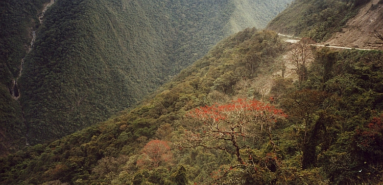
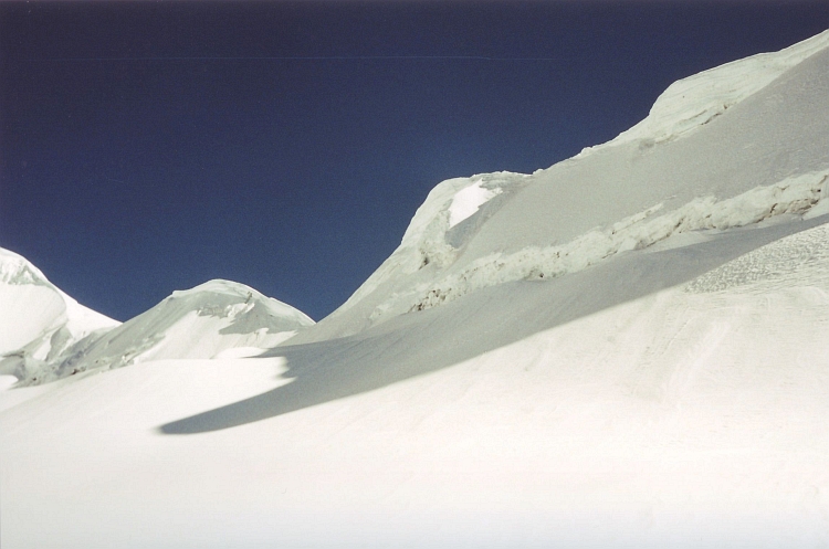
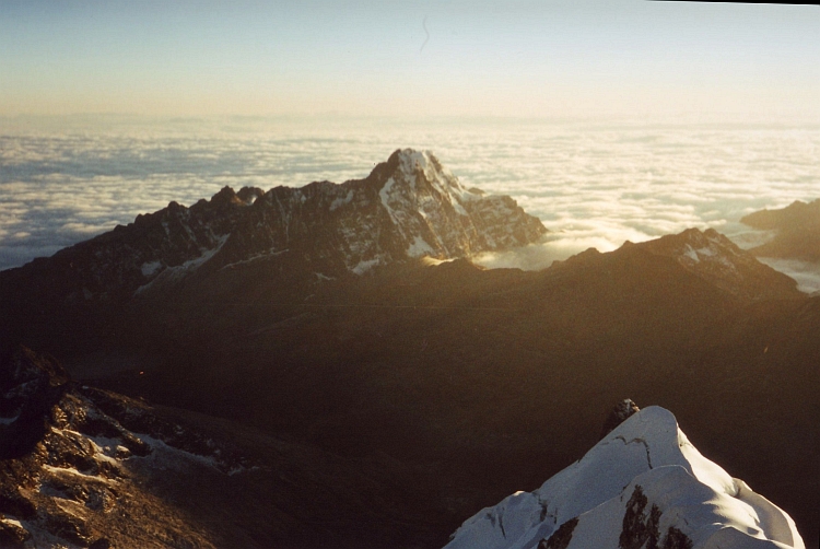
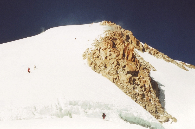
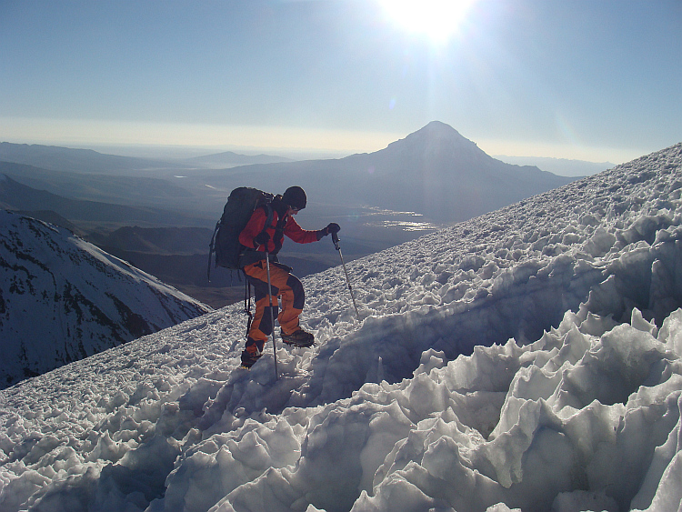
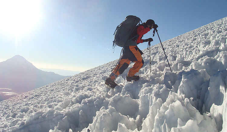
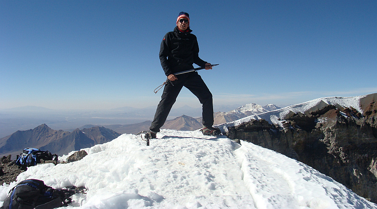
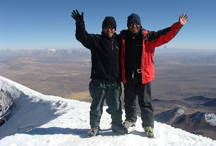
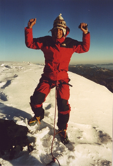 Without fiddling with the senseless secure points we were able to climb
significantly faster. We set a solid pace in order to remain in the wall as short
as possible. I was breathing like a mad dog when I reached the small top plateau.
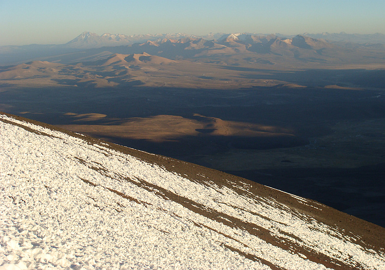
We were the first climbers to be on the top that day. After a minute the sun came
up behind the five- to six thousand meter lower Yungas. The thin layer of clouds
began to to swell above the jungle. On the other side of the mountain, we had
views across the Altiplano, the vast Bolivian plateau, which was bathing in the
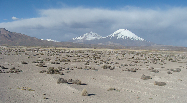
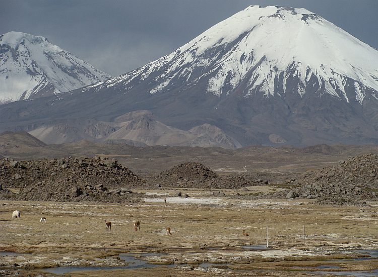
first sunbeams now. Two to three hundred kilometers further I spotted the
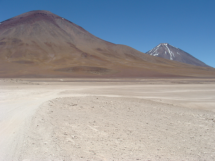
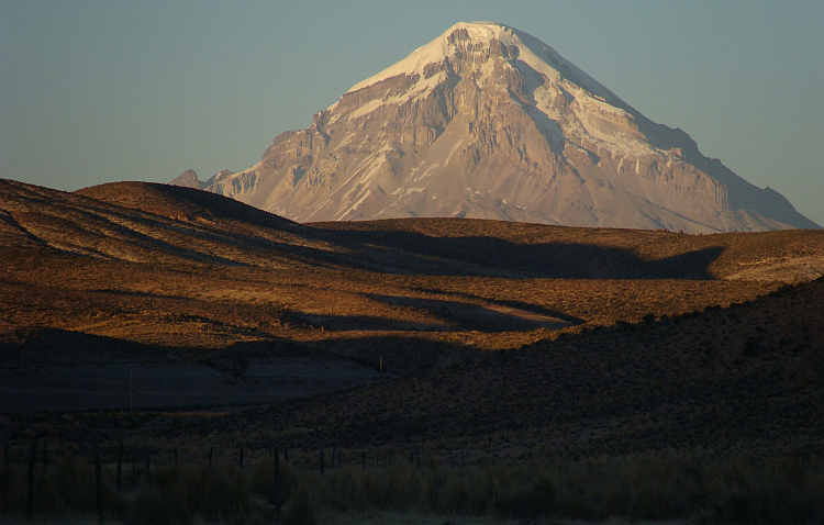
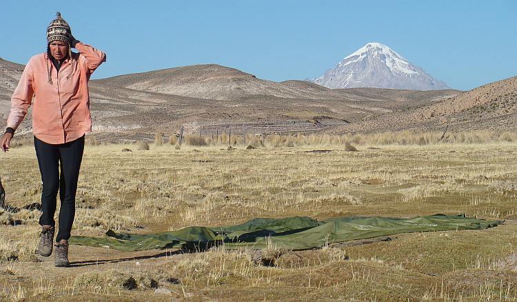
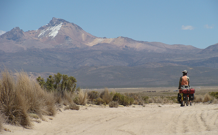
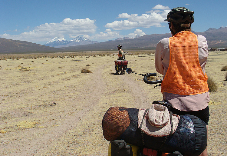
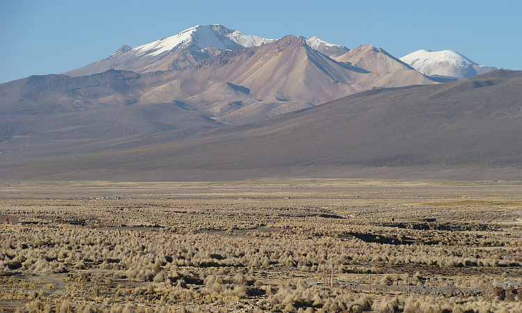
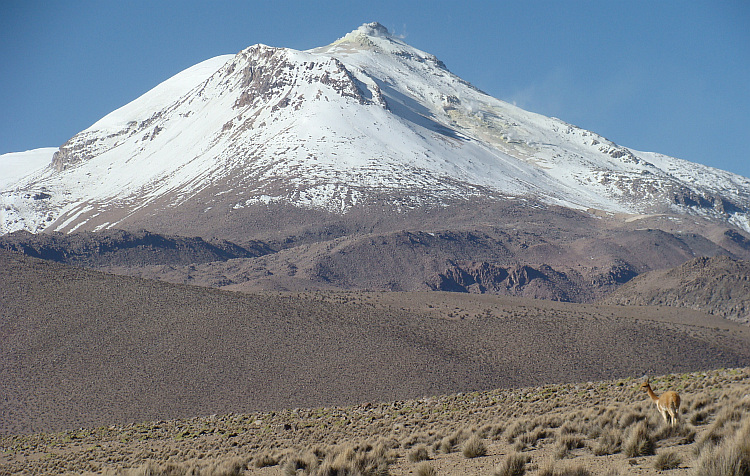
mountains near the western border with Chile. I recognized the highest mountain of
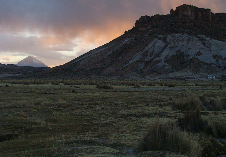
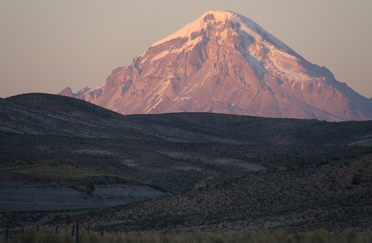
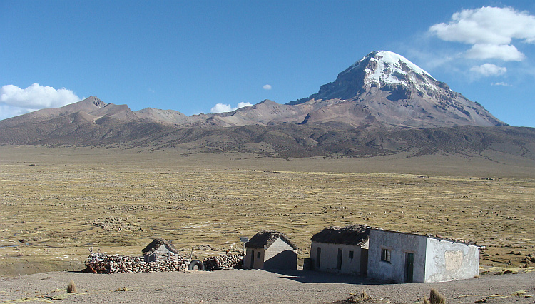
Bolivia, the Nevado Sajama and the twin volcanoes Parinacota and Pomerape.
On the descent we passed my Spanish friends. They had almost reached the summit.
Now the sun was shining, the ice was softer and now the ice wall was suddenly
very easy to climb. In retrospect, we had to sleep two hours longer. Then we
could have reached the top much more secure. Without further difficulties we
descended to the base camp.
Without fiddling with the senseless secure points we were able to climb
significantly faster. We set a solid pace in order to remain in the wall as short
as possible. I was breathing like a mad dog when I reached the small top plateau.
We were the first climbers to be on the top that day. After a minute the sun came
up behind the five- to six thousand meter lower Yungas. The thin layer of clouds
began to to swell above the jungle. On the other side of the mountain, we had
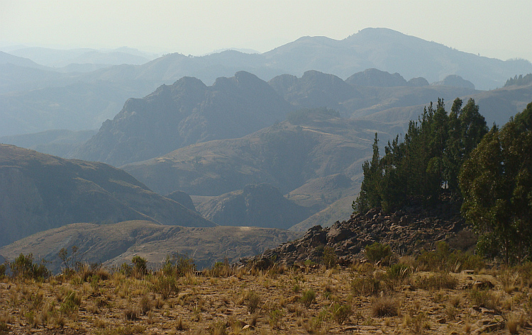
views across the Altiplano, the vast Bolivian plateau, which was bathing in the
first sunbeams now. Two to three hundred kilometers further I spotted the
mountains near the western border with Chile. I recognized the highest mountain of
Bolivia, the Nevado Sajama and the twin volcanoes Parinacota and Pomerape.
On the descent we passed my Spanish friends. They had almost reached the summit.
Now the sun was shining, the ice was softer and now the ice wall was suddenly
very easy to climb. In retrospect, we had to sleep two hours longer. Then we
could have reached the top much more secure. Without further difficulties we
descended to the base camp.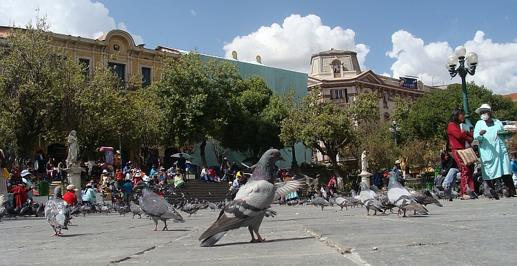
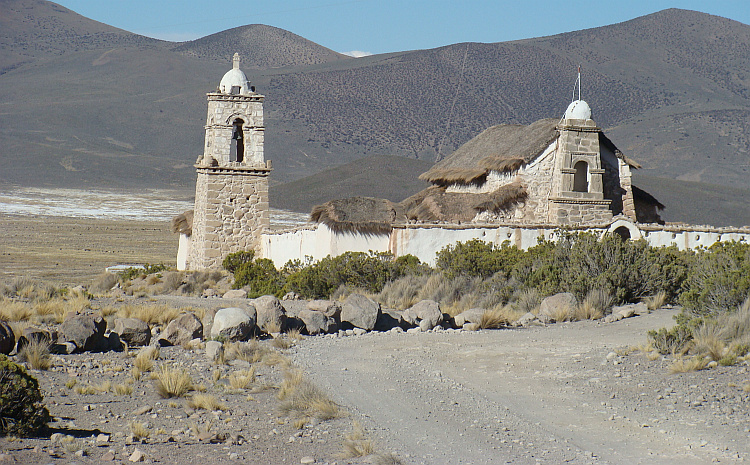
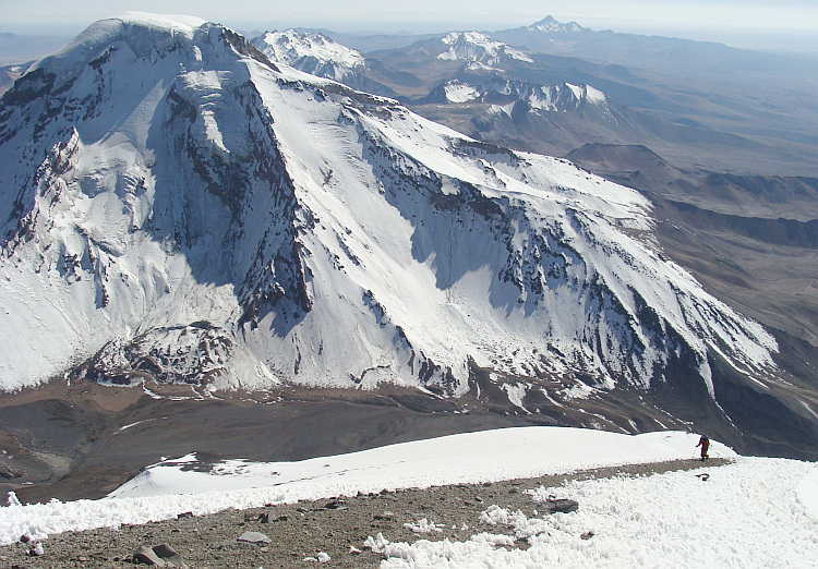
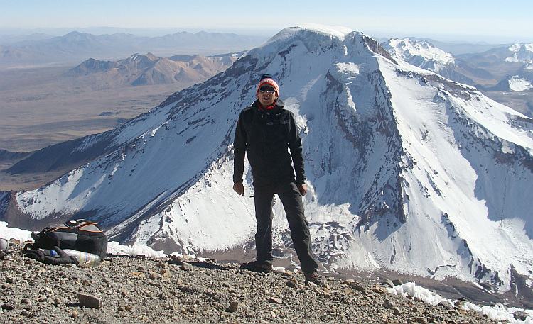
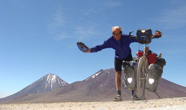
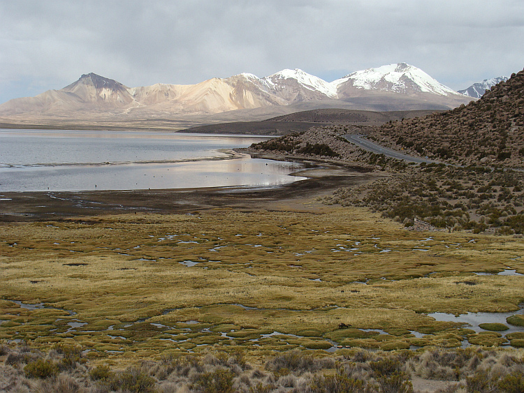
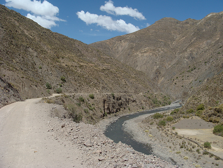
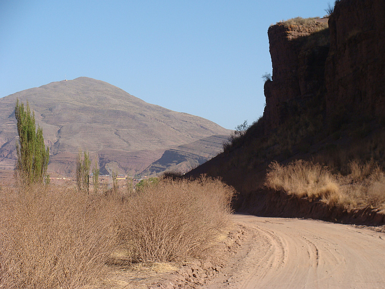
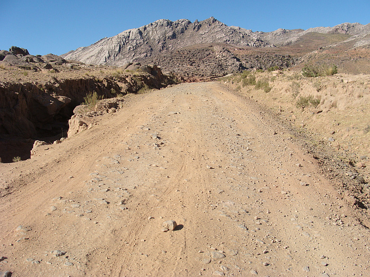
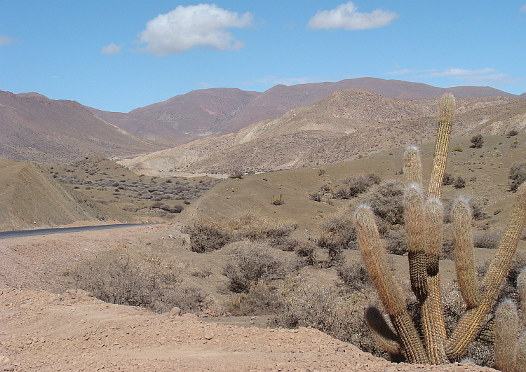
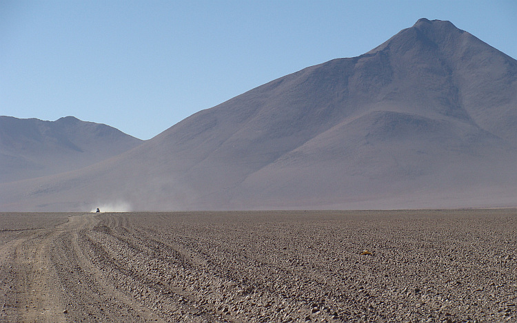
 After a climb to a pass over a small mountain range I reached the Chilean border.
From there I wanted to ride on to the village of Putre. I knew the route from my
trip in 2003. At that time the road was perfectly paved. That was now no longer
the case anymore. I plowed laboriously through deep sand layers. For a distance
of forty kilometers there were roadworks. Kilometers long rows of trucks passed
me by. Together with the stormy headwind they caused dust clouds, which cut off
the breath and produced persistent coughing. Visibility was limited to a few
meters. I consoled myself with the thought that I would probably reach the end of
the roadworks soon. That hope proved futile. I could bypass the dust storm
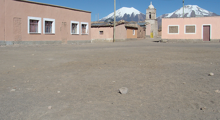
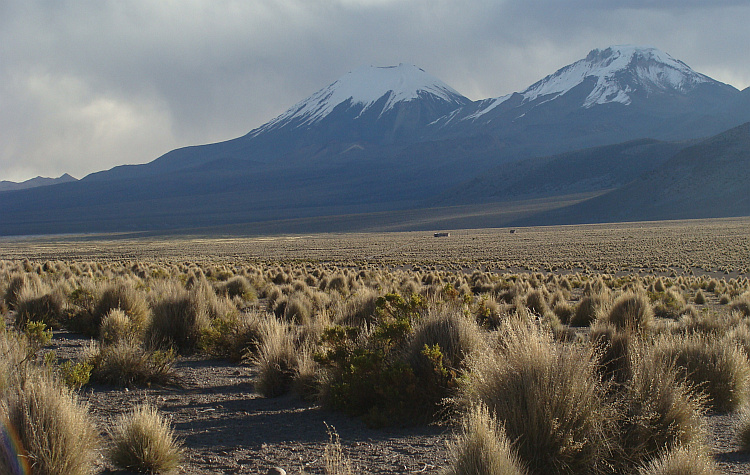
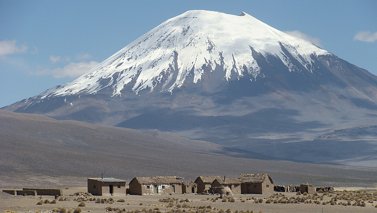
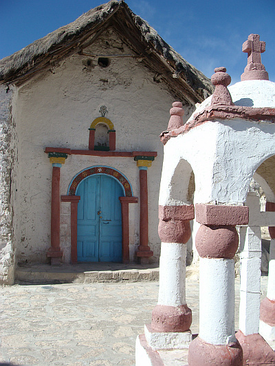
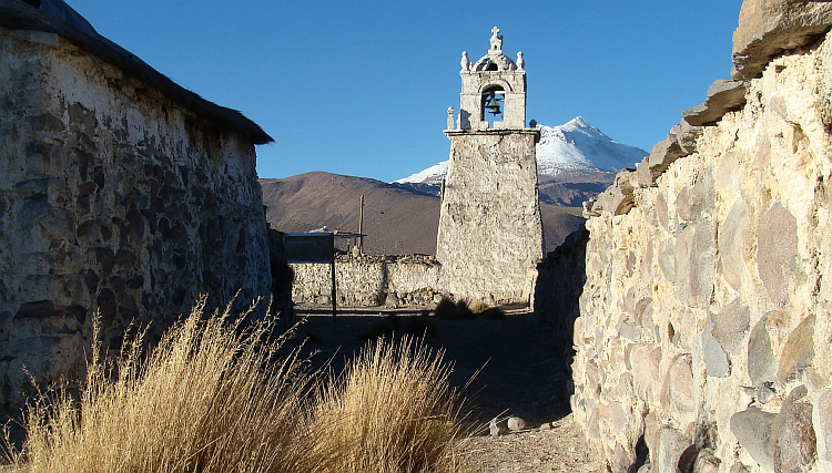
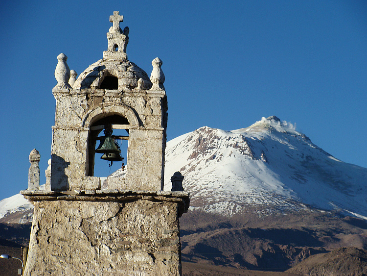
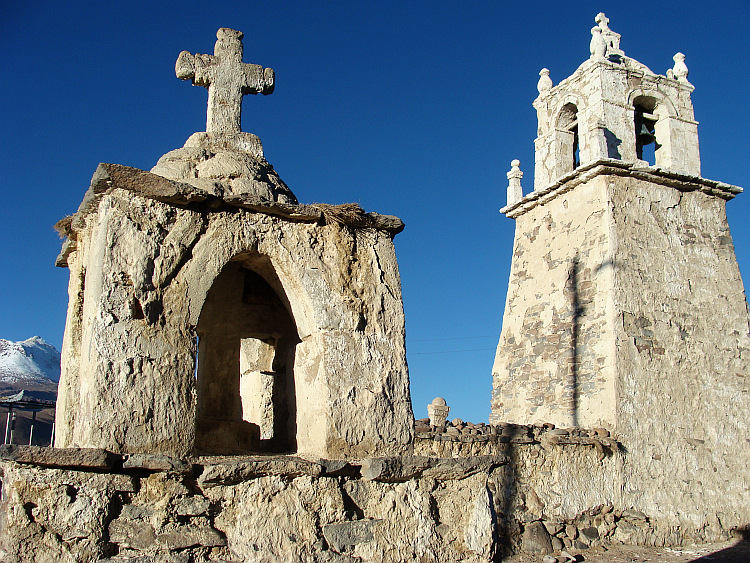
temporarily by visiting Parinacota, the settlement at the foot of the eponymous
volcano. The church is one of the most beautiful churches of the altiplano of the
Bolivian-Chilean border area.
After a climb to a pass over a small mountain range I reached the Chilean border.
From there I wanted to ride on to the village of Putre. I knew the route from my
trip in 2003. At that time the road was perfectly paved. That was now no longer
the case anymore. I plowed laboriously through deep sand layers. For a distance
of forty kilometers there were roadworks. Kilometers long rows of trucks passed
me by. Together with the stormy headwind they caused dust clouds, which cut off
the breath and produced persistent coughing. Visibility was limited to a few
meters. I consoled myself with the thought that I would probably reach the end of
the roadworks soon. That hope proved futile. I could bypass the dust storm
temporarily by visiting Parinacota, the settlement at the foot of the eponymous
volcano. The church is one of the most beautiful churches of the altiplano of the
Bolivian-Chilean border area.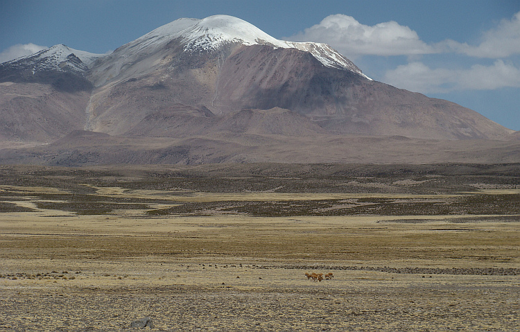
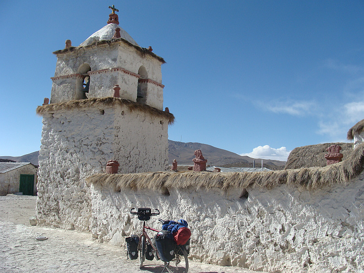
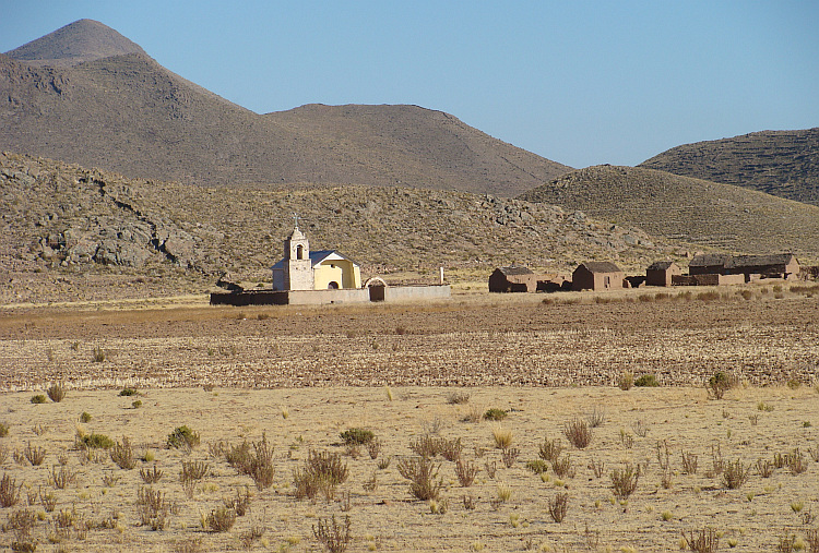
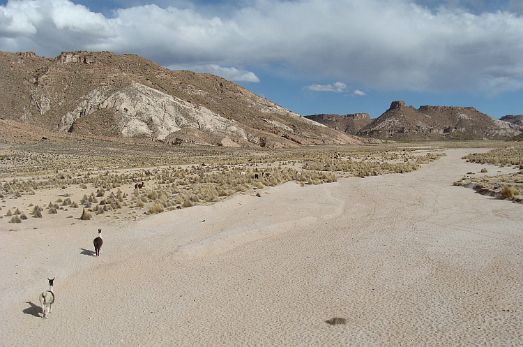
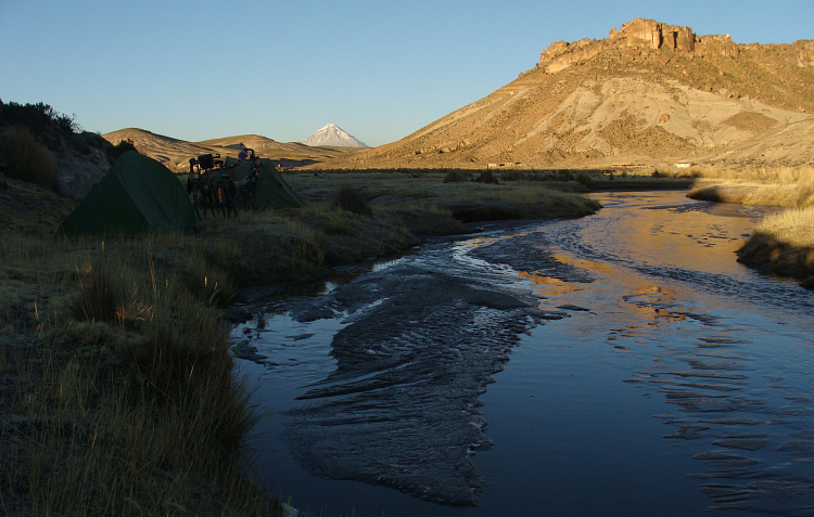
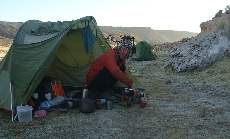
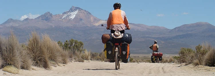
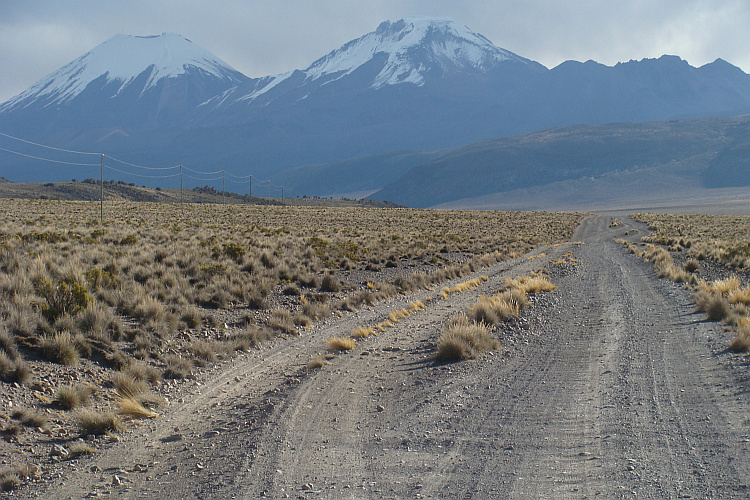
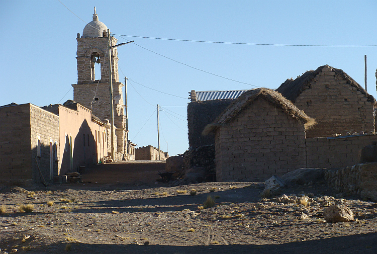
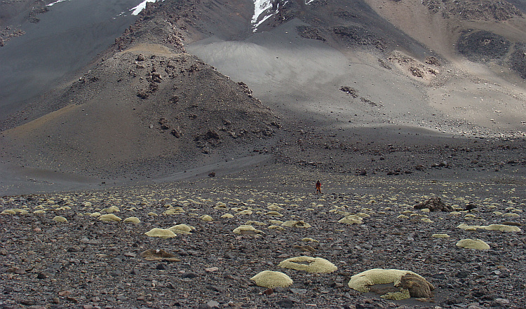
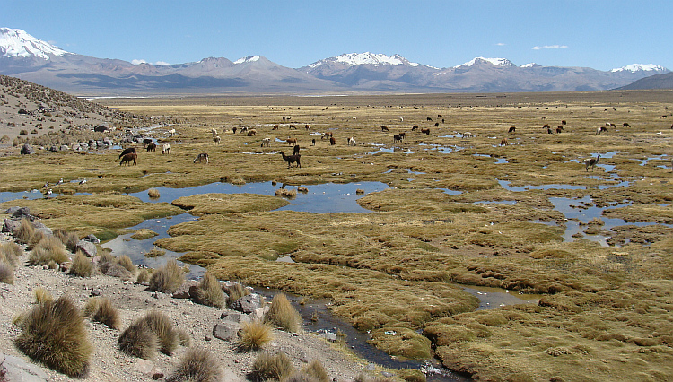
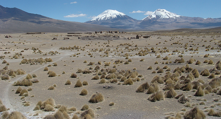
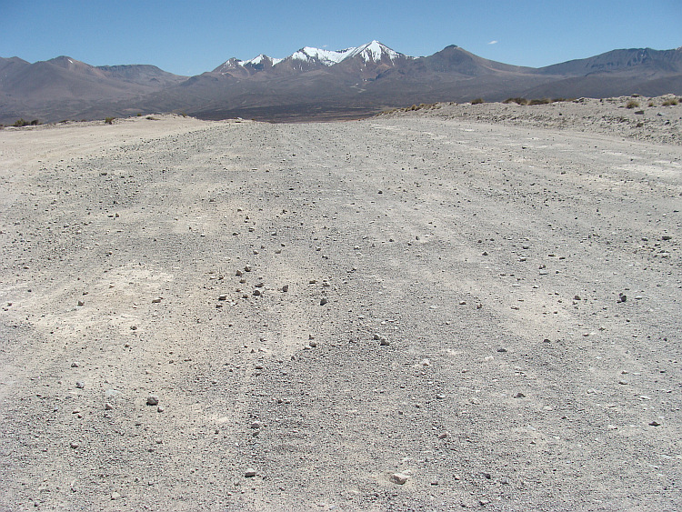
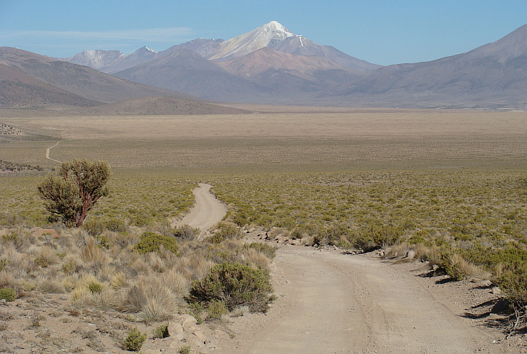
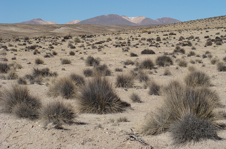
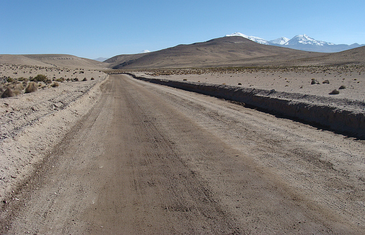
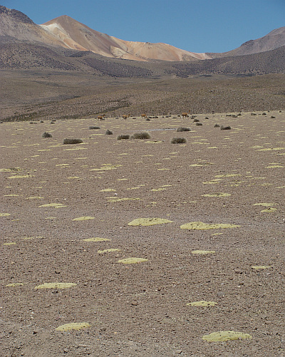
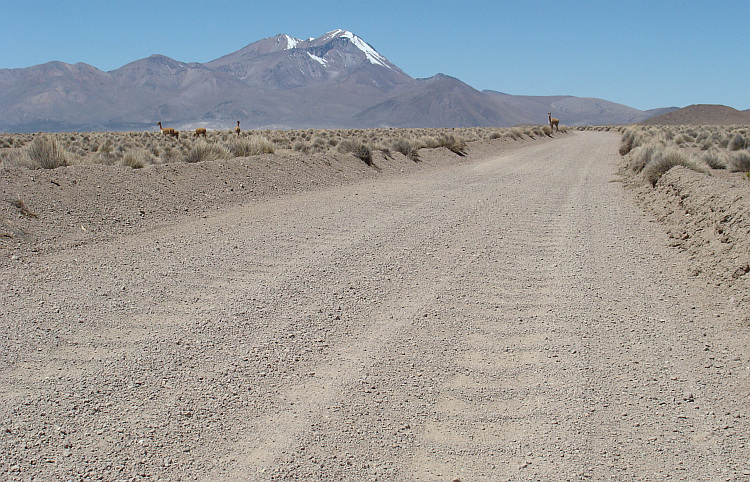
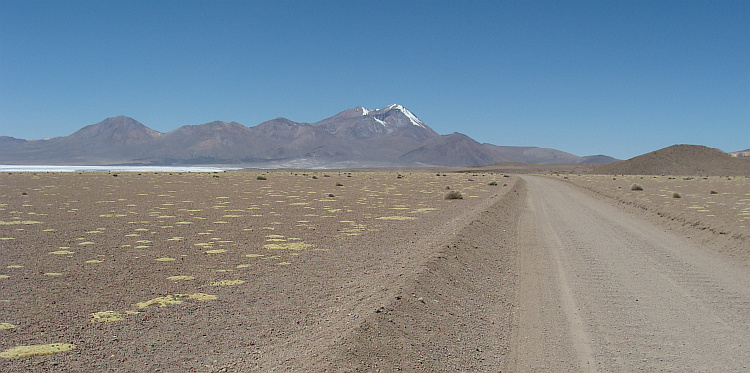
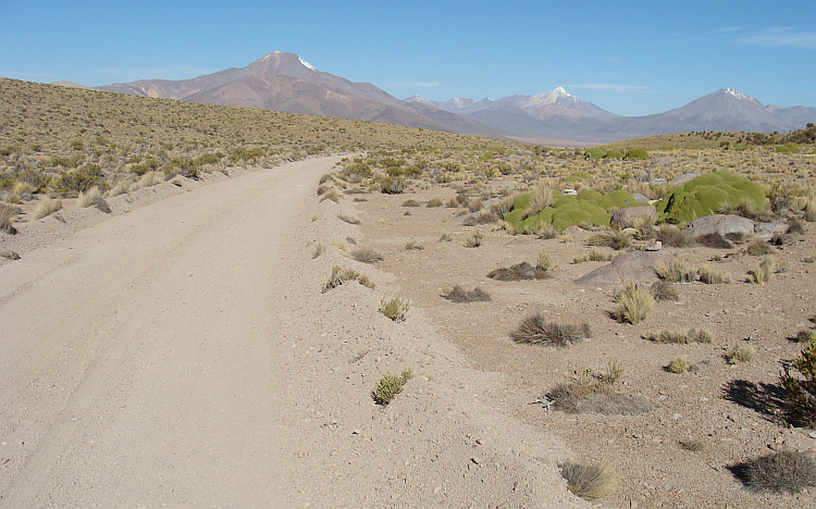
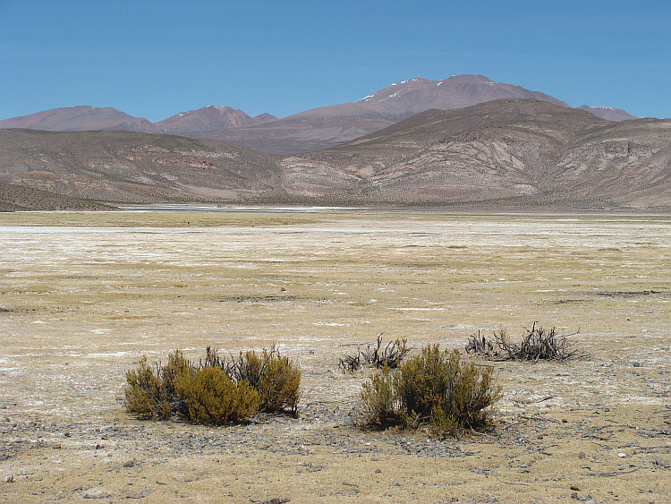
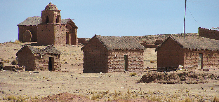
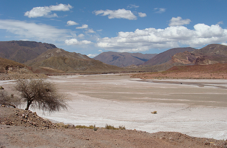
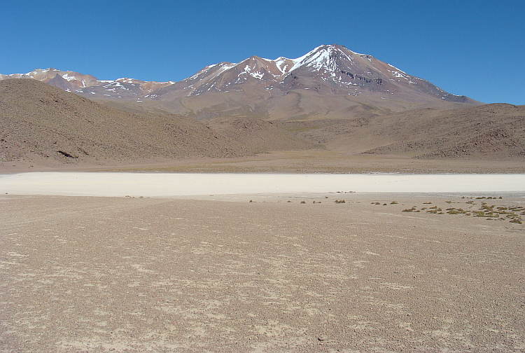
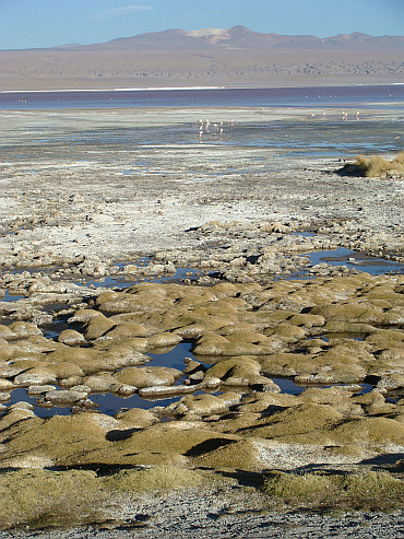
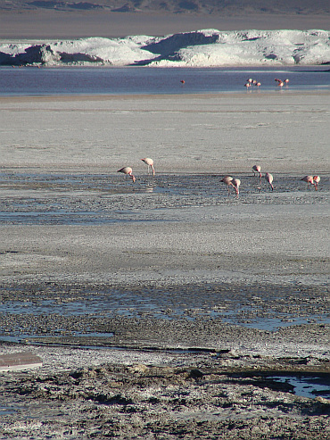
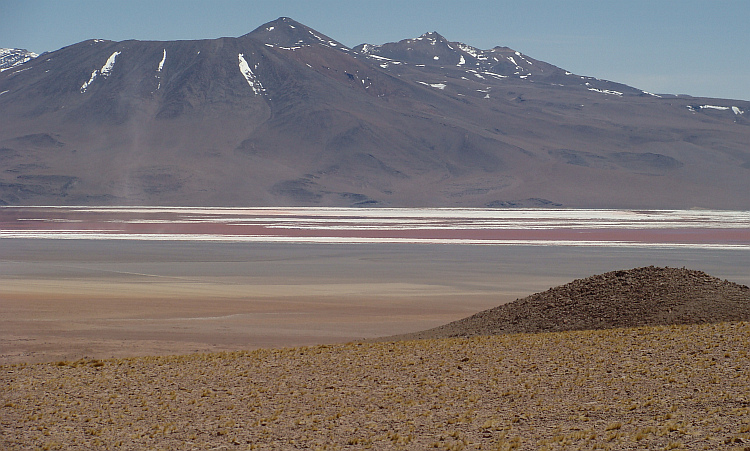
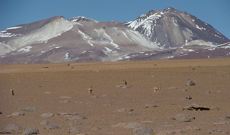
 In the small mountain village I took a break for a day to stock up for the next
few days. I was planning to follow a series of trails in the border area with
Bolivia, where a chain of National Parks protects the high altitude desert
landscapes with volcanoes and salt plains with their particular wildlife. A two
hundred kilometer route of hardly maintained dirt roads is linking the National
Parks Lauca, Vicuñas and Isluga together. The trail is nowhere below
four thousand meter altitude. According to blogs on the internet I had to prepare
myself for five to seven days cycling in the inhospitable area. Apart from some
ghost towns on the route there would not be any trace of human activity. In the
coming days I could not not count on obtaining any water or food so I had to be
self-reliant for more than a week. Only in a mountain hut on the salt flat Salar
de Surire I could possibly be able to get some fresh drinking water, but I could
not count on it.
In the small mountain village I took a break for a day to stock up for the next
few days. I was planning to follow a series of trails in the border area with
Bolivia, where a chain of National Parks protects the high altitude desert
landscapes with volcanoes and salt plains with their particular wildlife. A two
hundred kilometer route of hardly maintained dirt roads is linking the National
Parks Lauca, Vicuñas and Isluga together. The trail is nowhere below
four thousand meter altitude. According to blogs on the internet I had to prepare
myself for five to seven days cycling in the inhospitable area. Apart from some
ghost towns on the route there would not be any trace of human activity. In the
coming days I could not not count on obtaining any water or food so I had to be
self-reliant for more than a week. Only in a mountain hut on the salt flat Salar
de Surire I could possibly be able to get some fresh drinking water, but I could
not count on it.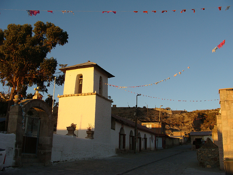
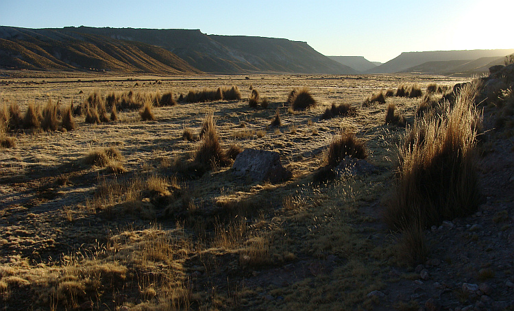
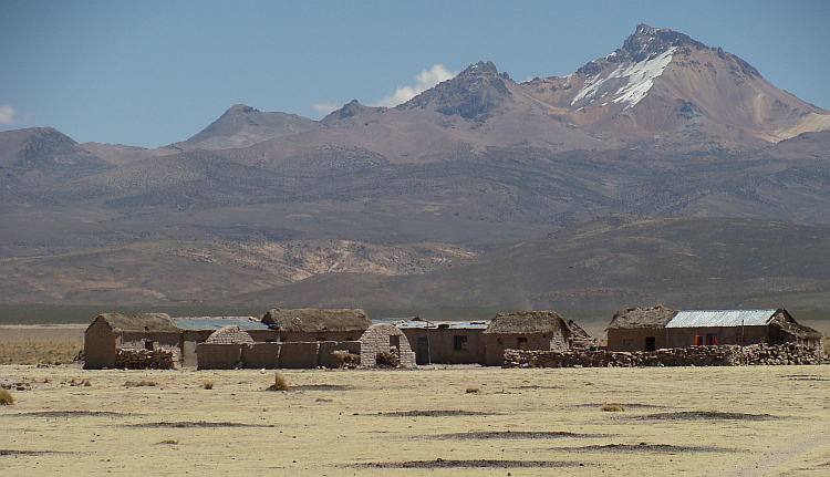
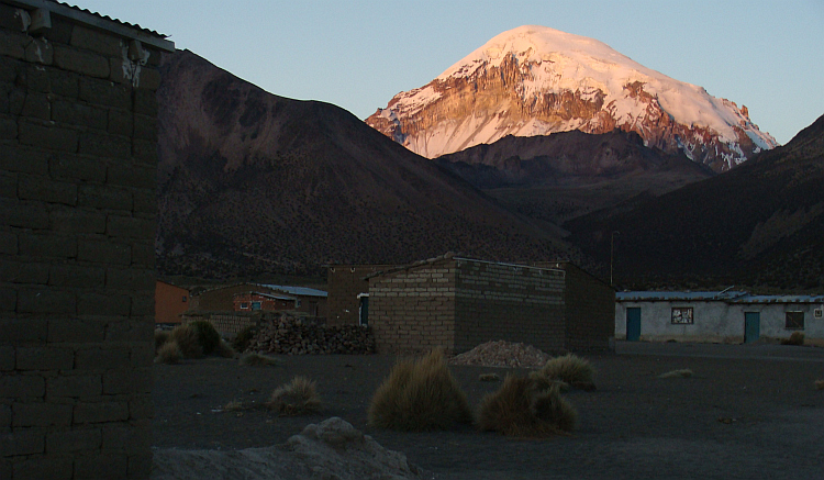
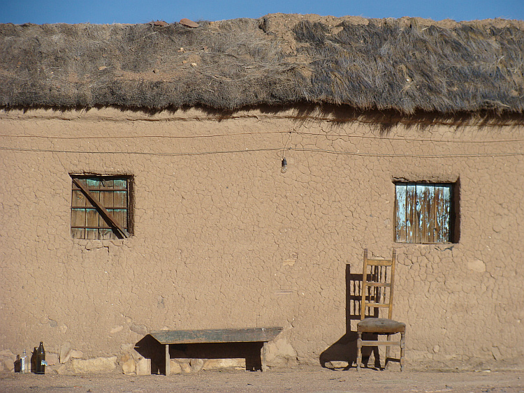
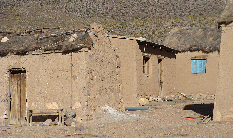
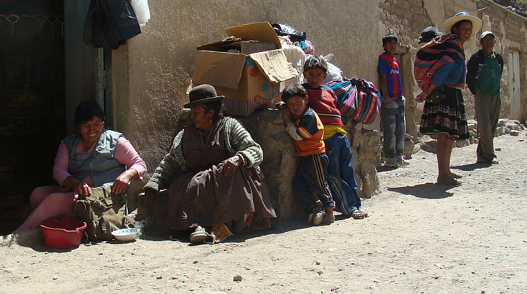
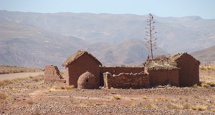
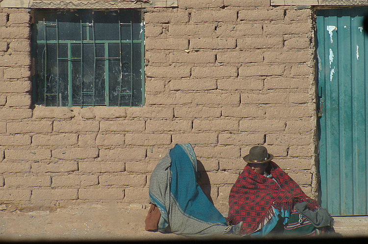
 Guallatire seemed completely deserted. On one of the houses was a barely
readable sign with the word "hotel" attached. The house seemed just as deserted
as the other houses, but still I knocked on the door. I scared up
of surprise, when the door opened unexpectedly. I stood in front of a
friendly looking woman with a face full of burns. Behind her was another woman,
also with burns on her face. Against all expectations, I had a place to stay
in a hotel room. The ladies offered simple, nutritious meals as well. So I did
not need to use my limited food supplies. Savings now could later on the route
come in handy. I dined along with a Chilean truck driver. My table companion was
a big, burly man with bushy eyebrows. Hours he told me about his life "on the
road". The man loved his work and he was firmly convinced that Chile is the most
beautiful country of the world.
Guallatire seemed completely deserted. On one of the houses was a barely
readable sign with the word "hotel" attached. The house seemed just as deserted
as the other houses, but still I knocked on the door. I scared up
of surprise, when the door opened unexpectedly. I stood in front of a
friendly looking woman with a face full of burns. Behind her was another woman,
also with burns on her face. Against all expectations, I had a place to stay
in a hotel room. The ladies offered simple, nutritious meals as well. So I did
not need to use my limited food supplies. Savings now could later on the route
come in handy. I dined along with a Chilean truck driver. My table companion was
a big, burly man with bushy eyebrows. Hours he told me about his life "on the
road". The man loved his work and he was firmly convinced that Chile is the most
beautiful country of the world. 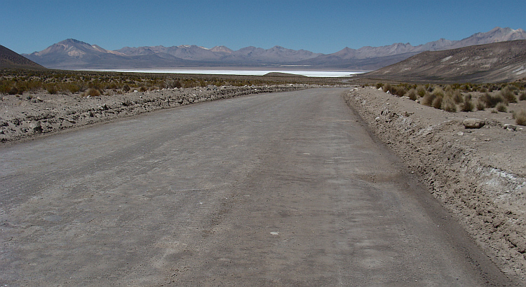

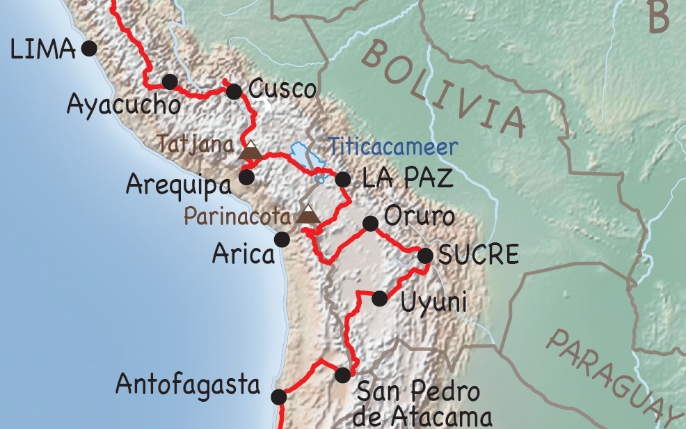
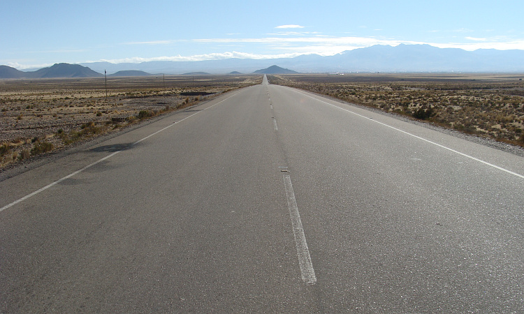
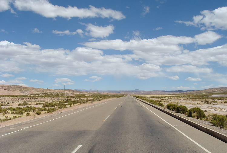
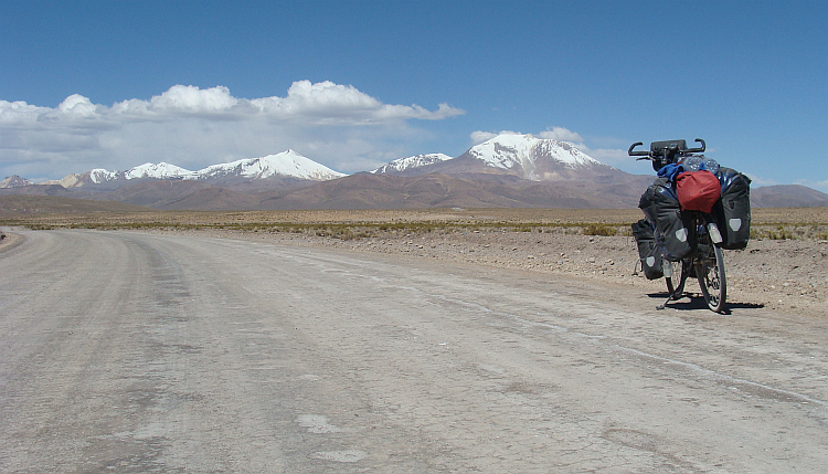
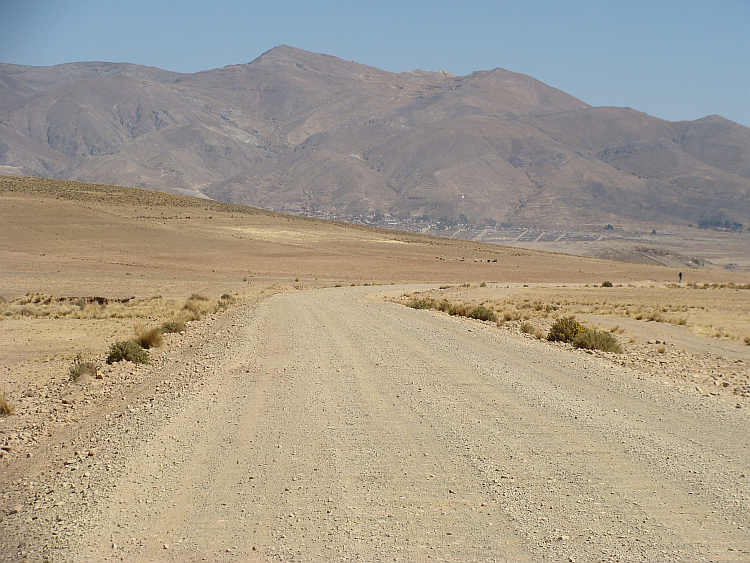
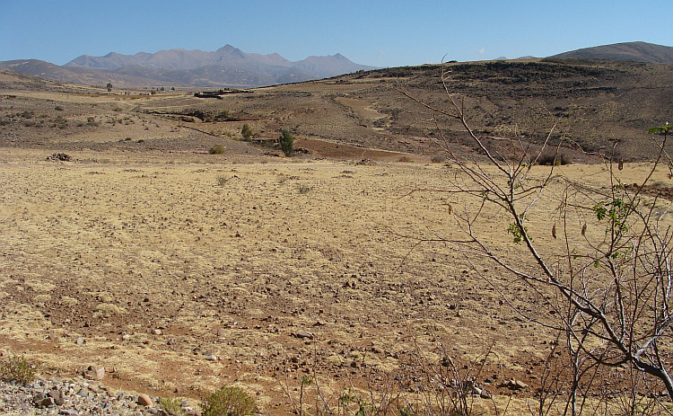
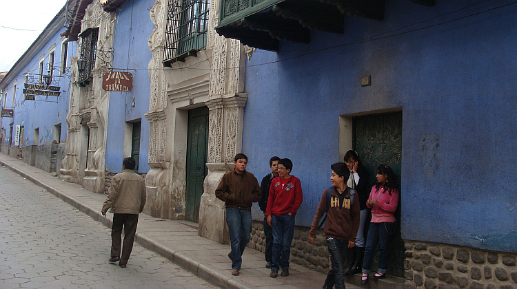
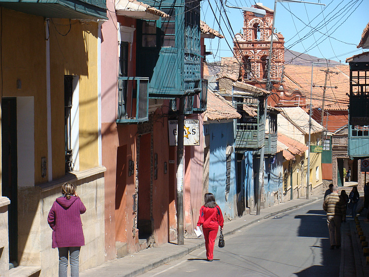
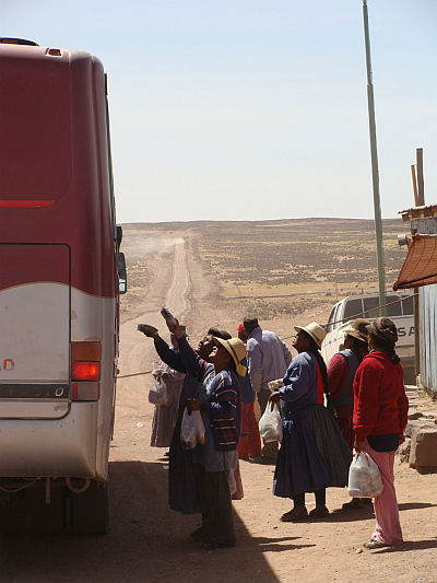 I continued on my way in Bolivia to visit the the colonial cities Sucre and
Potosí. I crossed the Bolivian border and crossed the Bolivian Altiplano
once again. In two long days I reached Oruro on the other side of the Altiplano.
I continued on my way in Bolivia to visit the the colonial cities Sucre and
Potosí. I crossed the Bolivian border and crossed the Bolivian Altiplano
once again. In two long days I reached Oruro on the other side of the Altiplano.
 I reached the crossroads. All road users had to wait before the intersection.
There was a cycling race going on. All traffic had to wait until all
participating riders had passed. A small police delegation had to organize the
situation at the crossroads. I had a discussion about the possible roads to
Sucre with an interested agent. The left road led the way into the mountains. The
right one remained on the plateau, west of the mountains. Left was the hard road,
right was the easy road. The principal agent was clear:
I reached the crossroads. All road users had to wait before the intersection.
There was a cycling race going on. All traffic had to wait until all
participating riders had passed. A small police delegation had to organize the
situation at the crossroads. I had a discussion about the possible roads to
Sucre with an interested agent. The left road led the way into the mountains. The
right one remained on the plateau, west of the mountains. Left was the hard road,
right was the easy road. The principal agent was clear: 
 I checked on the Internet the condition of the road that laid before me. Better late
than nevr, but now I could still return. I searched on the keywords Cycling,
Oruro and Sucre. Google Bolivia returned with only three relevant search
results. The top entry had the headline "Worst Road of the World". Clicking on
the entry brought me to a site with photos of a red dirt road with tire tracks
of twenty to thirty centimeters deep. The author had the unequal battle against
the elements and after a hundred kilometers he had given up cycling in favour of
hitchhiking the rest of the route. A second entry was the story of a couple that
needed no less than three weeks to bridge the three hundred kilometers, an average
of only fifteen kilometers a day. The third entry handled about a cyclist who
doubted whether he would take the difficult road or the paved route and concluded
with the statement that he was very happy to have taken the paved route. The
available information did not give me the desired feeling that I had made the
right choice. I decided to continue on the difficult road anyway. Even if I
were not going faster than five kilometers per hour on the arduous climbs, I
would still be faster than returning for the paved route Potosí.
I checked on the Internet the condition of the road that laid before me. Better late
than nevr, but now I could still return. I searched on the keywords Cycling,
Oruro and Sucre. Google Bolivia returned with only three relevant search
results. The top entry had the headline "Worst Road of the World". Clicking on
the entry brought me to a site with photos of a red dirt road with tire tracks
of twenty to thirty centimeters deep. The author had the unequal battle against
the elements and after a hundred kilometers he had given up cycling in favour of
hitchhiking the rest of the route. A second entry was the story of a couple that
needed no less than three weeks to bridge the three hundred kilometers, an average
of only fifteen kilometers a day. The third entry handled about a cyclist who
doubted whether he would take the difficult road or the paved route and concluded
with the statement that he was very happy to have taken the paved route. The
available information did not give me the desired feeling that I had made the
right choice. I decided to continue on the difficult road anyway. Even if I
were not going faster than five kilometers per hour on the arduous climbs, I
would still be faster than returning for the paved route Potosí. 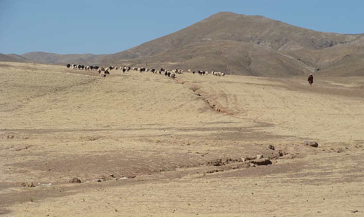
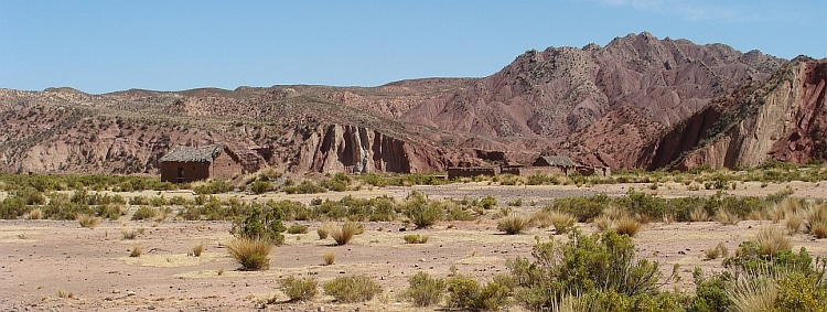
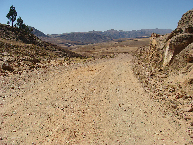
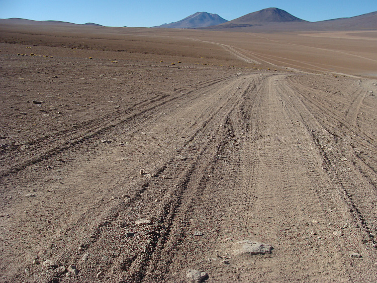
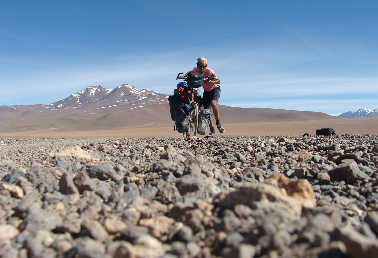
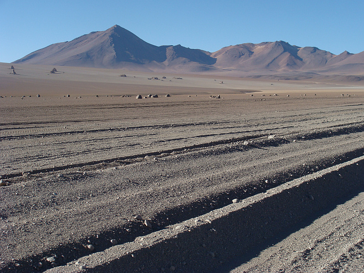
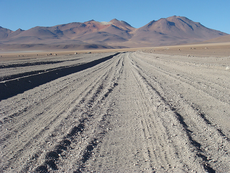
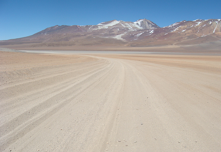
 "Sometimes I do not know where this dirty road is taking me," sings Townes van
Zandt. One after the other anonymous ridge was on my way. The route was a
concatenation of impossibly steep climbs and steep descents impossible. On
the climbs I needed all the strength in my legs to just keep going and on
the descents I needed all the strength in my fingers to brake hard enough.
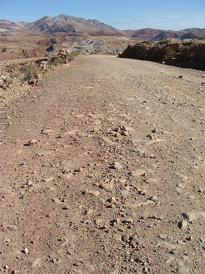
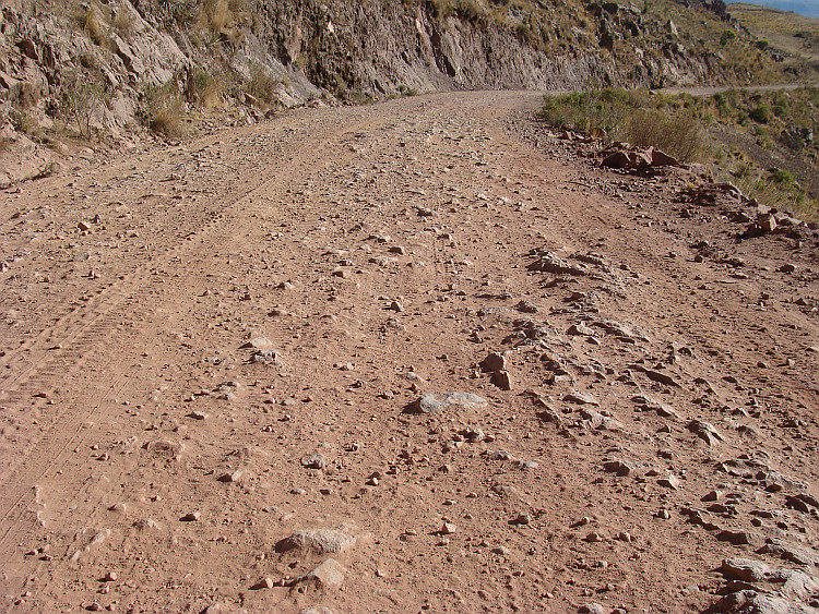
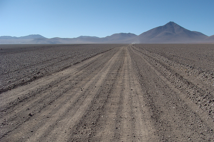
The road was in a miserable state. Large sharp stones protruded out of the
road. My stomach and intestines were subject to a jackhammer massage and on the
descents the bike was shaking so fiercely that I was afraid that my wrists
would break like matchsticks. The bike creaked under the heavy pressures that were
exerted. I was anxious that my carrier would break again because of the
extreme vibrations.
"Sometimes I do not know where this dirty road is taking me," sings Townes van
Zandt. One after the other anonymous ridge was on my way. The route was a
concatenation of impossibly steep climbs and steep descents impossible. On
the climbs I needed all the strength in my legs to just keep going and on
the descents I needed all the strength in my fingers to brake hard enough.
The road was in a miserable state. Large sharp stones protruded out of the
road. My stomach and intestines were subject to a jackhammer massage and on the
descents the bike was shaking so fiercely that I was afraid that my wrists
would break like matchsticks. The bike creaked under the heavy pressures that were
exerted. I was anxious that my carrier would break again because of the
extreme vibrations. 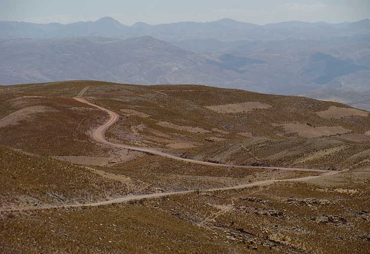
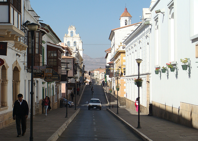
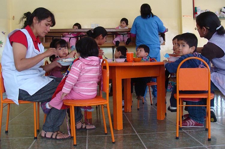
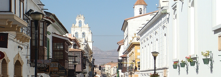
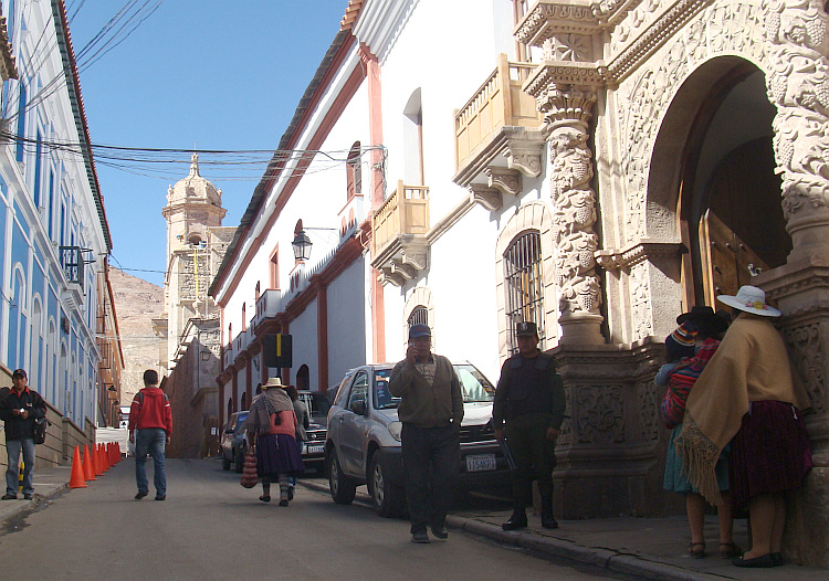
 During a week I followed Spanish classes at a language school in Sucre. Ximena
was my teacher, a woman who became a widow already when she was twenty second
years old. Her husband and their two year old daughter Laura were on a bridge
when a bus rammed the two. They both fell many meters into the ravine. Ximena
had seen it all happen. She found the lifeless body of her husband with little
Laura folded in his arms. She had to fear for the life of Laura as well, but
with an operation she could eventually be saved. She was a lively child of seven
years old now. Ximena had a tough life as a young widow. Frequently the tears
rolled down her cheeks. Her resilience was not broken despite the heart-breaking
history. In addition to raising her daughter and work at the school she attended
a university study to be able to acquire a better paying job and rise up out of
poverty and misery.
During a week I followed Spanish classes at a language school in Sucre. Ximena
was my teacher, a woman who became a widow already when she was twenty second
years old. Her husband and their two year old daughter Laura were on a bridge
when a bus rammed the two. They both fell many meters into the ravine. Ximena
had seen it all happen. She found the lifeless body of her husband with little
Laura folded in his arms. She had to fear for the life of Laura as well, but
with an operation she could eventually be saved. She was a lively child of seven
years old now. Ximena had a tough life as a young widow. Frequently the tears
rolled down her cheeks. Her resilience was not broken despite the heart-breaking
history. In addition to raising her daughter and work at the school she attended
a university study to be able to acquire a better paying job and rise up out of
poverty and misery.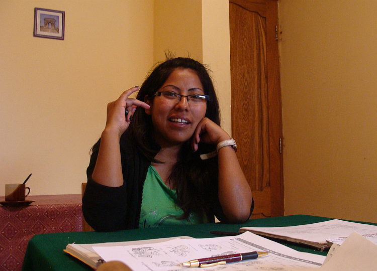
 Many discussion I held with the Japanese comandante about the future of
the pueblo, the future of the village. In the communist propaganda the pueblo
was symbol for a society where the people found salvation in working for the
commune. In this ideal society the whole village trusted the comandante and the
residents worked hard, because they knew that everyone would benefit from the
personal sacrifices. The reality proved more resilient though. In all communist
societies the already limited revenues of the sacrifices that the pueblo was making
mainly benefited the comandante. The villagers who were less confident were
prosecuted by the comandante and ended in prison camps. Everything for the glory
of the pueblo, but after almost a hundred years of communism in different
locations in the world we are still waiting for progress of the pueblo.
Many discussion I held with the Japanese comandante about the future of
the pueblo, the future of the village. In the communist propaganda the pueblo
was symbol for a society where the people found salvation in working for the
commune. In this ideal society the whole village trusted the comandante and the
residents worked hard, because they knew that everyone would benefit from the
personal sacrifices. The reality proved more resilient though. In all communist
societies the already limited revenues of the sacrifices that the pueblo was making
mainly benefited the comandante. The villagers who were less confident were
prosecuted by the comandante and ended in prison camps. Everything for the glory
of the pueblo, but after almost a hundred years of communism in different
locations in the world we are still waiting for progress of the pueblo. 
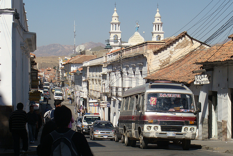
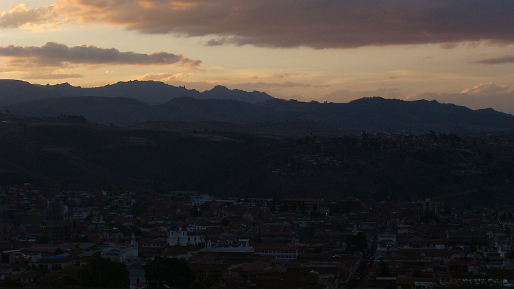
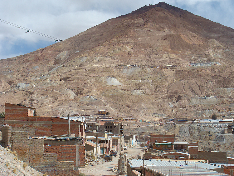
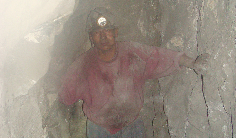
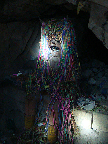
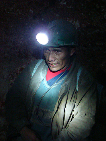
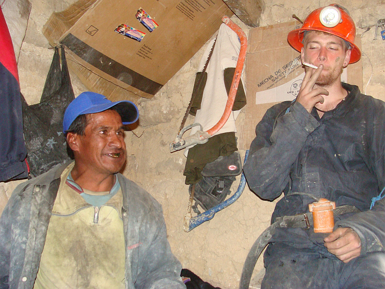
 I cycled to Potosí, the Bolivian mining town where significant quantities
of gold and silver were extracted in the past. The rich colonial center still
testified of the revenues from the distant past. The drab, shabby houses of the
surrounding city witnessed the revenues of the recent past. Yet some hundred
forty thousand men entered the dark shafts of the Cerro Rico on a daily basis,
hoping to find a new gold or silver vein. For most, the hope would prove futile,
but occasionally someone was lucky. An independent miner could become wealthy if
he would find a gold or silver vein and keep it hidden long enough for his
hundredforty thousand competitors. The last miner who did the trick, owned
several colonial buildings in the center of the city.
I cycled to Potosí, the Bolivian mining town where significant quantities
of gold and silver were extracted in the past. The rich colonial center still
testified of the revenues from the distant past. The drab, shabby houses of the
surrounding city witnessed the revenues of the recent past. Yet some hundred
forty thousand men entered the dark shafts of the Cerro Rico on a daily basis,
hoping to find a new gold or silver vein. For most, the hope would prove futile,
but occasionally someone was lucky. An independent miner could become wealthy if
he would find a gold or silver vein and keep it hidden long enough for his
hundredforty thousand competitors. The last miner who did the trick, owned
several colonial buildings in the center of the city. 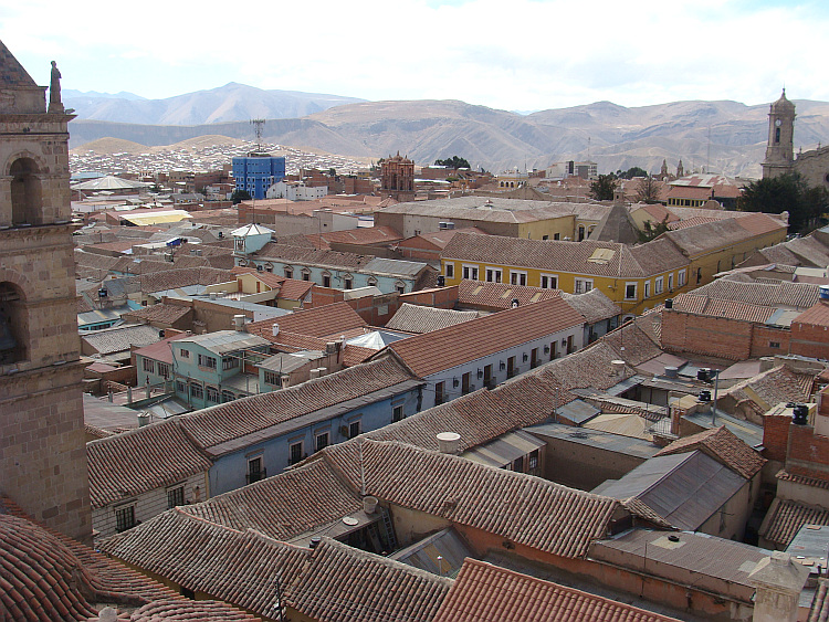
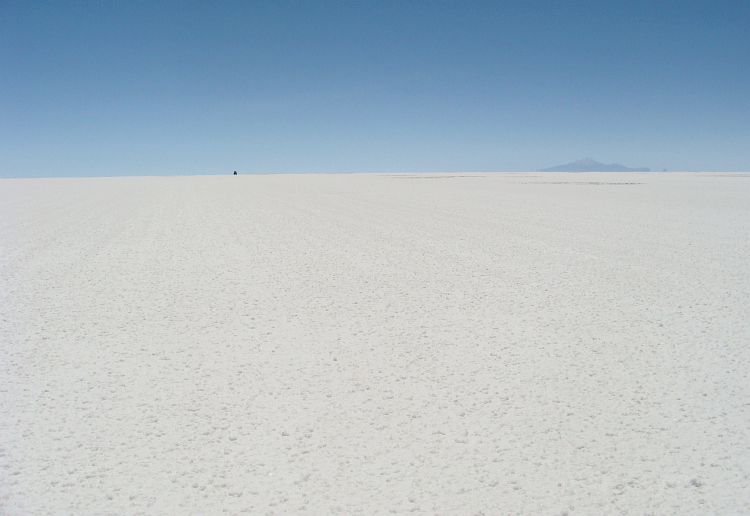
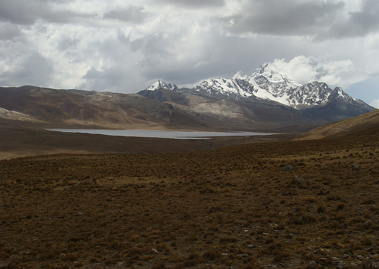
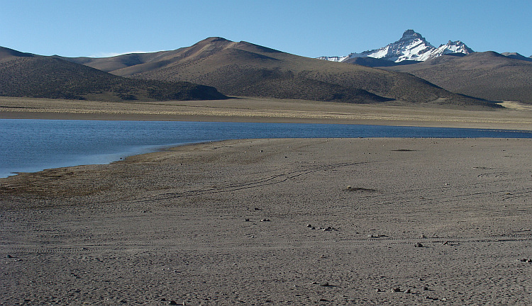
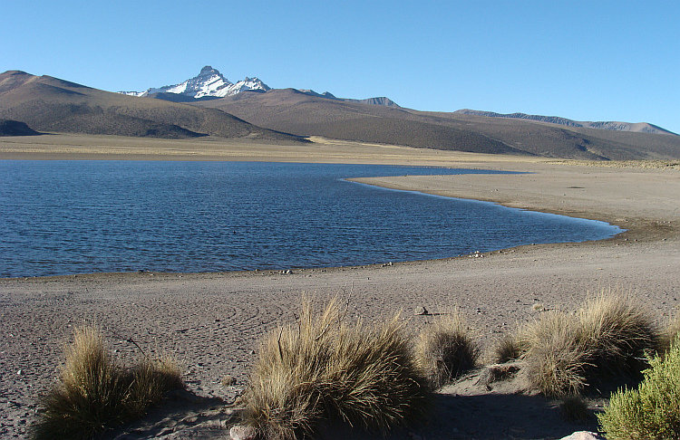
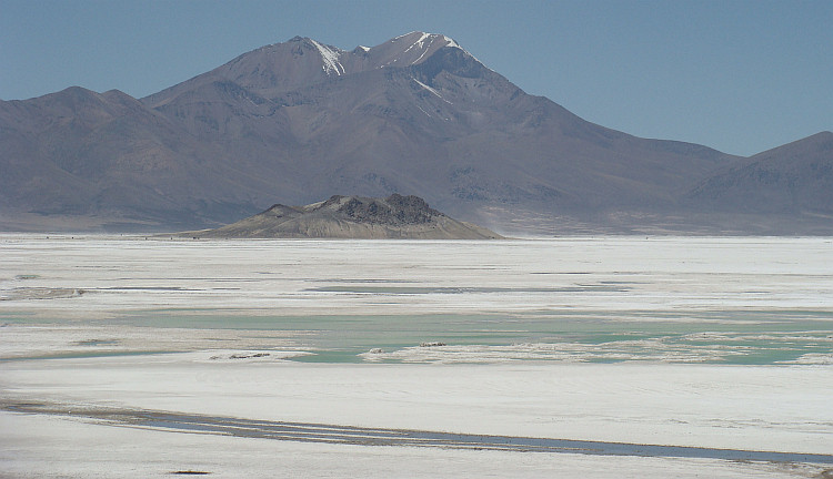
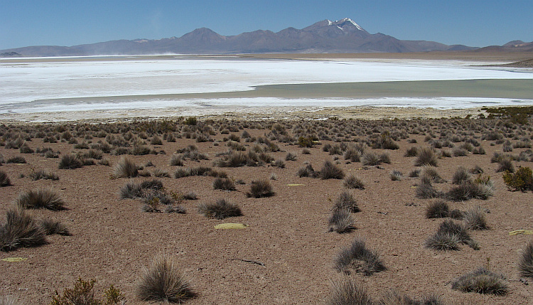
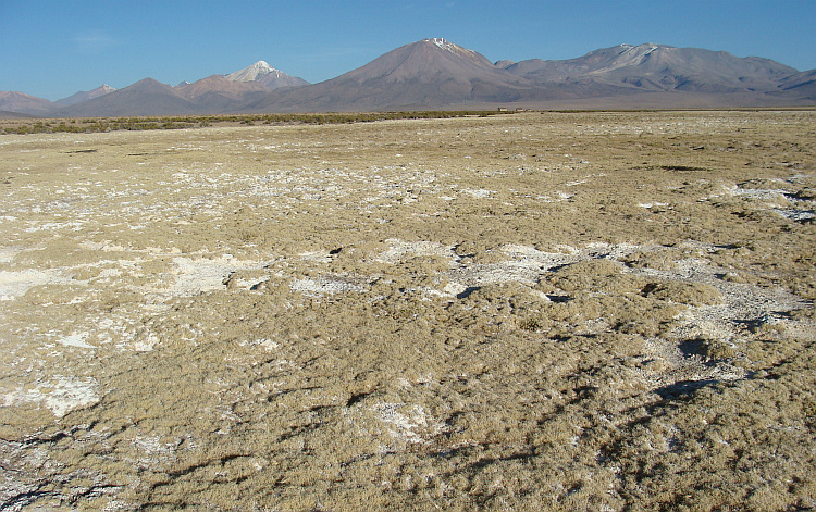
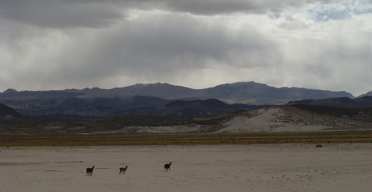
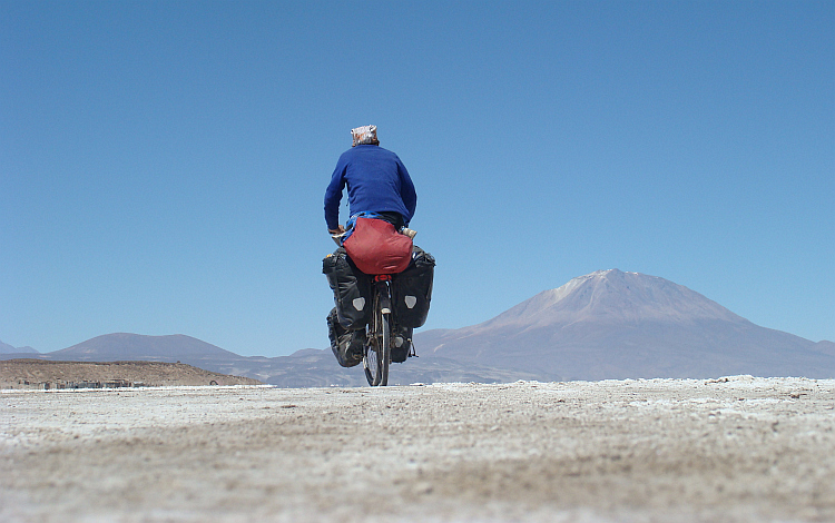
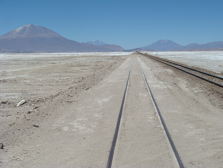
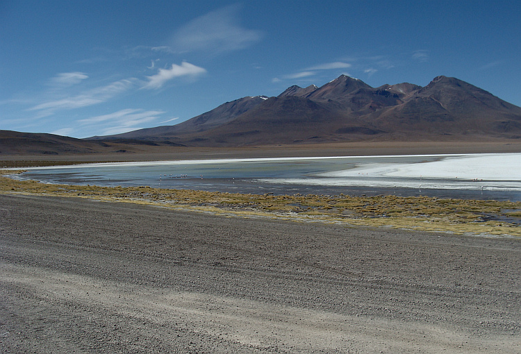
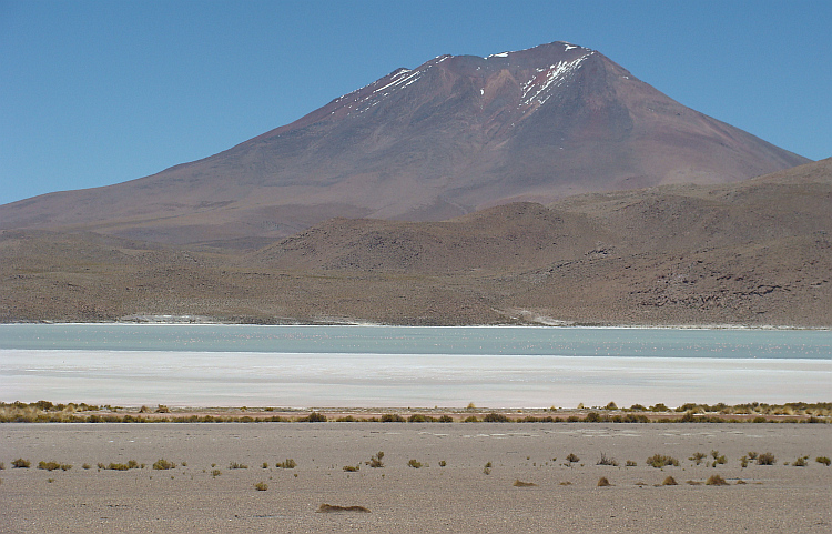
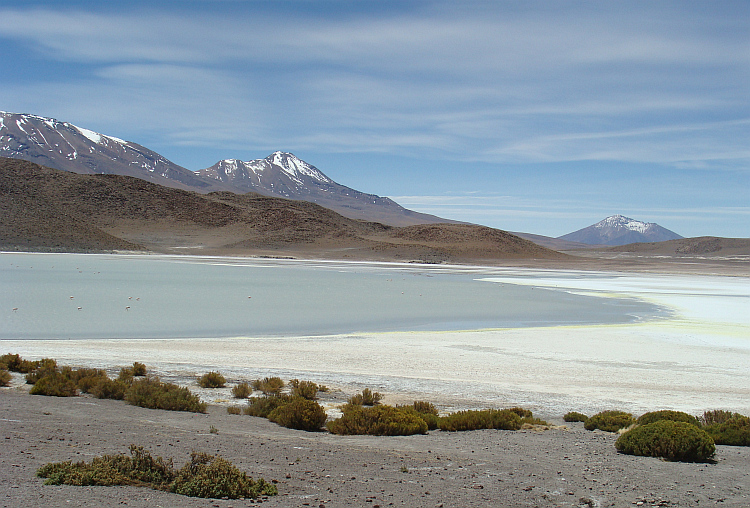
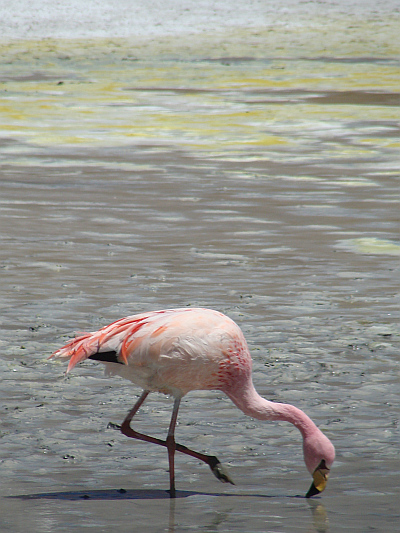
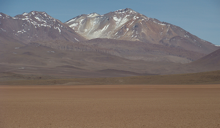
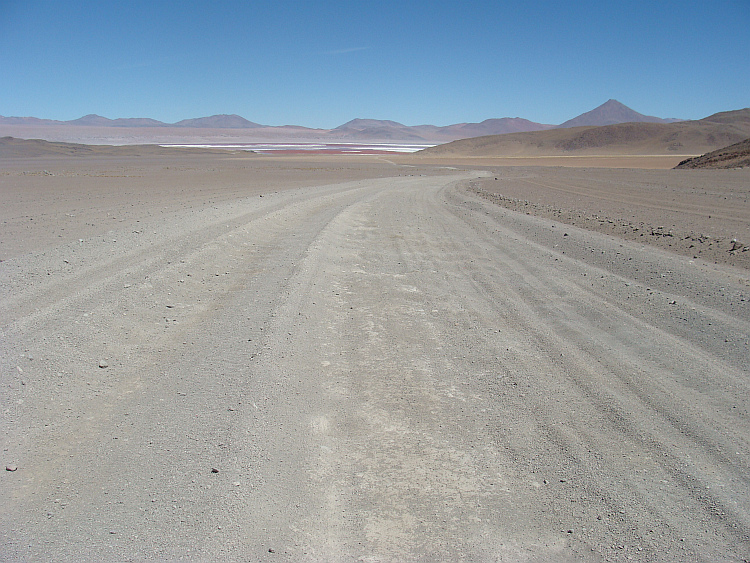
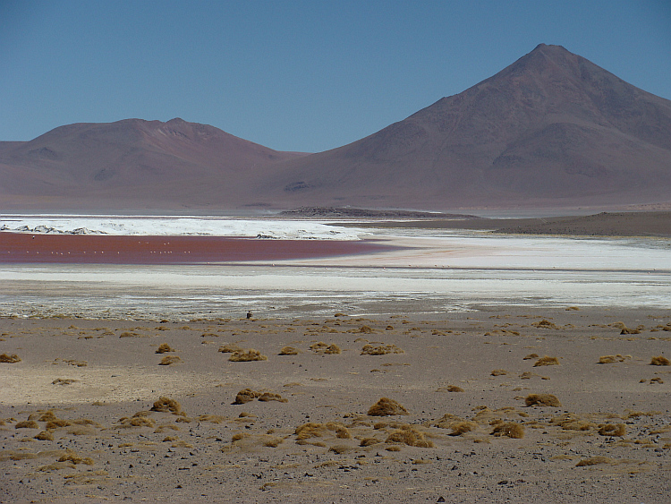
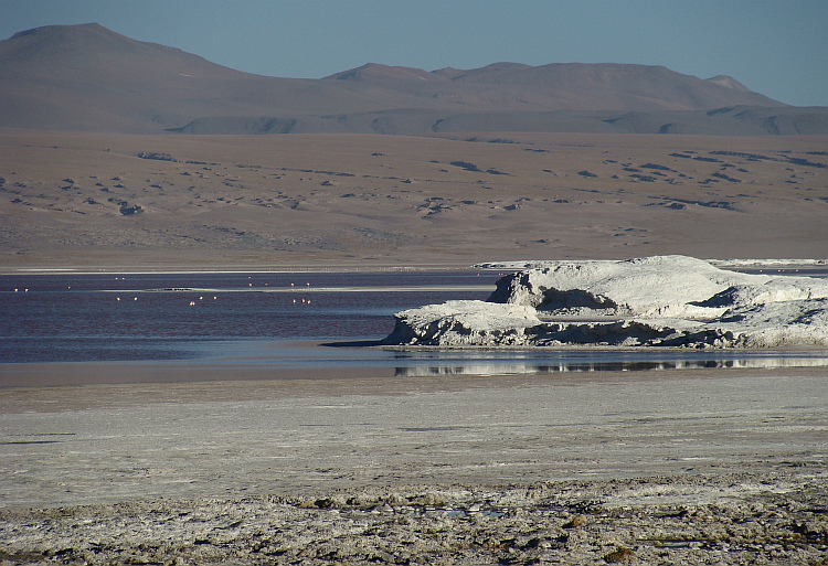
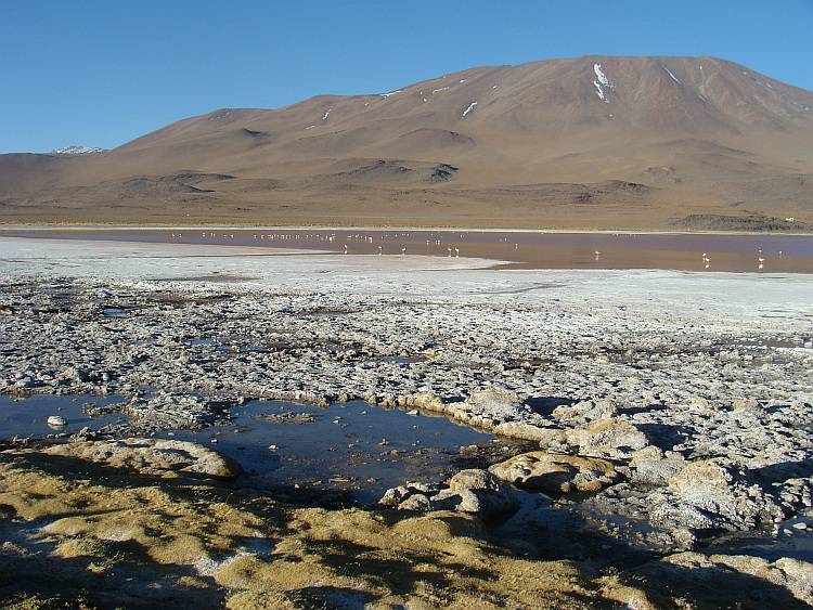
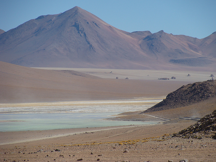
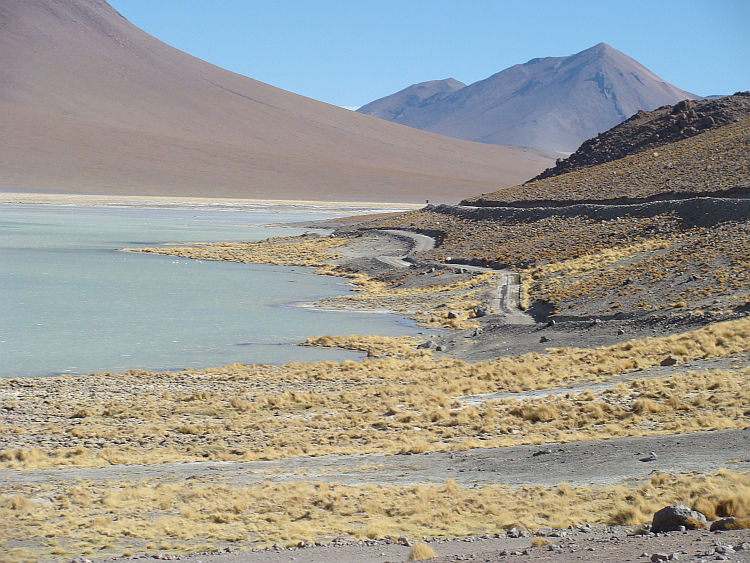
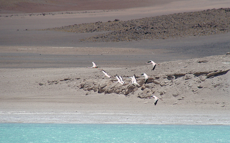
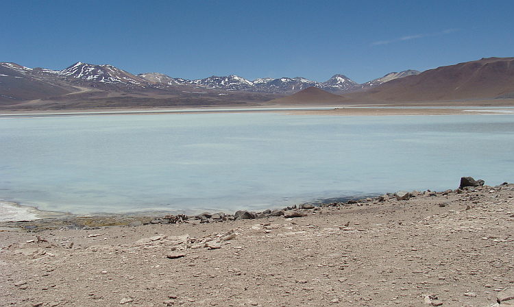
 The sensory experiences were limited to the blue of the sky and the white of
the plain. At a great distance some mountain ranges rose above the white sea
of salt. All scale was vanished on the endless plain. Everyone takes his own
way on the salar. The Salar de Uyuni can therefore be considered as the broadest
road in the world, albeit a road that goes from nothing to nothing. Nobody lives
on the salt flat and also in the surrounding areas is virtually no habitation.
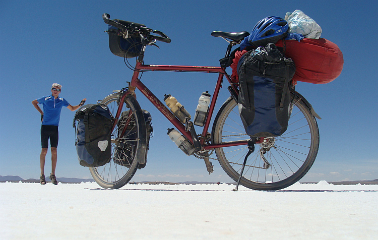
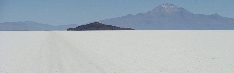
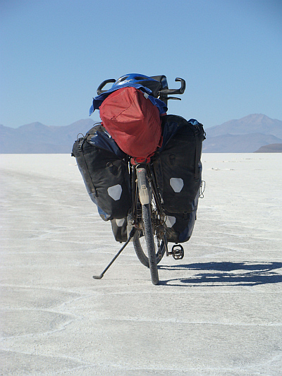
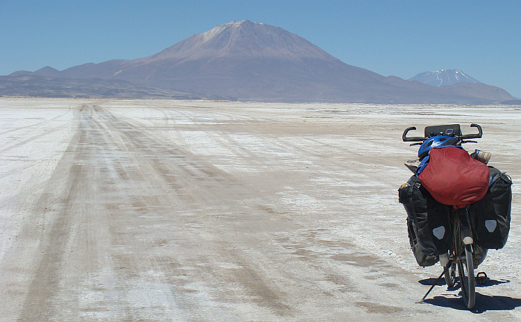
I pointed my GPS to the Isla de los Pescadores. I had a hundred kilometers to
cross to reach the island in the middle of the Salt Flat. It was relevant to
reach the Isla de los Pescadores today. It would be difficult to pitch my tent
on the hard salt. It was even more important not to get lost. As long as the
batteries in my GPS continued to function, the route was simple and I just had
to carry straight on. If, however, the GPS would not function, I would only have
the sun at my disposal to orient.
The sensory experiences were limited to the blue of the sky and the white of
the plain. At a great distance some mountain ranges rose above the white sea
of salt. All scale was vanished on the endless plain. Everyone takes his own
way on the salar. The Salar de Uyuni can therefore be considered as the broadest
road in the world, albeit a road that goes from nothing to nothing. Nobody lives
on the salt flat and also in the surrounding areas is virtually no habitation.
I pointed my GPS to the Isla de los Pescadores. I had a hundred kilometers to
cross to reach the island in the middle of the Salt Flat. It was relevant to
reach the Isla de los Pescadores today. It would be difficult to pitch my tent
on the hard salt. It was even more important not to get lost. As long as the
batteries in my GPS continued to function, the route was simple and I just had
to carry straight on. If, however, the GPS would not function, I would only have
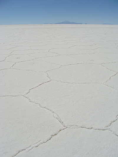
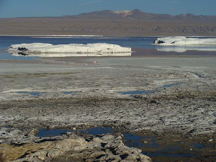
the sun at my disposal to orient.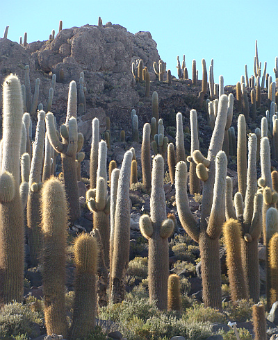 The crossing of the salt flats was accompanied by the pleasant sound of crackling
salt under the wheels. All across the salt flats was a pattern of about three
meter wide hexagons. The edges of the hexagons were about an centimeter high and
caused quite some friction. Much more than the friction of the hexagons, the
wind was able to slow me down effectively. I got a little foretaste of what was
waiting on the subsequent Laguna part of the route, where the wind is usually
even stronger. At the end of the day I made a preciesion landing on the Isla de
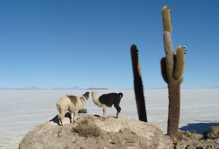
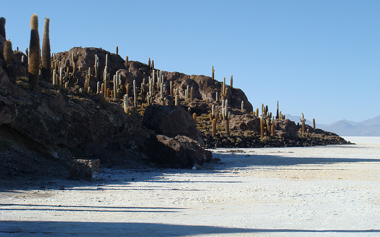
los Pescadores, the small island in the middle of the Salar with giant cacti.
The first day of the route was done.
The crossing of the salt flats was accompanied by the pleasant sound of crackling
salt under the wheels. All across the salt flats was a pattern of about three
meter wide hexagons. The edges of the hexagons were about an centimeter high and
caused quite some friction. Much more than the friction of the hexagons, the
wind was able to slow me down effectively. I got a little foretaste of what was
waiting on the subsequent Laguna part of the route, where the wind is usually
even stronger. At the end of the day I made a preciesion landing on the Isla de
los Pescadores, the small island in the middle of the Salar with giant cacti.
The first day of the route was done. 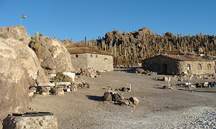
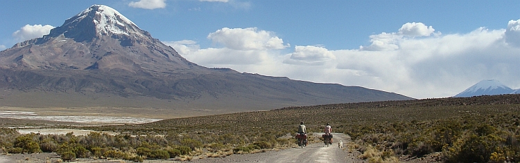
 Day two was similar to day one. In five to six hours I cycled across the salt flats
until I reached the mainland. On day three, I reached San Juan de Rosario, the
only village on the route to San Pedro de Atacama. There were a few small hotels
and there were some shops where I could complement my food and water supplies.
I was not the only gringo in San Juan. I met Nathan, a young Jewish-American
scientist who studied the history of residents around the Salar de Uyuni. There
was little known about their background and their history. Nathan cycled from
one to another settlement to interview the people. He was a special and
intelligent young man. It seemed fun to travel together for some time, so I
asked him if he wanted to ride with me to San Pedro de Atacama. Despite a
strong urge, he refused my request. That would not be correct to the people who
finance the research.
Day two was similar to day one. In five to six hours I cycled across the salt flats
until I reached the mainland. On day three, I reached San Juan de Rosario, the
only village on the route to San Pedro de Atacama. There were a few small hotels
and there were some shops where I could complement my food and water supplies.
I was not the only gringo in San Juan. I met Nathan, a young Jewish-American
scientist who studied the history of residents around the Salar de Uyuni. There
was little known about their background and their history. Nathan cycled from
one to another settlement to interview the people. He was a special and
intelligent young man. It seemed fun to travel together for some time, so I
asked him if he wanted to ride with me to San Pedro de Atacama. Despite a
strong urge, he refused my request. That would not be correct to the people who
finance the research.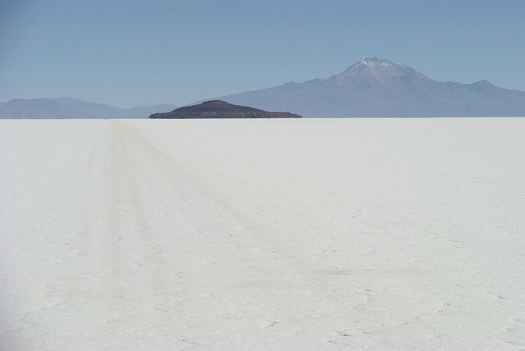
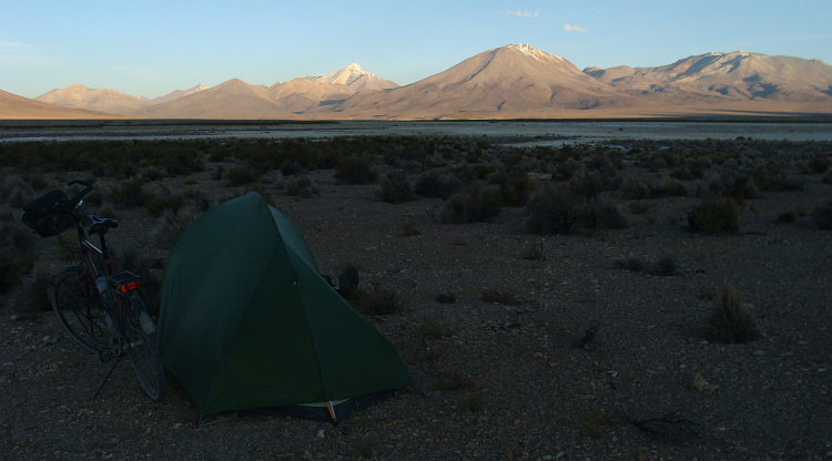
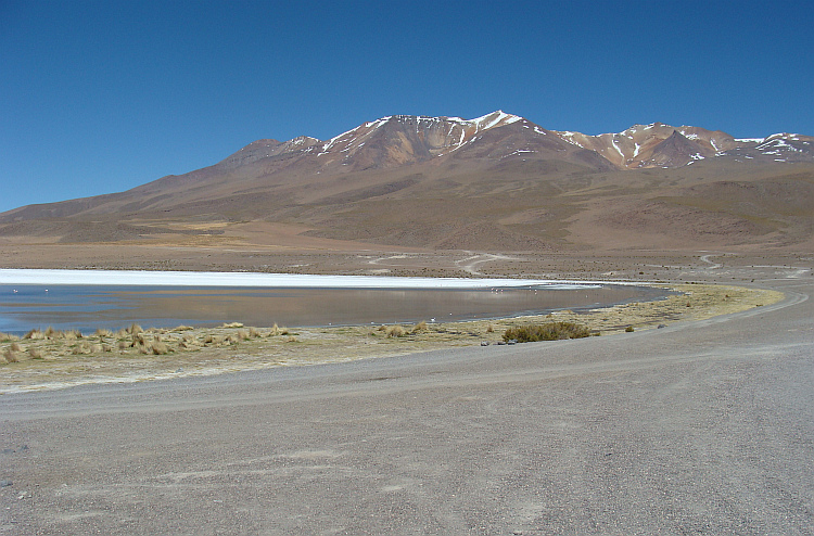
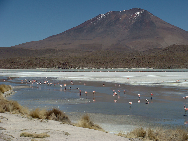
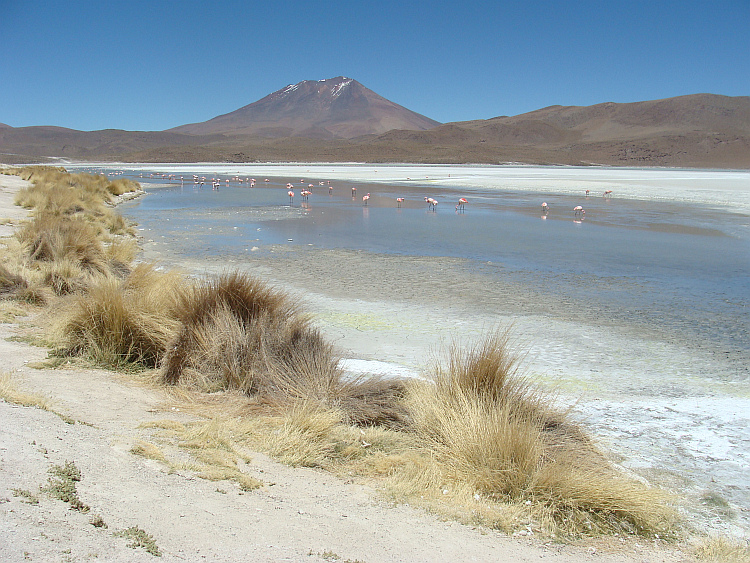
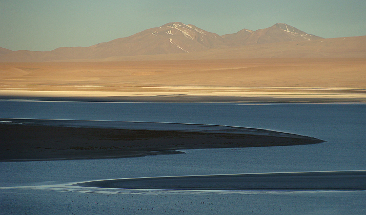
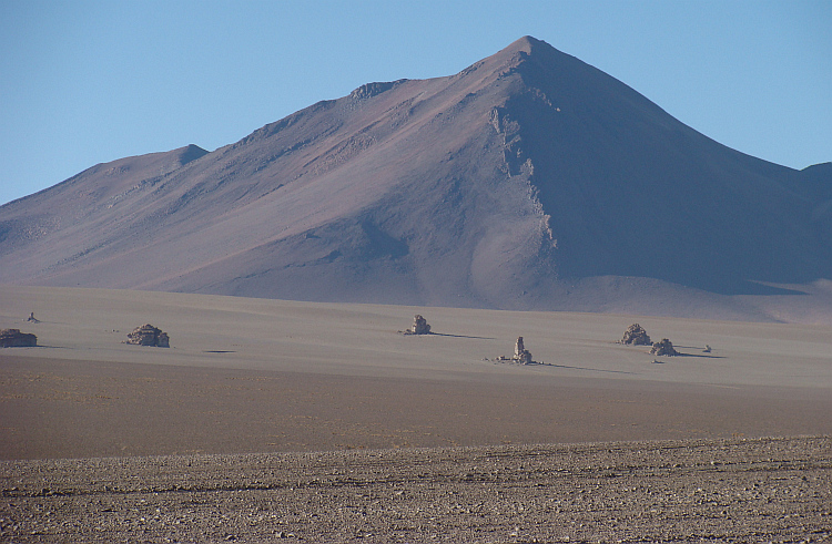
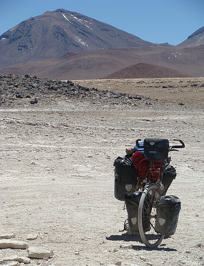
 Part one of the route, the crossing of the Salar was completed. Now I was about
to continue on the much heavier part two of the route, along the Lagunas, the
lakes of Southwest Bolivia. According to the most widely used Internet resources,
I would have to rely on myself for ten days. With twenty-five liters of water,
and with food supplies for ten days I left the last settlement of the
inhabited world.
Part one of the route, the crossing of the Salar was completed. Now I was about
to continue on the much heavier part two of the route, along the Lagunas, the
lakes of Southwest Bolivia. According to the most widely used Internet resources,
I would have to rely on myself for ten days. With twenty-five liters of water,
and with food supplies for ten days I left the last settlement of the
inhabited world.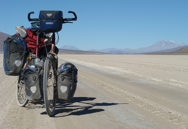
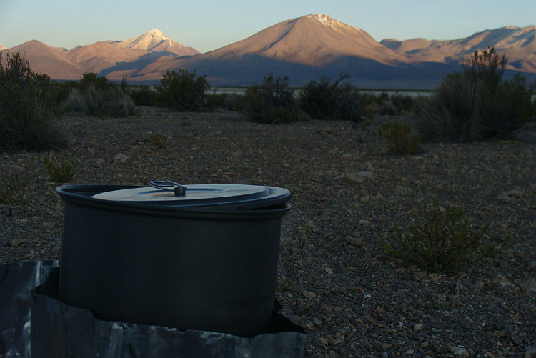
 That was a really good deal. Because the storm was still raging after I had washed
myself in the resort and the temperature had sunken well below zero, I decided
not to cook spaghetti with powder soup spaghetti outside in the dark, but to go
inside to eat with the tour groups. The sumptuous meal was significantly
better than the spaghetti with soup powder sauce yesterday and better than what
the best restaurants in the major cities of Bolivia had to offer. Most
guests could not appreciate the culinary excellence though. Almost all
travelers were ash white from altitude sickness and dripped off one by one to
the sleeping quarters. I was left alone with massive amounts of luxury food that
was untouched by the altitude sickness stricken tourists. After finishing the meal
I asked for the bill. Maria, the owner of the complex, smiled grandly. I asked
why she laughed. "We all find you a very nice guy and we are extremely honored that
you ride with your bike through our beautiful country and therefore you receive this
meal from the hotel."
That was a really good deal. Because the storm was still raging after I had washed
myself in the resort and the temperature had sunken well below zero, I decided
not to cook spaghetti with powder soup spaghetti outside in the dark, but to go
inside to eat with the tour groups. The sumptuous meal was significantly
better than the spaghetti with soup powder sauce yesterday and better than what
the best restaurants in the major cities of Bolivia had to offer. Most
guests could not appreciate the culinary excellence though. Almost all
travelers were ash white from altitude sickness and dripped off one by one to
the sleeping quarters. I was left alone with massive amounts of luxury food that
was untouched by the altitude sickness stricken tourists. After finishing the meal
I asked for the bill. Maria, the owner of the complex, smiled grandly. I asked
why she laughed. "We all find you a very nice guy and we are extremely honored that
you ride with your bike through our beautiful country and therefore you receive this
meal from the hotel."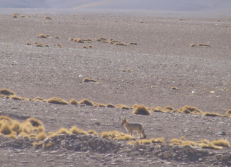
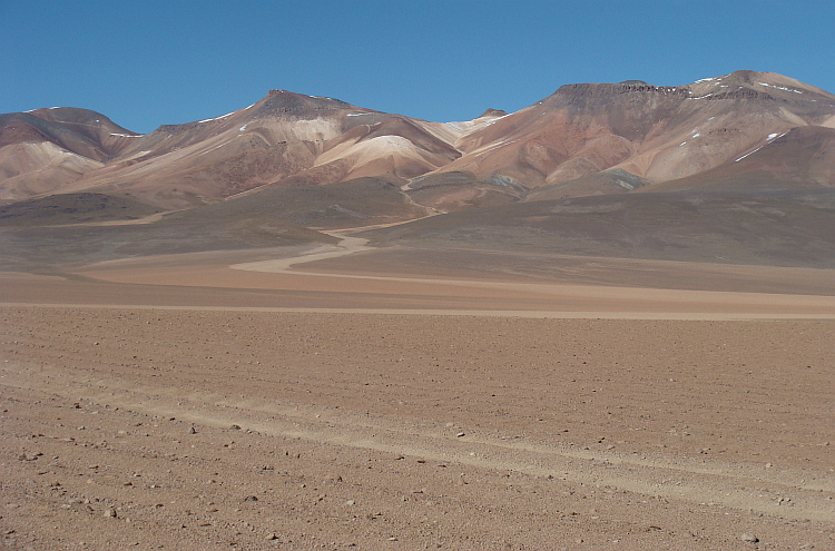
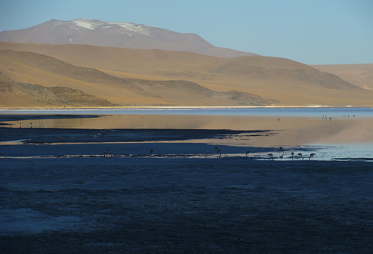
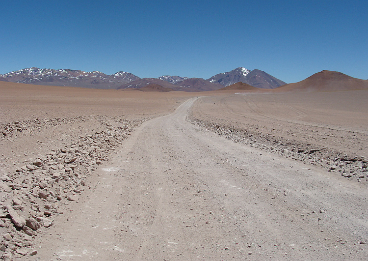
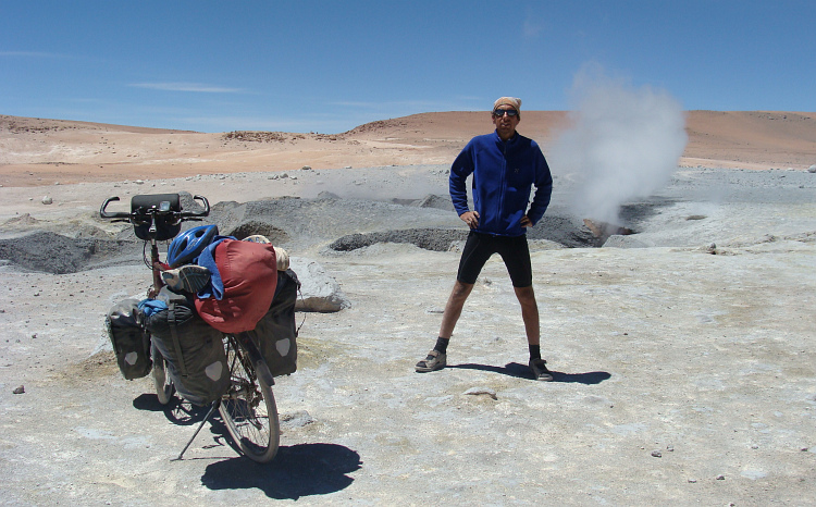
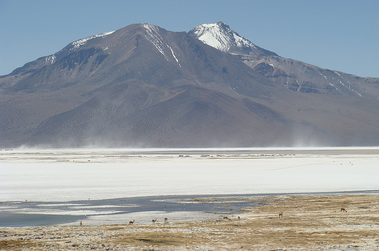
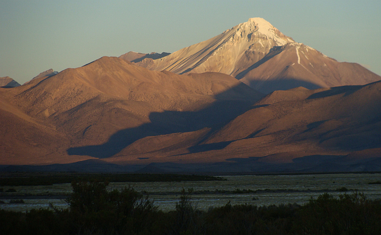
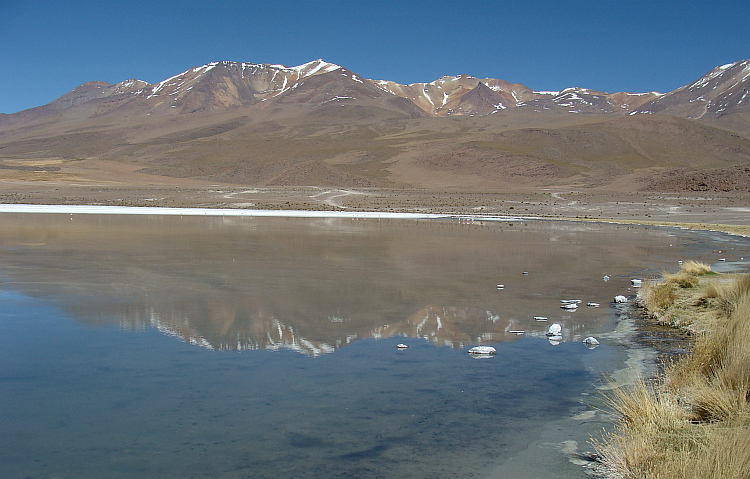
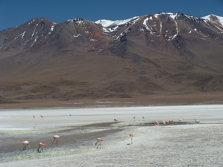
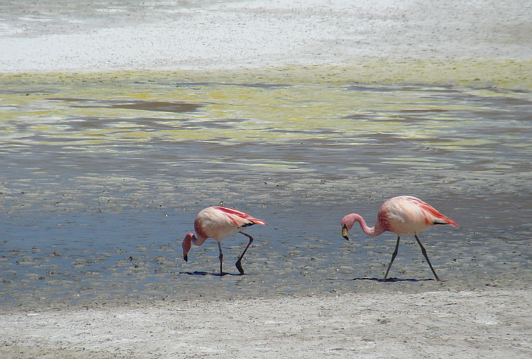
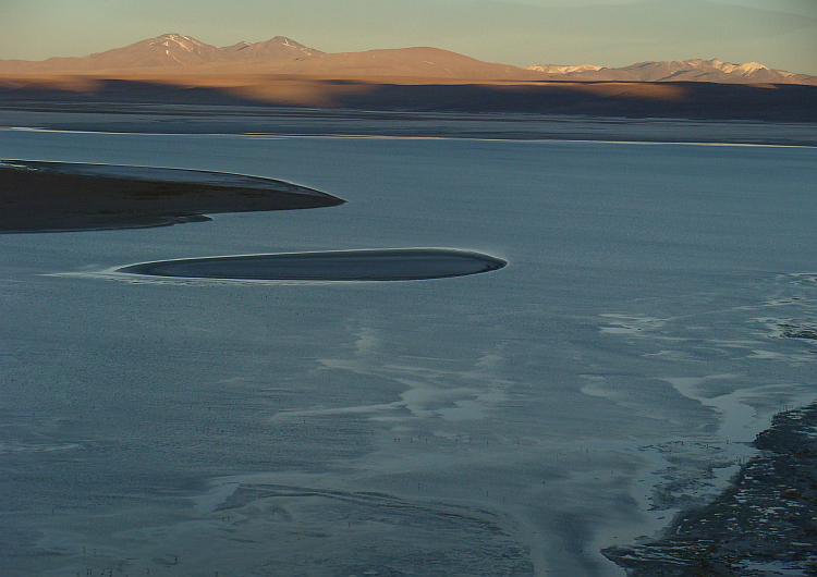
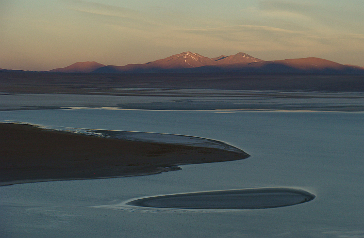
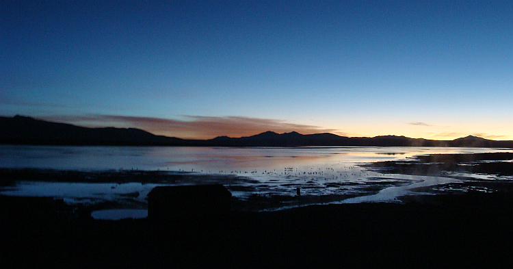
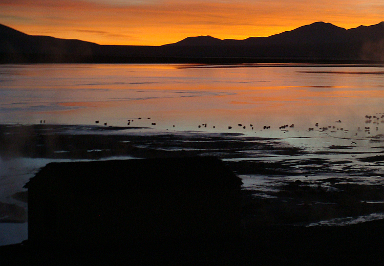
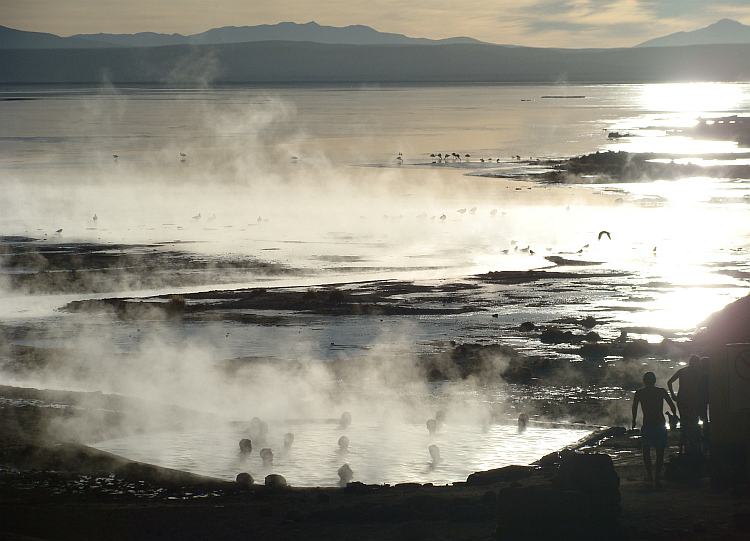
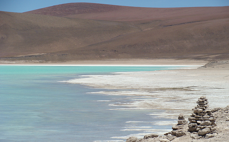
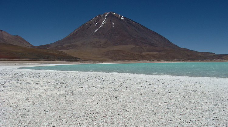
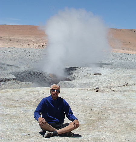 I reached the highest pass on the route. Nearly five thousand meter high was a
large geyser field, whose sulfur aromas vied with the foul smells of sweat from
the Lonely Cyclist. A long descent brought me to a new laguna with hot springs
and a restaurant. I was the only "customer" and I had the hot springs to myself.
For the first time in a week I could wash myself. When the sun went down
the Altiplano was drenched in the freezing cold, but I found myself paddling and
enjoying the steaming hot water of the springs. In the nearby restaurant I could
find a place to sleep on the ground. That saved me again from a cold night
outside. I did not have to cook, as the pasta was cooked by the owners.
They did not have a sauce, but I was allowed to use the ketchup. I wanted to say
that I still had enough soup powder in stock, but I rethought just in time. With
the two young men who worked in the restaurant, we climbed to a viewpoint where
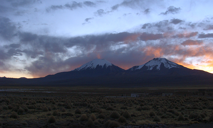
we experienced the dark yellow, orange and violet sunset over the lake.
I reached the highest pass on the route. Nearly five thousand meter high was a
large geyser field, whose sulfur aromas vied with the foul smells of sweat from
the Lonely Cyclist. A long descent brought me to a new laguna with hot springs
and a restaurant. I was the only "customer" and I had the hot springs to myself.
For the first time in a week I could wash myself. When the sun went down
the Altiplano was drenched in the freezing cold, but I found myself paddling and
enjoying the steaming hot water of the springs. In the nearby restaurant I could
find a place to sleep on the ground. That saved me again from a cold night
outside. I did not have to cook, as the pasta was cooked by the owners.
They did not have a sauce, but I was allowed to use the ketchup. I wanted to say
that I still had enough soup powder in stock, but I rethought just in time. With
the two young men who worked in the restaurant, we climbed to a viewpoint where
we experienced the dark yellow, orange and violet sunset over the lake.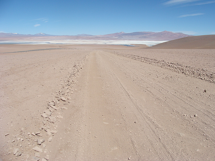

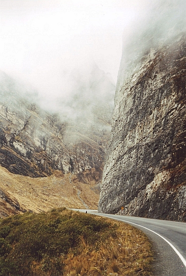
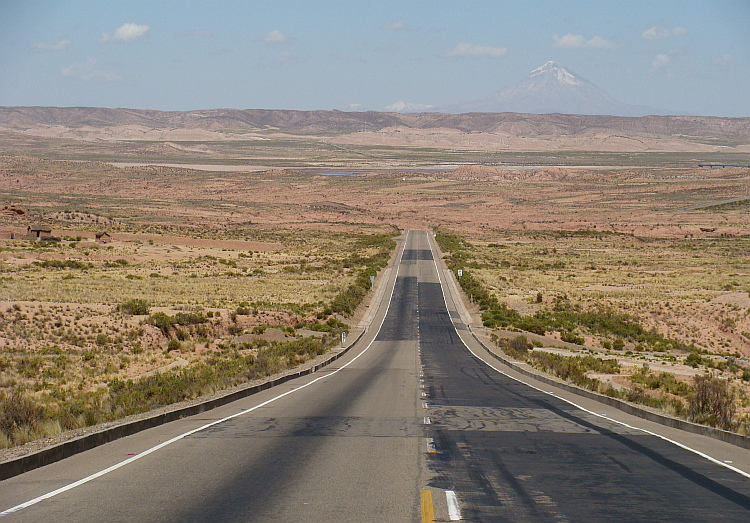
 One last climb awaited me, behind the volcano. The headwind started late
and only in the last kilometers of the otherwise relatively comfortable
climb the daily storm burst loose. Nothing could happen to me anymore. I
passed the Chilean border and reached the asphalt road that carried me down
two thousand meters from the freezer of the Altiplano to the oven of the Atacama
Desert. I felt the shaking and banging on the stone surface stopped when
reaching the asphalt on the main road from Argentina to San Pedro de Atacama.
Only a long descent on asphalt separated me from civilization and the
luxuries that civilization has brought us. Like a stone, I let myself go down.
I left Bolivia behind me, on the way to new adventures, but especially to a
shower. And a good bed. And a nutritious meal that does not have to be spiced up
with the horrible soup powder.
One last climb awaited me, behind the volcano. The headwind started late
and only in the last kilometers of the otherwise relatively comfortable
climb the daily storm burst loose. Nothing could happen to me anymore. I
passed the Chilean border and reached the asphalt road that carried me down
two thousand meters from the freezer of the Altiplano to the oven of the Atacama
Desert. I felt the shaking and banging on the stone surface stopped when
reaching the asphalt on the main road from Argentina to San Pedro de Atacama.
Only a long descent on asphalt separated me from civilization and the
luxuries that civilization has brought us. Like a stone, I let myself go down.
I left Bolivia behind me, on the way to new adventures, but especially to a
shower. And a good bed. And a nutritious meal that does not have to be spiced up
with the horrible soup powder.